
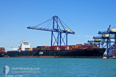
ZIM VIRGINIA
Container Ship
Current Trip
| Time Travelled | 18 h, 56 mins |
|---|---|
| Remaining Time | 16 h, 44 mins |
| Distance Travelled | 328.54 nm |
| Remaining Distance | 297.64 nm |
| AVG Speed | 14.8 Noeuds |
| MAX Speed | 18.8 Noeuds |
| AVG Wind | 18 knots |
| MAX Wind | 27 knots |
| MIN Temp | 19.1°C / 66.38°F |
| MAX Temp | 21.8°C / 71.24°F |
| Tirant d eau | 10.2 m |
| Position reçue | Maintenant |
Current Position
| Longitude | 28.38620° |
|---|---|
| Latitude | 35.78955° |
| Etat | Under way using engine |
| Vitesse | 17.8 Noeuds |
| Parcours | 268° |
| Zone | Mediterranean Sea - Eastern Basin |
| Station | T-AIS |
| Position reçue | Maintenant |
Info
Information
The current position of ZIM VIRGINIA is in Mediterranean Sea - Eastern Basin with coordinates 35.78955° / 28.38620° as reported on 2024-05-13 05:58 by AIS to our vessel tracker app. The vessel's current speed is 17.8 Noeuds and is heading at the port of ALIAGA. The estimated time of arrival as calculated by MyShipTracking vessel tracking app is 2024-05-13 22:43 LT
The vessel ZIM VIRGINIA (IMO: 9231808, MMSI: 428002000) is a Container Ship that was built in 2002 ( 22 Age ). It's sailing under the flag of [IL] Israel.
In this page you can find informations about the vessels current position, last detected port calls, and current voyage information. If the vessels is not in coverage by AIS you will find the latest position.
The current position of ZIM VIRGINIA is detected by our AIS receivers and we are not responsible for the reliability of the data. The last position was recorded while the vessel was in Coverage by the Ais receivers of our vessel tracking app.
The current draught of ZIM VIRGINIA as reported by AIS is 10.2 meters
Weather
| Temperature | 19.6°C / 67.28°F |
|---|---|
| Wind Speed | 18 knots |
| Direction | 323° NW |
| Pressure | 1010.4 hPa |
| Humidity | 65.9 % |
| Cloud Coverage | --- |
Featured Company
Last Port Calls
| Port | Arrival | Departure | Time In Port |
|---|---|---|---|
| 2024-05-11 20:40 | 2024-05-12 11:03 | 14 h | |
| 2024-05-08 22:52 | |||
| 2024-05-08 01:43 | 2024-05-08 08:48 | 7 h | |
| 2024-05-07 02:26 | 2024-05-08 01:40 | 23 h | |
| 2024-04-23 11:23 | 2024-04-23 22:33 | 11 h | |
| 2024-04-21 17:21 | 2024-04-22 23:35 | 1 d | |
| 2024-04-10 11:09 | 2024-04-11 08:46 | 21 h | |
| 2024-04-07 08:39 | 2024-04-07 22:26 | 13 h | |
| 2024-04-04 18:21 | 2024-04-05 22:49 | 1 d | |
| 2024-04-01 08:33 | 2024-04-02 09:05 | 1 d |
Last Trips
| Origin | Departure | Destination | Arrival | Distance | |
|---|---|---|---|---|---|
| 2024-05-08 11:48 | 2024-05-09 01:52 | 198.27 nm | |||
| 2024-05-08 04:40 | 2024-05-08 04:43 | 4.75 nm | |||
| 2024-04-24 00:33 | 2024-05-07 05:26 | 1850.18 nm | |||
| 2024-04-23 01:35 | 2024-04-23 13:23 | 167.35 nm | |||
| 2024-04-11 04:46 | 2024-04-21 19:21 | 4255.64 nm | |||
| 2024-04-07 18:26 | 2024-04-10 07:09 | 519.12 nm | |||
| 2024-04-05 18:49 | 2024-04-07 04:39 | 309.53 nm | |||
| 2024-04-02 06:05 | 2024-04-04 14:21 | 631.74 nm | |||
| 2024-03-23 09:31 | 2024-04-01 05:33 | 3535.68 nm | |||
| 2024-03-21 16:08 | 2024-03-22 14:28 | 165.73 nm |
Events
| Heure | Evenement | Détails | Position/ Destination | Info |
|---|---|---|---|---|
| 2024-05-13 04:56 | Changement de zone | Greek part of the Mediterranean Sea - Eastern Basin Turkish part of the Mediterranean Sea - Eastern Basin |
35.79173 / 28.76795
Mediterranean Sea - Eastern Basin
ALIAGA
|
Vitesse: 16.7 kn Parcours: 268° |
| 2024-05-13 04:39 | Etat Changé | Under way using engine Not under command |
35.79373 / 28.85700
ALIAGA
|
Vitesse: 14 kn Parcours: 267° |
| 2024-05-13 04:11 | Etat Changé | Not under command Under way using engine |
35.79393 / 28.93580
ALIAGA
|
Vitesse: 6.1 kn Parcours: 284° |
| 2024-05-13 03:32 | Changement de zone | Turkish part of the Mediterranean Sea - Eastern Basin Greek part of the Mediterranean Sea - Eastern Basin |
35.79635 / 29.15628
Mediterranean Sea - Eastern Basin
ALIAGA
|
Vitesse: 17.8 kn Parcours: 268° |
| 2024-05-13 03:12 | Etat Changé | Under way using engine Default |
35.80072 / 29.27637
ALIAGA
|
Vitesse: 17 kn Parcours: 267° |
| 2024-05-13 02:20 | Etat Changé | Default Under way using engine |
35.81075 / 29.58885
ALIAGA
|
Vitesse: 17.8 kn Parcours: 267° |
| 2024-05-13 01:43 | Changement de zone | Greek part of the Mediterranean Sea - Eastern Basin Turkish part of the Mediterranean Sea - Eastern Basin |
35.80380 / 29.81763
Mediterranean Sea - Eastern Basin
ALIAGA
|
Vitesse: 17.6 kn Parcours: 271° |
| 2024-05-13 01:22 | Etat Changé | Under way using engine Default |
35.80672 / 29.94472
ALIAGA
|
Vitesse: 17 kn Parcours: 268° |
| 2024-05-13 01:08 | Dans la zone couverte |
35.80672 / 29.94472
Mediterranean Sea - Eastern Basin
ALIAGA
|
Vitesse: 17.7 kn Parcours: 267° |
|
| 2024-05-12 19:56 | Hors de la zone couverte |
35.83472 / 31.93923
Mediterranean Sea - Eastern Basin
ALIAGA
|
Vitesse: 18.2 kn Parcours: 269° |