
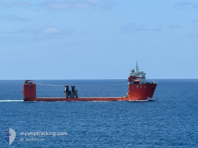
ZHONG REN 121
Other Type
Current Trip
| Time Travelled | 31 days |
|---|---|
| Remaining Time | 1 day |
| Distance Travelled | 1208.09 nm |
| Remaining Distance | 356.31 nm |
| AVG Speed | 9.1 Noeuds |
| MAX Speed | 13.8 Noeuds |
| AVG Wind | 10.8 knots |
| MAX Wind | 16.4 knots |
| MIN Temp | 4.2°C / 39.56°F |
| MAX Temp | 14.1°C / 57.38°F |
| Tirant d eau | 6.7 m |
| Position reçue | 1 m depuis |
Current Position
| Longitude | --- |
|---|---|
| Latitude | --- |
| Etat | Under way using engine |
| Vitesse | 10.2 Noeuds |
| Parcours | 56.9° |
| Zone | English Channel |
| Station | T-AIS |
| Position reçue | 1 m depuis |
Info
Information
The current position of ZHONG REN 121 is in English Channel with coordinates 49.18041° / -4.63180° as reported on 2025-02-18 04:58 by AIS to our vessel tracker app. The vessel's current speed is 10.2 Noeuds and is heading at the port of VLISSINGEN. The estimated time of arrival as calculated by MyShipTracking vessel tracking app is 2025-02-19 19:27 LT
The vessel ZHONG REN 121 (IMO: 9922938, MMSI: 413336320) is a Other Type It's sailing under the flag of [CN] China.
In this page you can find informations about the vessels current position, last detected port calls, and current voyage information. If the vessels is not in coverage by AIS you will find the latest position.
The current position of ZHONG REN 121 is detected by our AIS receivers and we are not responsible for the reliability of the data. The last position was recorded while the vessel was in Coverage by the Ais receivers of our vessel tracking app.
The current draught of ZHONG REN 121 as reported by AIS is 6.7 meters
Weather
| Temperature | 9.9°C / 49.82°F |
|---|---|
| Wind Speed | 14 knots |
| Direction | 132° SE |
| Pressure | 1014.4 hPa |
| Humidity | 86.6 % |
| Cloud Coverage | 100 % |
Featured Company
Last Port Calls
| Port | Arrival | Departure | Time In Port |
|---|---|---|---|
| 2025-01-05 02:02 | 2025-01-17 12:09 | 12 d | |
| 2025-01-01 15:20 | 2025-01-04 07:49 | 2 d | |
| 2024-12-25 10:35 | 2025-01-01 12:52 | 7 d | |
| 2024-12-14 15:14 | 2024-12-23 11:56 | 8 d | |
| 2024-12-09 10:22 |
Most Visited Ports (Last year)
| Port | Arrivals | |
|---|---|---|
| 3 | ||
| 3 | ||
| 2 | ||
| 2 | ||
| 1 | ||
| 1 |
Last Trips
| Origin | Departure | Destination | Arrival | Distance | |
|---|---|---|---|---|---|
| 2025-01-04 08:49 | 2025-01-05 03:02 | 89.54 nm | |||
| 2025-01-01 13:52 | 2025-01-01 16:20 | 17.17 nm | |||
| 2024-12-23 12:56 | 2024-12-25 11:35 | 323.45 nm | |||
| 2024-12-09 10:22 | 2024-12-14 16:14 | 878.80 nm |
Events
| Heure | Evenement | Détails | Position/ Destination | Info |
|---|---|---|---|---|
| 2025-02-18 03:38 | Detecté en mer | French part of the English Channel |
49.06990 / -4.91298
English Channel
VLISSINGEN
|
Vitesse: 9.3 kn Parcours: 58.7° |
| 2025-02-17 21:39 | Changement de destination | VLISSINGEN FLUSHING |
48.38708 / -5.83223
VLISSINGEN
|
Vitesse: 11.4 kn Parcours: 15.2° |
| 2025-02-17 19:05 | Dans la zone couverte |
47.90636 / -6.06827
Celtic Sea
FLUSHING
|
Vitesse: 12.2 kn Parcours: 18.6° |
|
| 2025-02-17 17:31 | Hors de la zone couverte |
47.59042 / -6.24119
Celtic Sea
FLUSHING
|
Vitesse: 13 kn Parcours: 21.7° |
|
| 2025-02-17 17:22 | Changement de zone | French part of the Celtic Sea Spanish part of the North Atlantic Ocean |
47.56174 / -6.25839
Celtic Sea
FLUSHING
|
Vitesse: 13.3 kn Parcours: 18.2° |
| 2025-02-17 17:22 | Dans la zone couverte |
47.56174 / -6.25839
Celtic Sea
FLUSHING
|
Vitesse: 13.3 kn Parcours: 18.2° |
|
| 2025-02-16 19:28 | Hors de la zone couverte |
43.53621 / -8.38772
North Atlantic Ocean
FLUSHING
|
Vitesse: 11.1 kn Parcours: 18.6° |
|
| 2025-02-16 18:17 | Changement de destination | FLUSHING FERROL |
43.45884 / -8.30491
FLUSHING
|
Vitesse: 8.6 kn Parcours: 274° |
| 2025-02-16 18:17 | Changement d'ETA | 2025/02/20 09:00 2025/01/21 09:00 |
43.45884 / -8.30491
FLUSHING
|
Vitesse: 8.6 kn Parcours: 274° |
| 2025-02-16 18:15 | Dans la zone couverte |
43.45884 / -8.30491
North Atlantic Ocean
|
Vitesse: 8.6 kn Parcours: 274° |