
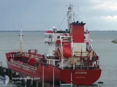
ZEUGMAN
Oil/Chemical Tanker
Current Trip
| Time Travelled | 21 h, 24 mins |
|---|---|
| Remaining Time | 6 h, 57 mins |
| Distance Travelled | 170.05 nm |
| Remaining Distance | 48.37 nm |
| AVG Speed | 6.9 Noeuds |
| MAX Speed | 10.7 Noeuds |
| AVG Wind | 27 knots |
| MAX Wind | 30.2 knots |
| MIN Temp | -3.2°C / 26.24°F |
| MAX Temp | 3.9°C / 39.02°F |
| Tirant d eau | 5 m |
| Position reçue | 1 m depuis |
Current Position
| Longitude | --- |
|---|---|
| Latitude | --- |
| Etat | Under way using engine |
| Vitesse | 6.4 Noeuds |
| Parcours | 177.5° |
| Zone | North Sea |
| Station | T-AIS |
| Position reçue | 1 m depuis |
Info
Information
The current position of ZEUGMAN is in North Sea with coordinates 55.68497° / 7.29912° as reported on 2026-01-07 12:49 by AIS to our vessel tracker app. The vessel's current speed is 6.4 Noeuds and is heading at the port of ESBJERG. The estimated time of arrival as calculated by MyShipTracking vessel tracking app is 2026-01-07 20:47 LT
The vessel ZEUGMAN (IMO: 9259111, MMSI: 215382000) is a Oil/Chemical Tanker that was built in 2003 ( 23 Age ). It's sailing under the flag of [MT] Malta.
In this page you can find informations about the vessels current position, last detected port calls, and current voyage information. If the vessels is not in coverage by AIS you will find the latest position.
The current position of ZEUGMAN is detected by our AIS receivers and we are not responsible for the reliability of the data. The last position was recorded while the vessel was in Coverage by the Ais receivers of our vessel tracking app.
The current draught of ZEUGMAN as reported by AIS is 5 meters
Weather
| Temperature | 3.1°C / 37.58°F |
|---|---|
| Wind Speed | 28 knots |
| Direction | 186° S |
| Pressure | 999.6 hPa |
| Humidity | 97.1 % |
| Cloud Coverage | 100 % |
Featured Company
Last Port Calls
| Port | Arrival | Departure | Time In Port |
|---|---|---|---|
| 2026-01-04 15:11 | 2026-01-06 16:26 | 2 d | |
| 2025-12-25 02:54 | 2025-12-25 17:06 | 14 h | |
| 2025-12-14 03:47 | 2025-12-15 03:19 | 23 h | |
| 2025-12-14 03:33 | 2025-12-14 03:38 | 4 m | |
| 2025-12-09 06:27 | 2025-12-10 20:08 | 1 d | |
| 2025-12-06 08:25 | 2025-12-07 09:17 | 1 d | |
| 2025-11-27 16:14 | 2025-11-28 13:07 | 20 h | |
| 2025-11-25 15:34 | 2025-11-26 20:29 | 1 d | |
| 2025-11-21 02:20 | 2025-11-21 14:13 | 11 h | |
| 2025-11-13 15:44 | 2025-11-15 09:13 | 1 d |
Last Trips
| Origin | Departure | Destination | Arrival | Distance | |
|---|---|---|---|---|---|
| 2025-12-25 17:06 | 2026-01-04 15:11 | 1177.22 nm | |||
| 2025-12-15 03:19 | 2025-12-25 02:54 | 2071.95 nm | |||
| 2025-12-14 03:38 | 2025-12-14 03:47 | 0.12 nm | |||
| 2025-12-10 20:08 | 2025-12-14 03:33 | 705.05 nm | |||
| 2025-12-07 09:17 | 2025-12-09 06:27 | 307.19 nm | |||
| 2025-11-28 13:07 | 2025-12-06 08:25 | 1308.78 nm | |||
| 2025-11-26 20:29 | 2025-11-27 16:14 | 161.67 nm | |||
| 2025-11-21 14:13 | 2025-11-25 15:34 | 472.10 nm | |||
| 2025-11-15 09:13 | 2025-11-21 02:20 | 863.43 nm | |||
| 2025-11-10 23:37 | 2025-11-13 15:44 | 539.64 nm |
Events
| Heure | Evenement | Détails | Position/ Destination | Info |
|---|---|---|---|---|
| 2026-01-07 07:30 | Etat Changé | Under way using engine Default |
56.27213 / 7.29008
DKEBJ
|
Vitesse: 8.2 kn Parcours: 179° |
| 2026-01-07 07:01 | Etat Changé | Default Under way using engine |
56.33762 / 7.30352
DKEBJ
|
Vitesse: 7.9 kn Parcours: 189.6° |
| 2026-01-06 22:23 | Detecté en mer | Danish part of the North Sea |
57.36292 / 8.16390
North Sea
DKEBJ
|
Vitesse: 8.2 kn Parcours: 245.4° |
| 2026-01-06 17:02 | Changement de destination | DKEBJ DKHVS |
57.57405 / 9.48335
DKEBJ
|
Vitesse: 10.7 kn Parcours: 263° |
| 2026-01-06 17:02 | Changement d'ETA | 2026/01/07 12:00 2026/01/07 08:00 |
57.57405 / 9.48335
DKEBJ
|
Vitesse: 10.7 kn Parcours: 263° |
| 2026-01-06 15:53 | Changement d'ETA | 2026/01/07 08:00 2026/01/07 09:00 |
57.61719 / 9.84194
DKHVS
|
Vitesse: 10.2 kn Parcours: 242.6° |
| 2026-01-06 15:26 | PORT DE DEPART |
|
57.60070 / 9.95712
DKHVS
|
Vitesse: 6.7 kn Parcours: 336° |
| 2026-01-06 15:14 | Démarrage |
57.59412 / 9.97796
[DK] HIRTSHALS
|
Vitesse: 4.5 kn Parcours: 297° |
|
| 2026-01-06 15:08 | Tirant d'eau modifié | 5 6.4 |
57.59337 / 9.98090
[DK] HIRTSHALS
|
Vitesse: 0.7 kn Parcours: 185° |
| 2026-01-06 15:08 | Changement de destination | DKHVS DKHIR |
57.59337 / 9.98090
[DK] HIRTSHALS
|
Vitesse: 0.7 kn Parcours: 185° |