

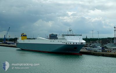
YSALINE
Cargo

Current Trip
| Trip Time | 9 h, 34 mins |
|---|---|
| Trip Distance | 126.37 nm |
| AVG Speed | 11.9 Noeuds |
| MAX Speed | 18.7 Noeuds |
| Tirant d eau | 6.8 m |
| AVG Wind | 12.2 knots |
| MAX Wind | 16 knots |
| MIN Temp | -0.7°C / 30.74°F |
| MAX Temp | 4.4°C / 39.92°F |
| Position reçue | 2 m depuis |
Current Position
| Longitude | --- |
|---|---|
| Latitude | --- |
| Etat | Moored |
| Vitesse | |
| Parcours | 257° |
| Zone | North Sea |
| Station | T-AIS |
| Position reçue | 2 m depuis |
Information
The current position of YSALINE is in North Sea with coordinates 51.34347° / 3.21993° as reported on 2025-02-18 13:26 by AIS to our vessel tracker app. The vessel's current speed is 0 Noeuds and is currently inside the port of ZEEBRUGGE.
The vessel YSALINE (IMO: 9823364, MMSI: 248744000) is a Cargo It's sailing under the flag of [MT] Malta.
In this page you can find informations about the vessels current position, last detected port calls, and current voyage information. If the vessels is not in coverage by AIS you will find the latest position.
The current position of YSALINE is detected by our AIS receivers and we are not responsible for the reliability of the data. The last position was recorded while the vessel was in Coverage by the Ais receivers of our vessel tracking app.
The current draught of YSALINE as reported by AIS is 6.8 meters
Weather
| Temperature | 4.3°C / 39.74°F |
|---|---|
| Wind Speed | 11 knots |
| Direction | 107° ESE |
| Pressure | 1023.3 hPa |
| Humidity | 41.7 % |
| Cloud Coverage | 100 % |


Featured Company
Last Port Calls
| Port | Arrival | Departure | Time In Port |
|---|---|---|---|
| 2025-02-18 04:40 | |||
| 2025-02-17 07:16 | 2025-02-17 19:06 | 11 h | |
| 2025-02-16 04:50 | 2025-02-16 20:11 | 15 h | |
| 2025-02-13 15:44 | 2025-02-14 14:45 | 23 h | |
| 2025-02-11 04:25 | 2025-02-12 04:35 | 1 d | |
| 2025-02-10 07:09 | 2025-02-10 19:09 | 11 h | |
| 2025-02-09 06:17 | 2025-02-09 21:03 | 14 h | |
| 2025-02-07 04:06 | 2025-02-07 18:19 | 14 h | |
| 2025-02-05 00:36 | 2025-02-05 14:15 | 13 h | |
| 2025-02-03 01:46 | 2025-02-03 14:51 | 13 h |
Last Trips
| Origin | Departure | Destination | Arrival | Distance | |
|---|---|---|---|---|---|
| 2025-02-17 19:06 | 2025-02-18 05:40 | 126.37 nm | |||
| 2025-02-16 21:11 | 2025-02-17 07:16 | 119.22 nm | |||
| 2025-02-14 14:45 | 2025-02-16 05:50 | 592.35 nm | |||
| 2025-02-12 05:35 | 2025-02-13 15:44 | 579.65 nm | |||
| 2025-02-10 19:09 | 2025-02-11 05:25 | 122.03 nm | |||
| 2025-02-09 22:03 | 2025-02-10 07:09 | 118.38 nm | |||
| 2025-02-07 18:19 | 2025-02-09 07:17 | 590.82 nm | |||
| 2025-02-05 15:15 | 2025-02-07 04:06 | 579.98 nm | |||
| 2025-02-03 15:51 | 2025-02-05 01:36 | 568.03 nm | |||
| 2025-02-01 20:23 | 2025-02-03 02:46 | 553.88 nm |
Events
| Heure | Evenement | Détails | Position/ Destination | Info |
|---|---|---|---|---|
| 2025-02-18 07:29 | Etat Changé | Moored Default |
51.34348 / 3.21988
[BE] ZEEBRUGGE
|
Vitesse: Parcours: 257° |
| 2025-02-18 07:23 | Etat Changé | Default Moored |
51.34347 / 3.21990
[BE] ZEEBRUGGE
|
Vitesse: Parcours: 257° |
| 2025-02-18 06:32 | Etat Changé | Moored Default |
51.34349 / 3.21988
[BE] ZEEBRUGGE
|
Vitesse: Parcours: 257° |
| 2025-02-18 06:29 | Etat Changé | Default Moored |
51.34345 / 3.21987
[BE] ZEEBRUGGE
|
Vitesse: Parcours: 257° |
| 2025-02-18 05:47 | Etat Changé | Moored Under way using engine |
51.34349 / 3.21988
[BE] ZEEBRUGGE
|
Vitesse: Parcours: 257° |
| 2025-02-18 04:57 | Arret |
51.34445 / 3.20739
[BE] ZEEBRUGGE
|
Vitesse: 0.1 kn Parcours: 285° |
|
| 2025-02-18 04:40 | Port d'arrivée |
|
51.36402 / 3.19003
[BE] ZEEBRUGGE
|
Vitesse: 11.2 kn Parcours: 134.2° |
| 2025-02-18 02:02 | Changement de zone | Belgian part of the North Sea French part of the North Sea |
51.33660 / 2.35868
North Sea
BEZEE
|
Vitesse: 12.9 kn Parcours: 70° |
| 2025-02-18 01:04 | Changement de zone | French part of the North Sea United Kingdom part of the North Sea |
51.35648 / 2.05267
North Sea
BEZEE
|
Vitesse: 12.8 kn Parcours: 125.9° |
| 2025-02-17 19:07 | Démarrage | 0.34 nm, West of PURFLEET |
51.46940 / .24603
BEZEE
|
Vitesse: 4.2 kn Parcours: 244° |