
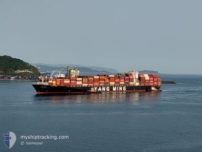
YM UPSURGENCE
Container Ship
Current Trip
| Trip Time | 15 days |
|---|---|
| Trip Distance | 5929.89 nm |
| AVG Speed | 13.8 Noeuds |
| MAX Speed | 13.8 Noeuds |
| Tirant d eau | 12.9 m |
| AVG Wind | 14.4 knots |
| MAX Wind | 30 knots |
| MIN Temp | 6.9°C / 44.42°F |
| MAX Temp | 24.2°C / 75.56°F |
| Position reçue | 3 m depuis |
Current Position
| Longitude | -118.27550° |
|---|---|
| Latitude | 33.75433° |
| Etat | Moored |
| Vitesse | 0.1 Noeuds |
| Parcours | 331° |
| Zone | North Pacific Ocean |
| Station | T-AIS |
| Position reçue | 3 m depuis |
Info
Information
The current position of YM UPSURGENCE is in North Pacific Ocean with coordinates 33.75433° / -118.27550° as reported on 2024-06-07 20:46 by AIS to our vessel tracker app. The vessel's current speed is 0.1 Noeuds and is currently inside the port of LOS ANGELES.
The vessel YM UPSURGENCE (IMO: 9462720, MMSI: 416465000) is a Container Ship that was built in 2012 ( 12 Age ). It's sailing under the flag of [TW] Taiwan.
In this page you can find informations about the vessels current position, last detected port calls, and current voyage information. If the vessels is not in coverage by AIS you will find the latest position.
The current position of YM UPSURGENCE is detected by our AIS receivers and we are not responsible for the reliability of the data. The last position was recorded while the vessel was in Coverage by the Ais receivers of our vessel tracking app.
The current draught of YM UPSURGENCE as reported by AIS is 12.9 meters
Weather
| Temperature | 19.2°C / 66.56°F |
|---|---|
| Wind Speed | 8 knots |
| Direction | 202° SSW |
| Pressure | 1012.9 hPa |
| Humidity | 71.3 % |
| Cloud Coverage | 8 % |
Featured Company
Last Port Calls
| Port | Arrival | Departure | Time In Port |
|---|---|---|---|
| 2024-06-07 06:21 | |||
| 2024-05-22 16:39 | 2024-05-23 17:53 | 1 d | |
| 2024-05-21 03:29 | 2024-05-21 23:44 | 20 h | |
| 2024-05-19 07:52 | 2024-05-20 05:44 | 21 h | |
| 2024-05-14 22:33 | 2024-05-15 17:40 | 19 h | |
| 2024-05-13 07:43 | 2024-05-14 00:25 | 16 h | |
| 2024-04-24 05:59 | 2024-04-26 03:21 | 1 d | |
| 2024-04-18 05:04 | 2024-04-22 06:24 | 4 d | |
| 2024-04-03 10:54 | 2024-04-04 06:46 | 19 h | |
| 2024-04-01 15:19 | 2024-04-02 15:57 | 1 d |
Most Visited Ports (Last year)
| Port | Arrivals | |
|---|---|---|
| 14 | ||
| 14 | ||
| 8 | ||
| 7 | ||
| 7 |
Last Trips
| Origin | Departure | Destination | Arrival | Distance | |
|---|---|---|---|---|---|
| 2024-05-23 17:53 | 2024-06-07 06:21 | 5929.89 nm | |||
| 2024-05-21 23:44 | 2024-05-22 16:39 | 235.61 nm | |||
| 2024-05-20 05:44 | 2024-05-21 03:29 | 345.15 nm | |||
| 2024-05-15 17:40 | 2024-05-19 07:52 | 489.24 nm | |||
| 2024-05-14 00:25 | 2024-05-14 22:33 | 240.40 nm | |||
| 2024-04-26 03:21 | 2024-05-13 07:43 | 5696.70 nm | |||
| 2024-04-22 06:24 | 2024-04-24 05:59 | 386.62 nm | |||
| 2024-04-04 06:46 | 2024-04-18 05:04 | 5927.45 nm | |||
| 2024-04-02 15:57 | 2024-04-03 10:54 | 235.81 nm | |||
| 2024-03-31 18:49 | 2024-04-01 15:19 | 344.65 nm |
Events
| Heure | Evenement | Détails | Position/ Destination | Info |
|---|---|---|---|---|
| 2024-06-07 14:17 | Etat Changé | Moored Under way using engine |
33.75433 / -118.27550
[US] LOS ANGELES
|
Vitesse: 0.1 kn Parcours: 331° |
| 2024-06-07 14:08 | Arret |
33.75450 / -118.27517
[US] LOS ANGELES
|
Vitesse: 0.3 kn Parcours: 326° |
|
| 2024-06-07 13:21 | Port d'arrivée |
|
33.70650 / -118.24617
[US] LOS ANGELES
|
Vitesse: 8.4 kn Parcours: 342° |
| 2024-06-07 08:40 | Changement d'ETA | 2024/06/07 13:00 2024/06/07 12:00 |
33.75267 / -118.67083
TWKEL > USLAX
|
Vitesse: 7.4 kn Parcours: 121° |
| 2024-06-07 05:29 | Etat Changé | Under way using engine Default |
33.97933 / -119.14817
TWKEL > USLAX
|
Vitesse: 8.6 kn Parcours: 122° |
| 2024-06-07 05:27 | Dans la zone couverte |
33.97583 / -119.14150
North Pacific Ocean
TWKEL > USLAX
|
Vitesse: 8.7 kn Parcours: 121° |
|
| 2024-06-07 04:15 | Etat Changé | Default Under way using engine |
34.05717 / -119.33100
TWKEL > USLAX
|
Vitesse: 8.4 kn Parcours: 102° |
| 2024-06-07 04:08 | Hors de la zone couverte |
34.06083 / -119.35217
North Pacific Ocean
TWKEL > USLAX
|
Vitesse: 8.4 kn Parcours: 102° |
|
| 2024-06-07 04:05 | Tirant d'eau modifié | 12.9 13 |
34.06233 / -119.36050
TWKEL > USLAX
|
Vitesse: 8.8 kn Parcours: 101° |
| 2024-06-07 04:05 | Changement d'ETA | 2024/06/07 12:00 2024/06/07 11:00 |
34.06233 / -119.36050
TWKEL > USLAX
|
Vitesse: 8.8 kn Parcours: 101° |