

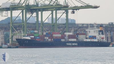
YM HAWK
Container Ship

Current Trip
SG SIN>BD CGX
| Time Travelled | 9 days |
|---|---|
| Remaining Time | --- |
| Distance Travelled | 1537.64 nm |
| Remaining Distance | --- |
| AVG Speed | 13.2 Noeuds |
| MAX Speed | 17.6 Noeuds |
| AVG Wind | 9.6 knots |
| MAX Wind | 21 knots |
| MIN Temp | 23°C / 73.4°F |
| MAX Temp | 30.6°C / 87.08°F |
| Tirant d eau | 8.8 m |
| Position reçue | 12 h, 37 m depuis |
Current Position
| Longitude | --- |
|---|---|
| Latitude | --- |
| Etat | Under way using engine |
| Vitesse | 5.5 Noeuds |
| Parcours | 332° |
| Zone | Bay of Bengal |
| Station | T-AIS |
| Position reçue | 12 h, 37 m depuis |
Information
The current position of YM HAWK is in Bay of Bengal with coordinates 22.16205° / 91.73720° as reported on 2025-03-27 01:58 by AIS to our vessel tracker app. The vessel's current speed is 5.5 Noeuds
The vessel YM HAWK (IMO: 9299317, MMSI: 416429000) is a Container Ship that was built in 2005 ( 20 Age ). It's sailing under the flag of [TW] Taiwan.
In this page you can find informations about the vessels current position, last detected port calls, and current voyage information. If the vessels is not in coverage by AIS you will find the latest position.
The current position of YM HAWK is detected by our AIS receivers and we are not responsible for the reliability of the data. The last position was recorded while the vessel was in Coverage by the Ais receivers of our vessel tracking app.
The current draught of YM HAWK as reported by AIS is 8.8 meters
Weather
| Temperature | 27.2°C / 80.96°F |
|---|---|
| Wind Speed | 11 knots |
| Direction | 226° SW |
| Pressure | 1004.6 hPa |
| Humidity | 79.9 % |
| Cloud Coverage | 1 % |


Featured Company
Last Port Calls
| Port | Arrival | Departure | Time In Port |
|---|---|---|---|
| 2025-03-17 18:31 | 2025-03-18 14:17 | 19 h | |
| 2025-03-10 20:33 | 2025-03-13 10:05 | 2 d | |
| 2025-03-01 08:38 | 2025-03-02 14:42 | 1 d | |
| 2025-02-28 05:05 | 2025-02-28 15:45 | 10 h | |
| 2025-02-22 04:29 | 2025-02-22 11:01 | 6 h | |
| 2025-02-17 20:37 | 2025-02-18 08:39 | 12 h | |
| 2025-02-15 23:44 | 2025-02-16 19:38 | 19 h | |
| 2025-02-14 12:36 | 2025-02-15 13:57 | 1 d | |
| 2025-02-12 13:34 | 2025-02-13 09:02 | 19 h | |
| 2025-02-11 00:46 | 2025-02-11 08:22 | 7 h |
Last Trips
| Origin | Departure | Destination | Arrival | Distance | |
|---|---|---|---|---|---|
| 2025-03-13 10:05 | 2025-03-17 18:31 | 1514.99 nm | |||
| 2025-03-02 14:42 | 2025-03-10 20:33 | 1524.42 nm | |||
| 2025-02-28 15:45 | 2025-03-01 08:38 | 198.47 nm | |||
| 2025-02-22 11:01 | 2025-02-28 05:05 | 1411.45 nm | |||
| 2025-02-18 08:39 | 2025-02-22 04:29 | 810.80 nm | |||
| 2025-02-16 19:38 | 2025-02-17 20:37 | 351.23 nm | |||
| 2025-02-15 13:57 | 2025-02-15 23:44 | 138.69 nm | |||
| 2025-02-13 09:02 | 2025-02-14 12:36 | 158.37 nm | |||
| 2025-02-11 08:22 | 2025-02-12 13:34 | 356.48 nm | |||
| 2025-02-03 16:33 | 2025-02-11 00:46 | 1938.11 nm |
Events
| Heure | Evenement | Détails | Position/ Destination | Info |
|---|---|---|---|---|
| 2025-03-27 13:34 | Démarrage | 3.89 nm, South West of CHITTAGONG |
22.18843 / 91.76742
SG SIN>BD CGX
|
Vitesse: 4.1 kn Parcours: 68° |
| 2025-03-27 13:02 | Arret | 4 nm, South West of CHITTAGONG |
22.18803 / 91.76521
SG SIN>BD CGX
|
Vitesse: 0.3 kn Parcours: 176° |
| 2025-03-27 11:33 | Démarrage | 8.27 nm, South West of CHITTAGONG |
22.12758 / 91.72270
SG SIN>BD CGX
|
Vitesse: 4.5 kn Parcours: 353° |
| 2025-03-27 06:06 | Arret | 8.43 nm, South West of CHITTAGONG |
22.12463 / 91.72185
SG SIN>BD CGX
|
Vitesse: 0.3 kn Parcours: 167° |
| 2025-03-27 03:06 | Démarrage | 5.69 nm, South West of CHITTAGONG |
22.17297 / 91.73872
SG SIN>BD CGX
|
Vitesse: 3.4 kn Parcours: 107° |
| 2025-03-27 02:53 | Arret | 5.93 nm, South West of CHITTAGONG |
22.16967 / 91.73621
SG SIN>BD CGX
|
Vitesse: 0.2 kn Parcours: 176° |
| 2025-03-27 02:06 | Etat Changé | Default Under way using engine |
22.16552 / 91.73460
SG SIN>BD CGX
|
Vitesse: 5.5 kn Parcours: 332° |
| 2025-03-27 01:58 | Hors de la zone couverte |
22.16205 / 91.73720
Bay of Bengal
|
Vitesse: 5.5 kn Parcours: 332° |
|
| 2025-03-27 01:49 | Etat Changé | Under way using engine Default |
22.14670 / 91.74655
SG SIN>BD CGX
|
Vitesse: 7.7 kn Parcours: 340° |
| 2025-03-27 01:34 | Dans la zone couverte |
22.14670 / 91.74655
Bay of Bengal
|
Vitesse: 7.5 kn Parcours: 329° |