
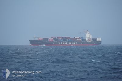
YM COOPERATION
Cargo D
Current Trip
KRPUS>CNSHA
| Time Travelled | 3 days |
|---|---|
| Remaining Time | --- |
| Distance Travelled | 656.33 nm |
| Remaining Distance | --- |
| AVG Speed | 13.3 Noeuds |
| MAX Speed | 17.6 Noeuds |
| AVG Wind | 17 knots |
| MAX Wind | 30 knots |
| MIN Temp | 8.9°C / 48.02°F |
| MAX Temp | 19.9°C / 67.82°F |
| Tirant d eau | 9 m |
| Position reçue | 8 d depuis |
Current Position
| Longitude | --- |
|---|---|
| Latitude | --- |
| Etat | Under way using engine |
| Vitesse | 9.8 Noeuds |
| Parcours | 196.3° |
| Zone | Japan Sea |
| Station | T-AIS |
| Position reçue | 8 d depuis |
Info
Information
The current position of YM COOPERATION is in Japan Sea with coordinates 34.90891° / 129.13847° as reported on 2024-12-04 02:20 by AIS to our vessel tracker app. The vessel's current speed is 9.8 Noeuds
The vessel YM COOPERATION (IMO: 9864588, MMSI: 636019900) is a Cargo D It's sailing under the flag of [LR] Liberia.
In this page you can find informations about the vessels current position, last detected port calls, and current voyage information. If the vessels is not in coverage by AIS you will find the latest position.
The current position of YM COOPERATION is detected by our AIS receivers and we are not responsible for the reliability of the data. The last position was recorded while the vessel was in Coverage by the Ais receivers of our vessel tracking app.
The current draught of YM COOPERATION as reported by AIS is 9 meters
Weather
| Temperature | 16.2°C / 61.16°F |
|---|---|
| Wind Speed | 20 knots |
| Direction | 40° NE |
| Pressure | 1020.8 hPa |
| Humidity | 76 % |
| Cloud Coverage | 22 % |
Featured Company
Last Port Calls
| Port | Arrival | Departure | Time In Port |
|---|---|---|---|
| 2024-12-08 20:08 | 2024-12-09 09:24 | 13 h | |
| 2024-12-02 08:04 | 2024-12-04 01:09 | 1 d | |
| 2024-11-27 18:40 | 2024-11-28 10:48 | 16 h | |
| 2024-11-22 14:15 | 2024-11-23 10:32 | 20 h | |
| 2024-11-19 20:22 | 2024-11-20 11:51 | 15 h | |
| 2024-11-17 21:12 | 2024-11-18 20:12 | 23 h | |
| 2024-11-16 08:42 | 2024-11-16 21:53 | 13 h | |
| 2024-11-11 04:37 | 2024-11-11 22:32 | 17 h | |
| 2024-11-08 20:56 | 2024-11-09 10:24 | 13 h | |
| 2024-11-03 12:15 | 2024-11-04 23:27 | 1 d |
Last Trips
| Origin | Departure | Destination | Arrival | Distance | |
|---|---|---|---|---|---|
| 2024-12-04 10:09 | 2024-12-09 04:08 | 565.20 nm | |||
| 2024-11-28 18:48 | 2024-12-02 17:04 | 1245.07 nm | |||
| 2024-11-23 17:32 | 2024-11-28 02:40 | 1555.97 nm | |||
| 2024-11-20 19:51 | 2024-11-22 21:15 | 807.93 nm | |||
| 2024-11-19 04:12 | 2024-11-20 04:22 | 239.29 nm | |||
| 2024-11-17 05:53 | 2024-11-18 05:12 | 207.31 nm | |||
| 2024-11-12 06:32 | 2024-11-16 16:42 | 1759.07 nm | |||
| 2024-11-09 18:24 | 2024-11-11 12:37 | 651.49 nm | |||
| 2024-11-05 08:27 | 2024-11-09 04:56 | 623.18 nm | |||
| 2024-10-30 22:05 | 2024-11-03 21:15 | 1241.03 nm |
Events
| Heure | Evenement | Détails | Position/ Destination | Info |
|---|---|---|---|---|
| 2024-12-12 13:56 | Démarrage | 14.6 nm, South West of WEITOU |
24.31570 / 118.41015
KRPUS>CNSHA
|
Vitesse: 9.1 kn Parcours: 176° |
| 2024-12-11 06:50 | Arret | 14.34 nm, South West of WEITOU |
24.32463 / 118.40479
KRPUS>CNSHA
|
Vitesse: 0.3 kn Parcours: 112° |
| 2024-12-09 09:25 | Démarrage | 2.93 nm, South East of SHANGHAI |
31.34238 / 121.65498
KRPUS>CNSHA
|
Vitesse: 3.6 kn Parcours: 93° |
| 2024-12-09 09:24 | PORT DE DEPART |
|
31.34238 / 121.65498
KRPUS>CNSHA
|
Vitesse: 1 kn Parcours: 96° |
| 2024-12-08 20:24 | Arret |
31.33975 / 121.65084
[CN] SHANGHAI
|
Vitesse: Parcours: 118° |
|
| 2024-12-08 20:08 | Port d'arrivée |
|
31.34069 / 121.65163
[CN] SHANGHAI
|
Vitesse: 5 kn Parcours: 138° |
| 2024-12-08 19:53 | Démarrage | 2.31 nm, South East of SHANGHAI |
31.34897 / 121.64529
KRPUS>CNSHA
|
Vitesse: 6 kn Parcours: 128° |
| 2024-12-08 19:09 | Arret | 2.16 nm, South East of SHANGHAI |
31.35044 / 121.64284
KRPUS>CNSHA
|
Vitesse: 0.1 kn Parcours: 135° |
| 2024-12-08 14:04 | Démarrage |
31.22247 / 122.45946
KRPUS>CNSHA
|
Vitesse: 5.6 kn Parcours: 212° |
|
| 2024-12-05 08:59 | Arret |
31.22571 / 122.46331
KRPUS>CNSHA
|
Vitesse: 0.2 kn Parcours: 283° |