

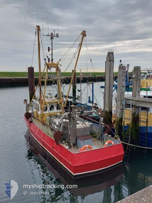
YE3 ZEEPAARD
Fishing

Current Trip
VISGRONDEN
| Time Travelled | 4 h, 1 mins |
|---|---|
| Remaining Time | --- |
| Distance Travelled | 0.29 nm |
| Remaining Distance | --- |
| AVG Speed | --- |
| MAX Speed | --- |
| AVG Wind | 14 knots |
| MAX Wind | 14 knots |
| MIN Temp | 4°C / 39.2°F |
| MAX Temp | 4°C / 39.2°F |
| Tirant d eau | 1.1 m |
| Position reçue | 3 h, 46 m depuis |
Current Position
| Longitude | --- |
|---|---|
| Latitude | --- |
| Etat | Engaged in Fishing |
| Vitesse | |
| Parcours | --- |
| Zone | North Sea |
| Station | T-AIS |
| Position reçue | 3 h, 46 m depuis |
Information
The current position of YE3 ZEEPAARD is in North Sea with coordinates 53.17533° / 5.45394° as reported on 2025-03-15 16:10 by AIS to our vessel tracker app. The vessel's current speed is 0 Noeuds
The vessel YE3 ZEEPAARD (MMSI: 244650683) is a Fishing It's sailing under the flag of [NL] Netherlands.
In this page you can find informations about the vessels current position, last detected port calls, and current voyage information. If the vessels is not in coverage by AIS you will find the latest position.
The current position of YE3 ZEEPAARD is detected by our AIS receivers and we are not responsible for the reliability of the data. The last position was recorded while the vessel was in Coverage by the Ais receivers of our vessel tracking app.
The current draught of YE3 ZEEPAARD as reported by AIS is 1.1 meters
Weather
| Temperature | 4°C / 39.2°F |
|---|---|
| Wind Speed | 14 knots |
| Direction | 44° NE |
| Pressure | 1022.3 hPa |
| Humidity | 69.4 % |
| Cloud Coverage | 7 % |


Featured Company
Last Port Calls
| Port | Arrival | Departure | Time In Port |
|---|---|---|---|
| 2025-03-15 16:36 | 2025-03-15 16:55 | 19 m | |
| 2025-03-14 21:41 | 2025-03-14 22:16 | 34 m | |
| 2025-03-14 11:50 | 2025-03-14 12:14 | 24 m | |
| 2025-03-14 10:57 |
Most Visited Ports (Last year)
| Port | Arrivals | |
|---|---|---|
| 1 | ||
| 1 | ||
| 1 |
Last Trips
| Origin | Departure | Destination | Arrival | Distance | |
|---|---|---|---|---|---|
| 2025-03-14 22:16 | 2025-03-15 16:36 | 79.80 nm | |||
| 2025-03-14 12:14 | 2025-03-14 21:41 | 59.38 nm | |||
| 2025-03-14 10:57 | 2025-03-14 11:50 | 4.67 nm |
Events
| Heure | Evenement | Détails | Position/ Destination | Info |
|---|---|---|---|---|
| 2025-03-15 16:10 | Hors de la zone couverte |
53.17533 / 5.45394
North Sea
|
Vitesse: Parcours: 511° |
|
| 2025-03-15 16:00 | Arret | 1.05 nm, East of HARLINGEN |
53.17529 / 5.45389
VISGRONDEN
|
Vitesse: 0.1 kn Parcours: 511° |
| 2025-03-15 15:55 | PORT DE DEPART |
|
53.17614 / 5.44663
VISGRONDEN
|
Vitesse: 4.5 kn Parcours: 124.1° |
| 2025-03-15 15:44 | Démarrage |
53.17971 / 5.42316
[NL] HARLINGEN
|
Vitesse: 4.6 kn Parcours: 75.8° |
|
| 2025-03-15 15:36 | Arret |
53.17915 / 5.41996
[NL] HARLINGEN
|
Vitesse: 0.1 kn Parcours: 511° |
|
| 2025-03-15 15:36 | Port d'arrivée |
|
53.17915 / 5.41996
[NL] HARLINGEN
|
Vitesse: 1.2 kn Parcours: 511° |
| 2025-03-15 14:12 | Démarrage | 2.57 nm, North West of MAKKUM |
53.07267 / 5.33576
VISGRONDEN
|
Vitesse: 3.2 kn Parcours: 342.6° |
| 2025-03-15 14:02 | Arret | 2.43 nm, North West of MAKKUM |
53.06949 / 5.33732
VISGRONDEN
|
Vitesse: Parcours: 511° |
| 2025-03-15 10:51 | Dans la zone couverte |
52.71542 / 5.31436
North Sea
|
Vitesse: 6.4 kn Parcours: 2.7° |
|
| 2025-03-15 06:27 | Hors de la zone couverte |
52.68896 / 5.29409
North Sea
|
Vitesse: Parcours: 511° |