
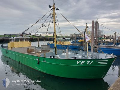
YE-71 JOHANNA ANTOIN
Not available
Current Trip
| Trip Time | 1 day |
|---|---|
| Trip Distance | 8.05 nm |
| AVG Speed | 3 Noeuds |
| MAX Speed | 6.5 Noeuds |
| Tirant d eau | 0.8 m |
| AVG Wind | 16.1 knots |
| MAX Wind | 23.9 knots |
| MIN Temp | 7.7°C / 45.86°F |
| MAX Temp | 10.9°C / 51.62°F |
| Position reçue | 1 h, 44 m depuis |
Current Position
| Longitude | --- |
|---|---|
| Latitude | --- |
| Etat | Engaged in Fishing |
| Vitesse | |
| Parcours | --- |
| Zone | North Sea |
| Station | T-AIS |
| Position reçue | 1 h, 44 m depuis |
Info
Information
The current position of YE-71 JOHANNA ANTOIN is in North Sea with coordinates 51.50144° / 4.05354° as reported on 2024-11-29 03:13 by AIS to our vessel tracker app. The vessel's current speed is 0 Noeuds and is currently inside the port of YERSEKE.
The vessel YE-71 JOHANNA ANTOIN (MMSI: 244770805) is a Not available It's sailing under the flag of [NL] Netherlands.
In this page you can find informations about the vessels current position, last detected port calls, and current voyage information. If the vessels is not in coverage by AIS you will find the latest position.
The current position of YE-71 JOHANNA ANTOIN is detected by our AIS receivers and we are not responsible for the reliability of the data. The last position was recorded while the vessel was in Coverage by the Ais receivers of our vessel tracking app.
The current draught of YE-71 JOHANNA ANTOIN as reported by AIS is 0.8 meters
Weather
| Temperature | 5.3°C / 41.54°F |
|---|---|
| Wind Speed | 6 knots |
| Direction | 173° S |
| Pressure | 1031.1 hPa |
| Humidity | 84.6 % |
| Cloud Coverage | 8 % |
Featured Company
Last Port Calls
| Port | Arrival | Departure | Time In Port |
|---|---|---|---|
| 2024-11-28 13:53 | |||
| 2024-11-27 10:59 | |||
| 2024-11-26 14:25 | 2024-11-27 07:29 | 17 h | |
| 2024-11-25 11:38 | 2024-11-26 07:15 | 19 h | |
| 2024-11-22 15:19 | 2024-11-25 07:16 | 2 d | |
| 2024-11-22 10:56 | 2024-11-22 13:59 | 3 h | |
| 2024-11-19 10:32 | 2024-11-22 07:04 | 2 d | |
| 2024-11-18 10:34 | 2024-11-19 07:25 | 20 h | |
| 2024-11-18 07:49 | |||
| 2024-11-13 13:04 | 2024-11-14 06:27 | 17 h |
Most Visited Ports (Last year)
| Port | Arrivals | |
|---|---|---|
| 185 |
Last Trips
| Origin | Departure | Destination | Arrival | Distance | |
|---|---|---|---|---|---|
| 2024-11-27 08:29 | 2024-11-28 14:53 | 8.05 nm | |||
| 2024-11-27 08:29 | 2024-11-27 11:59 | 3.97 nm | |||
| 2024-11-26 08:15 | 2024-11-26 15:25 | 8.56 nm | |||
| 2024-11-25 08:16 | 2024-11-25 12:38 | 4.61 nm | |||
| 2024-11-22 14:59 | 2024-11-22 16:19 | 0.96 nm | |||
| 2024-11-22 08:04 | 2024-11-22 11:56 | 3.38 nm | |||
| 2024-11-19 08:25 | 2024-11-19 11:32 | 5.01 nm | |||
| 2024-11-18 08:49 | 2024-11-18 11:34 | 2.77 nm | |||
| 2024-11-13 07:26 | 2024-11-13 14:04 | 4.26 nm | |||
| 2024-11-12 07:27 | 2024-11-12 11:56 | 4.19 nm |
Events
| Heure | Evenement | Détails | Position/ Destination | Info |
|---|---|---|---|---|
| 2024-11-29 03:13 | Hors de la zone couverte |
51.50144 / 4.05354
North Sea
[NL] YERSEKE
|
Vitesse: Parcours: 0° |
|
| 2024-11-29 02:02 | Dans la zone couverte |
51.50143 / 4.05349
North Sea
[NL] YERSEKE
|
Vitesse: Parcours: 0° |
|
| 2024-11-28 23:17 | Hors de la zone couverte |
51.50144 / 4.05347
North Sea
[NL] YERSEKE
|
Vitesse: Parcours: 0° |
|
| 2024-11-28 22:24 | Dans la zone couverte |
51.50137 / 4.05346
North Sea
[NL] YERSEKE
|
Vitesse: Parcours: 0° |
|
| 2024-11-28 14:54 | Hors de la zone couverte |
51.50140 / 4.05354
North Sea
[NL] YERSEKE
|
Vitesse: Parcours: 0° |
|
| 2024-11-28 14:13 | Arret |
51.50140 / 4.05360
[NL] YERSEKE
|
Vitesse: 0.3 kn Parcours: 511° |
|
| 2024-11-28 13:53 | Dans la zone couverte |
51.49812 / 4.05750
North Sea
[NL] YERSEKE
|
Vitesse: 4.9 kn Parcours: 291.5° |
|
| 2024-11-28 13:53 | Port d'arrivée |
|
51.49812 / 4.05750
[NL] YERSEKE
|
Vitesse: Parcours: 511° |
| 2024-11-28 12:24 | Hors de la zone couverte |
51.48626 / 4.05846
North Sea
|
Vitesse: Parcours: 133.4° |
|
| 2024-11-28 10:12 | Arret | 0.78 nm, South of YERSEKE |
51.48500 / 4.05816
YERSEKE-;
|
Vitesse: 0.2 kn Parcours: 511° |