
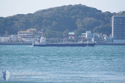
YAHATA_MARU
Cargo
Current Trip
| Trip Time | 19 h, 14 mins |
|---|---|
| Trip Distance | 236.11 nm |
| AVG Speed | 12.2 Noeuds |
| MAX Speed | 13.8 Noeuds |
| Tirant d eau | 3.9 m |
| AVG Wind | 5.3 knots |
| MAX Wind | 10.1 knots |
| MIN Temp | 13.1°C / 55.58°F |
| MAX Temp | 19.3°C / 66.74°F |
| Position reçue | 1 d depuis |
Current Position
| Longitude | 134.90293° |
|---|---|
| Latitude | 33.97415° |
| Etat | Under way using engine |
| Vitesse | 12.9 Noeuds |
| Parcours | 139.4° |
| Zone | Philippine Sea |
| Station | T-AIS |
| Position reçue | 1 d depuis |
Info
Information
The current position of YAHATA_MARU is in Philippine Sea with coordinates 33.97415° / 134.90293° as reported on 2024-05-03 12:57 by AIS to our vessel tracker app. The vessel's current speed is 12.9 Noeuds and is currently inside the port of NAGOYA.
The vessel YAHATA_MARU (IMO: 9566019, MMSI: 431001106) is a Cargo It's sailing under the flag of [JP] Japan.
In this page you can find informations about the vessels current position, last detected port calls, and current voyage information. If the vessels is not in coverage by AIS you will find the latest position.
The current position of YAHATA_MARU is detected by our AIS receivers and we are not responsible for the reliability of the data. The last position was recorded while the vessel was in Coverage by the Ais receivers of our vessel tracking app.
The current draught of YAHATA_MARU as reported by AIS is 3.9 meters
Weather
| Temperature | 19.3°C / 66.74°F |
|---|---|
| Wind Speed | 14 knots |
| Direction | 156° SSE |
| Pressure | 1022.1 hPa |
| Humidity | 69.4 % |
| Cloud Coverage | 35 % |
Featured Company
Last Port Calls
| Port | Arrival | Departure | Time In Port |
|---|---|---|---|
| 2024-05-04 04:04 | |||
| 2024-05-02 21:48 | 2024-05-03 08:50 | 11 h | |
| 2024-04-29 21:59 | 2024-05-02 08:52 | 2 d | |
| 2024-04-26 23:43 | 2024-04-29 02:37 | 2 d | |
| 2024-04-22 10:00 | 2024-04-25 02:52 | 2 d | |
| 2024-04-21 22:55 | 2024-04-22 08:40 | 9 h | |
| 2024-04-18 16:35 | 2024-04-20 06:48 | 1 d | |
| 2024-04-15 10:54 | 2024-04-17 06:11 | 1 d | |
| 2024-04-14 22:25 | 2024-04-15 05:49 | 7 h | |
| 2024-04-11 21:58 | 2024-04-12 08:29 | 10 h |
Last Trips
| Origin | Departure | Destination | Arrival | Distance | |
|---|---|---|---|---|---|
| 2024-05-03 17:50 | 2024-05-04 13:04 | 236.11 nm | |||
| 2024-05-02 17:52 | 2024-05-03 06:48 | 1.72 nm | |||
| 2024-04-29 11:37 | 2024-04-30 06:59 | 42.50 nm | |||
| 2024-04-25 11:52 | 2024-04-27 08:43 | 359.72 nm | |||
| 2024-04-22 17:40 | 2024-04-22 19:00 | 16.65 nm | |||
| 2024-04-20 15:48 | 2024-04-22 07:55 | 220.83 nm | |||
| 2024-04-17 15:11 | 2024-04-19 01:35 | 417.49 nm | |||
| 2024-04-15 14:49 | 2024-04-15 19:54 | 61.61 nm | |||
| 2024-04-12 17:29 | 2024-04-15 07:25 | 601.33 nm | |||
| 2024-04-11 11:52 | 2024-04-12 06:58 | 10.09 nm |
Events
| Heure | Evenement | Détails | Position/ Destination | Info |
|---|---|---|---|---|
| 2024-05-04 04:36 | Arret |
35.06247 / 136.85931
[JP] NAGOYA
|
Vitesse: 0.2 kn Parcours: 10° |
|
| 2024-05-04 04:04 | Port d'arrivée |
|
34.99430 / 136.82056
[JP] NAGOYA
|
Vitesse: 12.6 kn Parcours: 33° |
| 2024-05-03 13:05 | Etat Changé | Default Under way using engine |
33.95335 / 134.92452
JP NGO N4
|
Vitesse: 12.9 kn Parcours: 139.4° |
| 2024-05-03 12:57 | Etat Changé | Under way using engine Default |
33.97415 / 134.90293
JP NGO N4
|
Vitesse: 13 kn Parcours: 140° |
| 2024-05-03 12:57 | Hors de la zone couverte |
33.97415 / 134.90293
Philippine Sea
JP NGO N4
|
Vitesse: 12.9 kn Parcours: 139.4° |
|
| 2024-05-03 12:32 | Etat Changé | Default Under way using engine |
34.04122 / 134.83356
JP NGO N4
|
Vitesse: 12.6 kn Parcours: 138.8° |
| 2024-05-03 12:22 | Etat Changé | Under way using engine Default |
34.06912 / 134.80447
JP NGO N4
|
Vitesse: 12.6 kn Parcours: 140° |
| 2024-05-03 12:16 | Etat Changé | Default Under way using engine |
34.08393 / 134.78940
JP NGO N4
|
Vitesse: 12.6 kn Parcours: 140.1° |
| 2024-05-03 11:53 | Changement de zone | Japanese part of the Philippine Sea Japanese part of the Inland Sea |
34.14805 / 134.72458
Philippine Sea
JP NGO N4
|
Vitesse: 13.1 kn Parcours: 138.7° |
| 2024-05-03 11:50 | Etat Changé | Under way using engine Default |
34.15542 / 134.71682
JP NGO N4
|
Vitesse: 13.3 kn Parcours: 140° |