
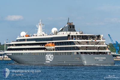
WORLD VOYAGER
Passenger
Current Trip
| Trip Time | 3 days |
|---|---|
| Trip Distance | 341.36 nm |
| AVG Speed | 6.9 Noeuds |
| MAX Speed | 13.1 Noeuds |
| Tirant d eau | 4.8 m |
| AVG Wind | 11.2 knots |
| MAX Wind | 17 knots |
| MIN Temp | 25.4°C / 77.72°F |
| MAX Temp | 28.2°C / 82.76°F |
| Position reçue | 1 m depuis |
Current Position
| Longitude | -63.04567° |
|---|---|
| Latitude | 18.01193° |
| Etat | Moored |
| Vitesse | 0.1 Noeuds |
| Parcours | 217° |
| Zone | Caribbean Sea |
| Station | T-AIS |
| Position reçue | 1 m depuis |
Info
Information
The current position of WORLD VOYAGER is in Caribbean Sea with coordinates 18.01193° / -63.04567° as reported on 2024-05-09 18:01 by AIS to our vessel tracker app. The vessel's current speed is 0.1 Noeuds and is currently inside the port of PHILIPSBURG.
The vessel WORLD VOYAGER (IMO: 9871529, MMSI: 255806150) is a Passenger It's sailing under the flag of [PT] Portugal.
In this page you can find informations about the vessels current position, last detected port calls, and current voyage information. If the vessels is not in coverage by AIS you will find the latest position.
The current position of WORLD VOYAGER is detected by our AIS receivers and we are not responsible for the reliability of the data. The last position was recorded while the vessel was in Coverage by the Ais receivers of our vessel tracking app.
The current draught of WORLD VOYAGER as reported by AIS is 4.8 meters
Weather
| Temperature | 27.2°C / 80.96°F |
|---|---|
| Wind Speed | 10 knots |
| Direction | 86° E |
| Pressure | 1013.6 hPa |
| Humidity | 77.6 % |
| Cloud Coverage | --- |
Featured Company
Last Port Calls
| Port | Arrival | Departure | Time In Port |
|---|---|---|---|
| 2024-05-09 09:23 | |||
| 2024-05-05 10:48 | 2024-05-05 23:41 | 12 h | |
| 2024-05-03 10:58 | 2024-05-04 00:01 | 13 h | |
| 2024-05-02 11:45 | 2024-05-03 00:10 | 12 h | |
| 2024-04-30 13:14 | 2024-04-30 23:07 | 9 h | |
| 2024-04-26 11:31 | 2024-04-26 21:59 | 10 h | |
| 2024-04-23 12:16 | 2024-04-25 02:06 | 1 d | |
| 2024-04-13 10:00 | 2024-04-13 20:12 | 10 h | |
| 2024-04-05 10:27 | 2024-04-06 19:02 | 1 d | |
| 2024-04-01 10:17 | 2024-04-01 21:25 | 11 h |
Most Visited Ports (Last year)
| Port | Arrivals | |
|---|---|---|
| 15 | ||
| 3 | ||
| 3 | ||
| 3 | ||
| 3 | ||
| 2 |
Last Trips
| Origin | Departure | Destination | Arrival | Distance | |
|---|---|---|---|---|---|
| 2024-05-05 19:41 | 2024-05-09 05:23 | 341.36 nm | |||
| 2024-05-03 20:01 | 2024-05-05 06:48 | 159.17 nm | |||
| 2024-05-02 20:10 | 2024-05-03 06:58 | 103.30 nm | |||
| 2024-04-30 19:07 | 2024-05-02 07:45 | 195.77 nm | |||
| 2024-04-26 17:59 | 2024-04-30 09:14 | 457.56 nm | |||
| 2024-04-24 22:06 | 2024-04-26 07:31 | 272.11 nm | |||
| 2024-04-13 17:12 | 2024-04-23 08:16 | 3118.24 nm | |||
| 2024-04-06 16:02 | 2024-04-13 07:00 | 1458.17 nm | |||
| 2024-04-01 18:25 | 2024-04-05 07:27 | 897.69 nm | |||
| 2024-03-29 21:25 | 2024-04-01 07:17 | 451.51 nm |
Events
| Heure | Evenement | Détails | Position/ Destination | Info |
|---|---|---|---|---|
| 2024-05-09 09:53 | Etat Changé | Moored Under way using engine |
18.01191 / -63.04565
[SX] PHILIPSBURG
|
Vitesse: Parcours: 217° |
| 2024-05-09 09:33 | Arret |
18.00878 / -63.04650
[SX] PHILIPSBURG
|
Vitesse: 0.2 kn Parcours: 204° |
|
| 2024-05-09 09:23 | Port d'arrivée |
|
18.00735 / -63.04782
[SX] PHILIPSBURG
|
Vitesse: 2.2 kn Parcours: 60° |
| 2024-05-09 07:43 | Detecté en mer | Sint-Maarten part of the Caribbean Sea |
17.98427 / -63.19764
Caribbean Sea
|
Vitesse: 7.9 kn Parcours: 93.8° |
| 2024-05-09 06:46 | Etat Changé | Under way using engine Default |
18.01390 / -63.31014
SANDY GROUND
|
Vitesse: 6 kn Parcours: 270° |
| 2024-05-09 06:38 | Etat Changé | Default Under way using engine |
18.01576 / -63.29720
SANDY GROUND
|
Vitesse: 6 kn Parcours: 270.8° |
| 2024-05-09 06:24 | Etat Changé | Under way using engine Default |
18.01573 / -63.27245
SANDY GROUND
|
Vitesse: 5.8 kn Parcours: 270° |
| 2024-05-09 06:18 | Etat Changé | Default Under way using engine |
18.01569 / -63.26264
SANDY GROUND
|
Vitesse: 5.8 kn Parcours: 269.5° |
| 2024-05-09 05:26 | Changement de zone | Saint-Martin part of the Caribbean Sea Anguilla part of the Caribbean Sea |
18.08230 / -63.25261
Caribbean Sea
|
Vitesse: 5.5 kn Parcours: 165.9° |
| 2024-05-09 03:47 | Etat Changé | Under way using engine Default |
18.11614 / -63.38360
SANDY GROUND
|
Vitesse: 4.5 kn Parcours: 157° |