
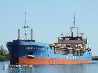
WILSON TWISTEDEN
General Cargo
Current Trip
| Time Travelled | 10 h, 24 mins |
|---|---|
| Remaining Time | 11 h, 3 mins |
| Distance Travelled | 96.14 nm |
| Remaining Distance | 103.90 nm |
| AVG Speed | 9.5 Noeuds |
| MAX Speed | 10.2 Noeuds |
| AVG Wind | 6.9 knots |
| MAX Wind | 9.8 knots |
| MIN Temp | 9.4°C / 48.92°F |
| MAX Temp | 11.4°C / 52.52°F |
| Tirant d eau | 4.2 m |
| Position reçue | 1 m depuis |
Current Position
| Longitude | 12.70382° |
|---|---|
| Latitude | 55.77431° |
| Etat | Under way using engine |
| Vitesse | 9.4 Noeuds |
| Parcours | 11.2° |
| Zone | Kattegat |
| Station | T-AIS |
| Position reçue | 1 m depuis |
Info
Information
The current position of WILSON TWISTEDEN is in Kattegat with coordinates 55.77431° / 12.70382° as reported on 2024-04-29 20:32 by AIS to our vessel tracker app. The vessel's current speed is 9.4 Noeuds and is heading at the port of AARHUS. The estimated time of arrival as calculated by MyShipTracking vessel tracking app is 2024-04-30 07:36 LT
The vessel WILSON TWISTEDEN (IMO: 9195468, MMSI: 314606000) is a General Cargo that was built in 2002 ( 22 Age ). It's sailing under the flag of [BB] Barbados.
In this page you can find informations about the vessels current position, last detected port calls, and current voyage information. If the vessels is not in coverage by AIS you will find the latest position.
The current position of WILSON TWISTEDEN is detected by our AIS receivers and we are not responsible for the reliability of the data. The last position was recorded while the vessel was in Coverage by the Ais receivers of our vessel tracking app.
The current draught of WILSON TWISTEDEN as reported by AIS is 4.2 meters
Weather
| Temperature | 10°C / 50°F |
|---|---|
| Wind Speed | 6 knots |
| Direction | 150° SSE |
| Pressure | 1025.3 hPa |
| Humidity | 75.2 % |
| Cloud Coverage | 100 % |
Featured Company
Last Port Calls
| Port | Arrival | Departure | Time In Port |
|---|---|---|---|
| 2024-04-29 03:49 | 2024-04-29 10:09 | 6 h | |
| 2024-04-23 19:30 | 2024-04-25 06:22 | 1 d | |
| 2024-04-19 06:41 | 2024-04-21 10:33 | 2 d | |
| 2024-04-17 19:59 | 2024-04-18 16:32 | 20 h | |
| 2024-04-05 11:44 | 2024-04-05 11:46 | 1 m | |
| 2024-04-05 00:39 | 2024-04-05 10:48 | 10 h | |
| 2024-04-03 01:52 | 2024-04-04 23:42 | 1 d | |
| 2024-04-01 09:25 | 2024-04-02 14:07 | 1 d | |
| 2024-03-29 23:01 | 2024-03-30 23:13 | 1 d | |
| 2024-03-18 21:29 | 2024-03-21 16:00 | 2 d |
Last Trips
| Origin | Departure | Destination | Arrival | Distance | |
|---|---|---|---|---|---|
| 2024-04-25 08:22 | 2024-04-29 05:49 | 177.86 nm | |||
| 2024-04-21 12:33 | 2024-04-23 21:30 | 463.92 nm | |||
| 2024-04-18 18:32 | 2024-04-19 08:41 | 116.13 nm | |||
| 2024-04-05 13:46 | 2024-04-17 21:59 | 1076.77 nm | |||
| 2024-04-05 12:48 | 2024-04-05 13:44 | 11.75 nm | |||
| 2024-04-05 01:42 | 2024-04-05 02:39 | 7.95 nm | |||
| 2024-04-02 16:07 | 2024-04-03 03:52 | 110.92 nm | |||
| 2024-03-31 00:13 | 2024-04-01 11:25 | 305.78 nm | |||
| 2024-03-21 17:00 | 2024-03-30 00:01 | 1271.55 nm | |||
| 2024-03-18 18:13 | 2024-03-18 22:29 | 45.02 nm |
Events
| Heure | Evenement | Détails | Position/ Destination | Info |
|---|---|---|---|---|
| 2024-04-29 18:50 | Changement de zone | Danish part of the Kattegat Swedish part of the Kattegat |
55.50287 / 12.71866
Kattegat
DKAAR
|
Vitesse: 9.4 kn Parcours: 3° |
| 2024-04-29 17:47 | Changement de zone | Swedish part of the Kattegat Swedish part of the Baltic Sea |
55.34001 / 12.68827
Kattegat
DKAAR
|
Vitesse: 9.4 kn Parcours: 6° |
| 2024-04-29 14:26 | Changement de zone | Swedish part of the Baltic Sea German part of the Baltic Sea |
55.01934 / 13.31763
Baltic Sea
DKAAR
|
Vitesse: 9.4 kn Parcours: 331.9° |
| 2024-04-29 11:52 | Tirant d'eau modifié | 4.2 3.1 |
54.66830 / 13.65687
DKAAR
|
Vitesse: 9.3 kn Parcours: 332.4° |
| 2024-04-29 11:52 | Changement de destination | DKAAR DEMUK |
54.66830 / 13.65687
DKAAR
|
Vitesse: 9.3 kn Parcours: 332.4° |
| 2024-04-29 11:52 | Changement d'ETA | 2024/04/30 12:00 2024/04/26 02:00 |
54.66830 / 13.65687
DKAAR
|
Vitesse: 9.3 kn Parcours: 332.4° |
| 2024-04-29 11:04 | Dans la zone couverte |
54.56149 / 13.75811
Baltic Sea
|
Vitesse: 9.3 kn Parcours: 333.2° |
|
| 2024-04-29 11:03 | Etat Changé | Under way using engine Default |
54.55920 / 13.76004
DEMUK
|
Vitesse: 9.2 kn Parcours: 29° |
| 2024-04-29 10:09 | Démarrage | 0.93 nm, South East of MUKRAN |
54.47333 / 13.61333
DEMUK
|
Vitesse: 9 kn Parcours: -1° |
| 2024-04-29 10:09 | PORT DE DEPART |
|
54.47333 / 13.61333
DEMUK
|
Vitesse: 1.4 kn Parcours: 158° |