
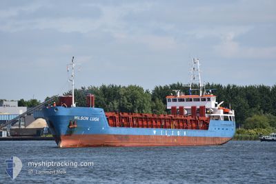
WILSON LUGA
General Cargo
Current Trip
| Trip Time | 22 h, 36 mins |
|---|---|
| Trip Distance | 160.91 nm |
| AVG Speed | 7.2 Noeuds |
| MAX Speed | 10.8 Noeuds |
| Tirant d eau | 3.5 m |
| AVG Wind | 16.5 knots |
| MAX Wind | 30 knots |
| MIN Temp | 3.2°C / 37.76°F |
| MAX Temp | 8.3°C / 46.94°F |
| Position reçue | Maintenant |
Current Position
| Longitude | --- |
|---|---|
| Latitude | --- |
| Etat | Moored |
| Vitesse | |
| Parcours | 230° |
| Zone | Kattegat |
| Station | T-AIS |
| Position reçue | Maintenant |
Info
Information
The current position of WILSON LUGA is in Kattegat with coordinates 57.71642° / 10.59789° as reported on 2024-12-22 11:31 by AIS to our vessel tracker app. The vessel's current speed is 0 Noeuds and is currently inside the port of SKAGEN.
The vessel WILSON LUGA (IMO: 9156187, MMSI: 314471000) is a General Cargo that was built in 1996 ( 28 Age ). It's sailing under the flag of [BB] Barbados.
In this page you can find informations about the vessels current position, last detected port calls, and current voyage information. If the vessels is not in coverage by AIS you will find the latest position.
The current position of WILSON LUGA is detected by our AIS receivers and we are not responsible for the reliability of the data. The last position was recorded while the vessel was in Coverage by the Ais receivers of our vessel tracking app.
The current draught of WILSON LUGA as reported by AIS is 4.6 meters
Weather
| Temperature | 6°C / 42.8°F |
|---|---|
| Wind Speed | 18 knots |
| Direction | 216° SW |
| Pressure | 982.6 hPa |
| Humidity | 80.9 % |
| Cloud Coverage | 42 % |
Featured Company
Last Port Calls
| Port | Arrival | Departure | Time In Port |
|---|---|---|---|
| 2024-12-19 01:13 | |||
| 2024-12-13 16:33 | 2024-12-18 02:37 | 4 d | |
| 2024-12-07 08:50 | 2024-12-07 23:17 | 14 h | |
| 2024-12-01 20:25 | 2024-12-04 10:31 | 2 d | |
| 2024-11-22 04:38 | 2024-11-23 13:35 | 1 d | |
| 2024-11-18 19:32 | 2024-11-19 13:51 | 18 h | |
| 2024-10-27 06:22 | 2024-11-17 11:22 | 21 d | |
| 2024-10-22 06:34 | 2024-10-25 07:07 | 3 d | |
| 2024-10-14 14:22 | 2024-10-17 15:58 | 3 d | |
| 2024-10-13 05:09 | 2024-10-14 05:37 | 1 d |
Last Trips
| Origin | Departure | Destination | Arrival | Distance | |
|---|---|---|---|---|---|
| 2024-12-18 03:37 | 2024-12-19 02:13 | 160.91 nm | |||
| 2024-12-08 00:17 | 2024-12-13 17:33 | 971.34 nm | |||
| 2024-12-04 11:31 | 2024-12-07 09:50 | 252.48 nm | |||
| 2024-11-23 14:35 | 2024-12-01 21:25 | 871.06 nm | |||
| 2024-11-19 14:51 | 2024-11-22 05:38 | 543.31 nm | |||
| 2024-11-17 12:22 | 2024-11-18 20:32 | 38.09 nm | |||
| 2024-10-25 09:07 | 2024-10-27 07:22 | 429.94 nm | |||
| 2024-10-17 17:58 | 2024-10-22 08:34 | 658.32 nm | |||
| 2024-10-14 07:37 | 2024-10-14 16:22 | 4.43 nm | |||
| 2024-10-13 06:13 | 2024-10-13 07:09 | 6.51 nm |
Events
| Heure | Evenement | Détails | Position/ Destination | Info |
|---|---|---|---|---|
| 2024-12-21 12:19 | Etat Changé | Moored Default |
57.71642 / 10.59794
[DK] SKAGEN
|
Vitesse: Parcours: 230° |
| 2024-12-21 12:16 | Etat Changé | Default Moored |
57.71641 / 10.59801
[DK] SKAGEN
|
Vitesse: Parcours: 230° |
| 2024-12-20 17:34 | Etat Changé | Moored Default |
57.71875 / 10.60009
[DK] SKAGEN
|
Vitesse: Parcours: 223° |
| 2024-12-20 17:31 | Etat Changé | Default Moored |
57.71876 / 10.60013
[DK] SKAGEN
|
Vitesse: Parcours: 223° |
| 2024-12-20 15:49 | Tirant d'eau modifié | 4.6 3.5 |
57.71872 / 10.60012
[DK] SKAGEN
|
Vitesse: Parcours: 223° |
| 2024-12-20 15:49 | Changement de destination | NOVAE BJUGN DKSKA SKAGEN |
57.71872 / 10.60012
[DK] SKAGEN
|
Vitesse: Parcours: 223° |
| 2024-12-20 15:49 | Changement d'ETA | 2024/12/25 15:00 2024/12/19 01:00 |
57.71872 / 10.60012
[DK] SKAGEN
|
Vitesse: Parcours: 223° |
| 2024-12-20 00:22 | Etat Changé | Moored Default |
57.71892 / 10.60037
[DK] SKAGEN
|
Vitesse: Parcours: 223° |
| 2024-12-20 00:19 | Etat Changé | Default Moored |
57.71891 / 10.60038
[DK] SKAGEN
|
Vitesse: Parcours: 223° |
| 2024-12-19 22:04 | Etat Changé | Moored Default |
57.71890 / 10.60032
[DK] SKAGEN
|
Vitesse: Parcours: 222° |