

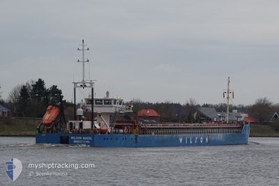
WILSON BAERL
General Cargo

Current Trip
| Time Travelled | 8 h, 48 mins |
|---|---|
| Remaining Time | 1 day |
| Distance Travelled | 73.90 nm |
| Remaining Distance | 302.56 nm |
| AVG Speed | 11.2 Noeuds |
| MAX Speed | 13 Noeuds |
| AVG Wind | 12.4 knots |
| MAX Wind | 21 knots |
| MIN Temp | -3.8°C / 25.16°F |
| MAX Temp | 3.1°C / 37.58°F |
| Tirant d eau | 4.1 m |
| Position reçue | 1 h, 59 m depuis |
Current Position
| Longitude | --- |
|---|---|
| Latitude | --- |
| Etat | Under way using engine |
| Vitesse | 8.6 Noeuds |
| Parcours | 278° |
| Zone | North Sea |
| Station | T-AIS |
| Position reçue | 1 h, 59 m depuis |
Information
The current position of WILSON BAERL is in North Sea with coordinates 54.00017° / 8.26767° as reported on 2025-02-19 14:26 by AIS to our vessel tracker app. The vessel's current speed is 8.6 Noeuds and is heading at the port of IMMINGHAM. The estimated time of arrival as calculated by MyShipTracking vessel tracking app is 2025-02-21 03:15 LT
The vessel WILSON BAERL (IMO: 9194311, MMSI: 314605000) is a General Cargo that was built in 1999 ( 26 Age ). It's sailing under the flag of [BB] Barbados.
In this page you can find informations about the vessels current position, last detected port calls, and current voyage information. If the vessels is not in coverage by AIS you will find the latest position.
The current position of WILSON BAERL is detected by our AIS receivers and we are not responsible for the reliability of the data. The last position was recorded while the vessel was in Coverage by the Ais receivers of our vessel tracking app.
The current draught of WILSON BAERL as reported by AIS is 4.1 meters
Weather
| Temperature | 3.4°C / 38.12°F |
|---|---|
| Wind Speed | 24 knots |
| Direction | 135° SE |
| Pressure | 1025.2 hPa |
| Humidity | 49.7 % |
| Cloud Coverage | --- |


Featured Company
Last Port Calls
| Port | Arrival | Departure | Time In Port |
|---|---|---|---|
| 2025-02-18 13:25 | 2025-02-19 08:38 | 19 h | |
| 2025-02-09 18:15 | 2025-02-12 12:14 | 2 d | |
| 2025-02-06 11:04 | 2025-02-07 02:06 | 15 h | |
| 2025-02-03 18:42 | 2025-02-04 17:58 | 23 h | |
| 2025-01-31 23:04 | 2025-02-01 13:46 | 14 h | |
| 2025-01-31 20:52 | 2025-01-31 22:07 | 1 h | |
| 2025-01-30 00:57 | 2025-01-30 19:12 | 18 h | |
| 2025-01-20 18:13 | 2025-01-21 13:10 | 18 h | |
| 2025-01-14 11:06 | 2025-01-16 14:19 | 2 d | |
| 2025-01-11 22:06 | 2025-01-13 20:06 | 1 d |
Last Trips
| Origin | Departure | Destination | Arrival | Distance | |
|---|---|---|---|---|---|
| 2025-02-12 12:14 | 2025-02-18 13:25 | 502.14 nm | |||
| 2025-02-07 02:06 | 2025-02-09 18:15 | 462.99 nm | |||
| 2025-02-04 17:58 | 2025-02-06 11:04 | 302.00 nm | |||
| 2025-02-01 13:46 | 2025-02-03 18:42 | 412.17 nm | |||
| 2025-01-31 22:07 | 2025-01-31 23:04 | 9.21 nm | |||
| 2025-01-30 19:12 | 2025-01-31 20:52 | 103.48 nm | |||
| 2025-01-21 13:10 | 2025-01-30 00:57 | 911.49 nm | |||
| 2025-01-16 14:19 | 2025-01-20 18:13 | 639.78 nm | |||
| 2025-01-13 20:06 | 2025-01-14 11:06 | 115.74 nm | |||
| 2025-01-08 17:49 | 2025-01-11 22:06 | 624.22 nm |
Events
| Heure | Evenement | Détails | Position/ Destination | Info |
|---|---|---|---|---|
| 2025-02-19 14:33 | Etat Changé | Default Under way using engine |
54.00267 / 8.24017
GBIMM
|
Vitesse: 8.6 kn Parcours: 278° |
| 2025-02-19 14:26 | Hors de la zone couverte |
54.00017 / 8.26767
North Sea
GBIMM
|
Vitesse: 8.6 kn Parcours: 278° |
|
| 2025-02-19 14:25 | Etat Changé | Under way using engine Default |
53.99983 / 8.27300
GBIMM
|
Vitesse: 8.5 kn Parcours: 279° |
| 2025-02-19 14:21 | Etat Changé | Default Under way using engine |
53.99850 / 8.28900
GBIMM
|
Vitesse: 8.4 kn Parcours: 281° |
| 2025-02-19 14:12 | Etat Changé | Under way using engine Default |
53.99483 / 8.32483
GBIMM
|
Vitesse: 8.2 kn Parcours: 279° |
| 2025-02-19 13:57 | Dans la zone couverte |
53.99550 / 8.31833
North Sea
GBIMM
|
Vitesse: 8.3 kn Parcours: 281° |
|
| 2025-02-19 13:01 | Etat Changé | Default Under way using engine |
53.96767 / 8.57017
GBIMM
|
Vitesse: 7.6 kn Parcours: 286° |
| 2025-02-19 12:56 | Hors de la zone couverte |
53.96550 / 8.58933
North Sea
GBIMM
|
Vitesse: 7.6 kn Parcours: 286° |
|
| 2025-02-19 11:22 | Changement d'ETA | 2025/02/21 04:00 2025/02/21 05:00 |
53.84483 / 8.91517
GBIMM
|
Vitesse: 11.6 kn Parcours: 263° |
| 2025-02-19 07:49 | Tirant d'eau modifié | 4.1 4 |
53.55450 / 9.80650
GBIMM
|
Vitesse: 10.3 kn Parcours: 286° |