
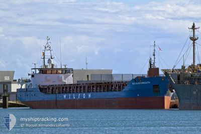
WILSON AVONMOUTH
General Cargo
Current Trip
| Time Travelled | 3 days |
|---|---|
| Remaining Time | 15 h, 21 mins |
| Distance Travelled | 806.30 nm |
| Remaining Distance | 156.99 nm |
| AVG Speed | 9.7 Noeuds |
| MAX Speed | 10.9 Noeuds |
| AVG Wind | 13.7 knots |
| MAX Wind | 22.9 knots |
| MIN Temp | 4.5°C / 40.1°F |
| MAX Temp | 8.6°C / 47.48°F |
| Tirant d eau | 3.9 m |
| Position reçue | 3 m depuis |
Current Position
| Longitude | 10.27246° |
|---|---|
| Latitude | 66.93846° |
| Etat | Under way using engine |
| Vitesse | 9.6 Noeuds |
| Parcours | 71.6° |
| Zone | Norwegian Sea |
| Station | T-AIS |
| Position reçue | 3 m depuis |
Info
Information
The current position of WILSON AVONMOUTH is in Norwegian Sea with coordinates 66.93846° / 10.27246° as reported on 2024-05-12 01:48 by AIS to our vessel tracker app. The vessel's current speed is 9.6 Noeuds and is heading at the port of STOKMARKNES. The estimated time of arrival as calculated by MyShipTracking vessel tracking app is 2024-05-12 17:12 LT
The vessel WILSON AVONMOUTH (IMO: 9313747, MMSI: 314604000) is a General Cargo that was built in 2010 ( 14 Age ). It's sailing under the flag of [BB] Barbados.
In this page you can find informations about the vessels current position, last detected port calls, and current voyage information. If the vessels is not in coverage by AIS you will find the latest position.
The current position of WILSON AVONMOUTH is detected by our AIS receivers and we are not responsible for the reliability of the data. The last position was recorded while the vessel was in Coverage by the Ais receivers of our vessel tracking app.
The current draught of WILSON AVONMOUTH as reported by AIS is 3.9 meters
Weather
| Temperature | 7.8°C / 46.04°F |
|---|---|
| Wind Speed | 12 knots |
| Direction | 215° SW |
| Pressure | 1016.9 hPa |
| Humidity | 98.9 % |
| Cloud Coverage | 100 % |
Featured Company
Last Port Calls
| Port | Arrival | Departure | Time In Port |
|---|---|---|---|
| 2024-05-07 09:45 | 2024-05-08 15:16 | 1 d | |
| 2024-05-04 16:16 | 2024-05-06 19:32 | 2 d | |
| 2024-05-02 08:04 | 2024-05-03 03:18 | 19 h | |
| 2024-04-26 16:33 | 2024-04-26 17:01 | 27 m | |
| 2024-04-25 15:43 | 2024-04-26 15:08 | 23 h | |
| 2024-04-25 14:28 | 2024-04-25 14:56 | 28 m | |
| 2024-04-24 17:00 | 2024-04-24 18:30 | 1 h | |
| 2024-04-17 14:30 | 2024-04-18 17:27 | 1 d | |
| 2024-04-09 13:23 | 2024-04-10 12:50 | 23 h | |
| 2024-03-26 17:19 | 2024-04-08 20:43 | 13 d |
Last Trips
| Origin | Departure | Destination | Arrival | Distance | |
|---|---|---|---|---|---|
| 2024-05-06 19:32 | 2024-05-07 09:45 | 126.80 nm | |||
| 2024-05-03 03:18 | 2024-05-04 16:16 | 338.92 nm | |||
| 2024-04-26 19:01 | 2024-05-02 08:04 | 1183.89 nm | |||
| 2024-04-26 17:08 | 2024-04-26 18:33 | 10.66 nm | |||
| 2024-04-25 16:56 | 2024-04-25 17:43 | 7.02 nm | |||
| 2024-04-24 20:30 | 2024-04-25 16:28 | 143.71 nm | |||
| 2024-04-18 19:27 | 2024-04-24 19:00 | 983.60 nm | |||
| 2024-04-10 14:50 | 2024-04-17 16:30 | 1575.05 nm | |||
| 2024-04-08 22:43 | 2024-04-09 15:23 | 128.80 nm |
Events
| Heure | Evenement | Détails | Position/ Destination | Info |
|---|---|---|---|---|
| 2024-05-12 01:01 | Tirant d'eau modifié | 3.9 5 |
66.90378 / 9.96104
NOSKN
|
Vitesse: 9.9 kn Parcours: 74.9° |
| 2024-05-12 01:01 | Changement de destination | NOSKN ISAYE |
66.90378 / 9.96104
NOSKN
|
Vitesse: 9.9 kn Parcours: 74.9° |
| 2024-05-12 01:01 | Changement d'ETA | 2024/05/13 06:00 2024/05/02 16:00 |
66.90378 / 9.96104
NOSKN
|
Vitesse: 9.9 kn Parcours: 74.9° |
| 2024-05-12 00:26 | Etat Changé | Under way using engine Default |
66.87371 / 9.72897
ISAYE
|
Vitesse: 10 kn Parcours: 68° |
| 2024-05-12 00:26 | Dans la zone couverte |
66.87371 / 9.72897
Norwegian Sea
|
Vitesse: 9.8 kn Parcours: 72.9° |
|
| 2024-05-11 23:31 | Etat Changé | Default Under way using engine |
66.82600 / 9.35824
ISAYE
|
Vitesse: 9.9 kn Parcours: 77° |
| 2024-05-11 23:11 | Hors de la zone couverte |
66.81421 / 9.22469
Norwegian Sea
|
Vitesse: 9.9 kn Parcours: 77° |
|
| 2024-05-11 23:09 | Detecté en mer | Norwegian part of the Norwegian Sea |
66.81260 / 9.20615
Norwegian Sea
|
Vitesse: 9.8 kn Parcours: 75.5° |
| 2024-05-11 23:09 | Etat Changé | Under way using engine Default |
66.81260 / 9.20615
ISAYE
|
Vitesse: 10 kn Parcours: 76° |
| 2024-05-11 23:09 | Dans la zone couverte |
66.81260 / 9.20615
Norwegian Sea
|
Vitesse: 9.8 kn Parcours: 75.5° |