
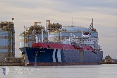
WILPRIDE
Lng Tanker
Current Trip
| Time Travelled | 36 days |
|---|---|
| Remaining Time | 1 h, 28 mins |
| Distance Travelled | 11334.42 nm |
| Remaining Distance | 32.84 nm |
| AVG Speed | 14.8 Noeuds |
| MAX Speed | 22.4 Noeuds |
| AVG Wind | 14.4 knots |
| MAX Wind | 32.2 knots |
| MIN Temp | 10.7°C / 51.26°F |
| MAX Temp | 25.7°C / 78.26°F |
| Tirant d eau | 10.9 m |
| Position reçue | 9 m depuis |
Current Position
| Longitude | --- |
|---|---|
| Latitude | --- |
| Etat | Under way using engine |
| Vitesse | 19.9 Noeuds |
| Parcours | 110.2° |
| Zone | Bay of Biscay |
| Station | T-AIS |
| Position reçue | 9 m depuis |
Info
Information
The current position of WILPRIDE is in Bay of Biscay with coordinates 43.74339° / -5.03581° as reported on 2025-01-03 04:41 by AIS to our vessel tracker app. The vessel's current speed is 19.9 Noeuds and is heading at the port of GIJON. The estimated time of arrival as calculated by MyShipTracking vessel tracking app is 2025-01-03 07:19 LT
The vessel WILPRIDE (IMO: 9627966, MMSI: 256278000) is a Lng Tanker that was built in 2013 ( 12 Age ). It's sailing under the flag of [MT] Malta.
In this page you can find informations about the vessels current position, last detected port calls, and current voyage information. If the vessels is not in coverage by AIS you will find the latest position.
The current position of WILPRIDE is detected by our AIS receivers and we are not responsible for the reliability of the data. The last position was recorded while the vessel was in Coverage by the Ais receivers of our vessel tracking app.
The current draught of WILPRIDE as reported by AIS is 10.9 meters
Weather
| Temperature | 12.1°C / 53.78°F |
|---|---|
| Wind Speed | 17 knots |
| Direction | 138° SE |
| Pressure | 1019.9 hPa |
| Humidity | 70.2 % |
| Cloud Coverage | 100 % |
Featured Company
Most Visited Ports (Last year)
| Port | Arrivals | |
|---|---|---|
| 3 | ||
| 2 | ||
| 1 | ||
| 1 |
Events
| Heure | Evenement | Détails | Position/ Destination | Info |
|---|---|---|---|---|
| 2025-01-03 04:43 | Etat Changé | Default Under way using engine |
43.74012 / -5.01908
ESGIJ
|
Vitesse: 19.9 kn Parcours: 110.2° |
| 2025-01-03 04:37 | Etat Changé | Under way using engine Default |
43.75169 / -5.06619
ESGIJ
|
Vitesse: 19.6 kn Parcours: 115° |
| 2025-01-03 04:34 | Etat Changé | Default Under way using engine |
43.75890 / -5.08846
ESGIJ
|
Vitesse: 19.3 kn Parcours: 114.3° |
| 2025-01-03 04:04 | Etat Changé | Under way using engine Default |
43.80805 / -5.29987
ESGIJ
|
Vitesse: 19.8 kn Parcours: 105° |
| 2025-01-03 04:02 | Etat Changé | Default Under way using engine |
43.81134 / -5.31675
ESGIJ
|
Vitesse: 19.6 kn Parcours: 105.4° |
| 2025-01-03 02:00 | Etat Changé | Under way using engine Default |
43.89981 / -6.18415
ESGIJ
|
Vitesse: 18.2 kn Parcours: 213° |
| 2025-01-03 01:55 | Etat Changé | Default Under way using engine |
43.92319 / -6.17405
ESGIJ
|
Vitesse: 18.2 kn Parcours: 214.4° |
| 2025-01-03 01:47 | Etat Changé | Under way using engine Default |
43.94604 / -6.12725
ESGIJ
|
Vitesse: 19.2 kn Parcours: 284° |
| 2025-01-03 01:27 | Etat Changé | Default Under way using engine |
43.91483 / -5.98922
ESGIJ
|
Vitesse: 19.2 kn Parcours: 288.6° |
| 2025-01-03 00:20 | Etat Changé | Under way using engine Default |
43.80795 / -5.52801
ESGIJ
|
Vitesse: 18.8 kn Parcours: 286° |