

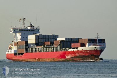
WILHELM
Container Ship

Current Trip
| Trip Time | 1 day |
|---|---|
| Trip Distance | 347.55 nm |
| AVG Speed | 11.4 Noeuds |
| MAX Speed | 15.5 Noeuds |
| Tirant d eau | 7.8 m |
| AVG Wind | 18.9 knots |
| MAX Wind | 26 knots |
| MIN Temp | 12.9°C / 55.22°F |
| MAX Temp | 19.8°C / 67.64°F |
| Position reçue | 2 d depuis |
Current Position
| Longitude | --- |
|---|---|
| Latitude | --- |
| Etat | Under way using engine |
| Vitesse | 10.9 Noeuds |
| Parcours | 39.3° |
| Zone | North Atlantic Ocean |
| Station | T-AIS |
| Position reçue | 2 d depuis |
Information
The current position of WILHELM is in North Atlantic Ocean with coordinates 29.07610° / -14.29754° as reported on 2025-03-24 16:02 by AIS to our vessel tracker app. The vessel's current speed is 10.9 Noeuds and is currently inside the port of AGADIR.
The vessel WILHELM (IMO: 9376050, MMSI: 212777000) is a Container Ship that was built in 2008 ( 17 Age ). It's sailing under the flag of [CY] Cyprus.
In this page you can find informations about the vessels current position, last detected port calls, and current voyage information. If the vessels is not in coverage by AIS you will find the latest position.
The current position of WILHELM is detected by our AIS receivers and we are not responsible for the reliability of the data. The last position was recorded while the vessel was in Coverage by the Ais receivers of our vessel tracking app.
The current draught of WILHELM as reported by AIS is 7.8 meters
Weather
| Temperature | 18.7°C / 65.66°F |
|---|---|
| Wind Speed | 2 knots |
| Direction | 106° ESE |
| Pressure | 1015 hPa |
| Humidity | 55.5 % |
| Cloud Coverage | --- |


Featured Company
Last Port Calls
| Port | Arrival | Departure | Time In Port |
|---|---|---|---|
| 2025-03-25 15:58 | |||
| 2025-03-23 22:26 | 2025-03-24 08:39 | 10 h | |
| 2025-03-23 05:11 | 2025-03-23 18:46 | 13 h | |
| 2025-03-19 06:18 | 2025-03-20 21:58 | 1 d | |
| 2025-03-14 06:11 | 2025-03-15 20:32 | 1 d | |
| 2025-03-13 06:22 | 2025-03-13 20:50 | 14 h | |
| 2025-03-09 21:52 | 2025-03-10 14:53 | 17 h | |
| 2025-03-06 06:49 | 2025-03-07 02:25 | 19 h | |
| 2025-03-03 08:38 | 2025-03-04 05:05 | 20 h | |
| 2025-03-02 18:04 | 2025-03-03 03:57 | 9 h |
Most Visited Ports (Last year)
| Port | Arrivals | |
|---|---|---|
| 61 | ||
| 16 | ||
| 15 | ||
| 15 | ||
| 15 | ||
| 14 |
Last Trips
| Origin | Departure | Destination | Arrival | Distance | |
|---|---|---|---|---|---|
| 2025-03-24 08:39 | 2025-03-25 15:58 | 347.55 nm | |||
| 2025-03-23 18:46 | 2025-03-23 22:26 | 54.54 nm | |||
| 2025-03-20 21:58 | 2025-03-23 05:11 | 737.50 nm | |||
| 2025-03-15 20:32 | 2025-03-19 06:18 | 943.26 nm | |||
| 2025-03-13 20:50 | 2025-03-14 06:11 | 121.82 nm | |||
| 2025-03-10 14:53 | 2025-03-13 06:22 | 776.57 nm | |||
| 2025-03-07 02:25 | 2025-03-09 21:52 | 252.32 nm | |||
| 2025-03-04 05:05 | 2025-03-06 06:49 | 716.90 nm | |||
| 2025-03-03 03:57 | 2025-03-03 08:38 | 57.00 nm | |||
| 2025-02-28 09:18 | 2025-03-02 18:04 | 728.91 nm |
Events
| Heure | Evenement | Détails | Position/ Destination | Info |
|---|---|---|---|---|
| 2025-03-25 16:24 | Arret |
30.42938 / -9.64472
[MA] AGADIR
|
Vitesse: Parcours: 324° |
|
| 2025-03-25 15:58 | Port d'arrivée |
|
30.42041 / -9.64086
[MA] AGADIR
|
Vitesse: 8 kn Parcours: 28° |
| 2025-03-25 15:02 | Démarrage | 3.28 nm, West of AGADIR |
30.42524 / -9.69654
MAAGA
|
Vitesse: 4.1 kn Parcours: 313° |
| 2025-03-25 13:11 | Arret | 3.23 nm, West of AGADIR |
30.42333 / -9.69593
MAAGA
|
Vitesse: 0.2 kn Parcours: 290° |
| 2025-03-24 16:13 | Etat Changé | Default Under way using engine |
29.09756 / -14.27236
MAAGA
|
Vitesse: 10.9 kn Parcours: 39.3° |
| 2025-03-24 16:02 | Hors de la zone couverte |
29.07610 / -14.29754
North Atlantic Ocean
MAAGA
|
Vitesse: 10.9 kn Parcours: 39.3° |
|
| 2025-03-24 15:52 | Etat Changé | Under way using engine Default |
29.05411 / -14.32321
MAAGA
|
Vitesse: 11.2 kn Parcours: 48° |
| 2025-03-24 15:52 | Dans la zone couverte |
29.05411 / -14.32321
North Atlantic Ocean
MAAGA
|
Vitesse: 11.1 kn Parcours: 43.4° |
|
| 2025-03-24 14:03 | Etat Changé | Default Under way using engine |
28.81200 / -14.58752
MAAGA
|
Vitesse: 11.1 kn Parcours: 40.7° |
| 2025-03-24 13:56 | Hors de la zone couverte |
28.79538 / -14.60761
North Atlantic Ocean
MAAGA
|
Vitesse: 11.1 kn Parcours: 40.7° |