
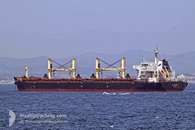
WHITE FIN
Bulk Carrier
Current Trip
| Time Travelled | 17 days |
|---|---|
| Remaining Time | --- |
| Distance Travelled | 4325.23 nm |
| Remaining Distance | --- |
| AVG Speed | 11 Noeuds |
| MAX Speed | 13 Noeuds |
| AVG Wind | 9.1 knots |
| MAX Wind | 26 knots |
| MIN Temp | 20.8°C / 69.44°F |
| MAX Temp | 37.1°C / 98.78°F |
| Tirant d eau | 9.2 m |
| Position reçue | 28 m depuis |
Current Position
| Longitude | 2.67410° |
|---|---|
| Latitude | 37.04035° |
| Etat | Under way using engine |
| Vitesse | 12.6 Noeuds |
| Parcours | 262.2° |
| Zone | Mediterranean Sea - Western Basin |
| Station | T-AIS |
| Position reçue | 28 m depuis |
Info
Information
The current position of WHITE FIN is in Mediterranean Sea - Western Basin with coordinates 37.04035° / 2.67410° as reported on 2024-06-15 17:35 by AIS to our vessel tracker app. The vessel's current speed is 12.6 Noeuds and is heading at the port of JORF LASFAR. The estimated time of arrival as calculated by MyShipTracking vessel tracking app is 2024-06-18 22:00 LT
The vessel WHITE FIN (IMO: 9607291, MMSI: 256608000) is a Bulk Carrier that was built in 2011 ( 13 Age ). It's sailing under the flag of [MT] Malta.
In this page you can find informations about the vessels current position, last detected port calls, and current voyage information. If the vessels is not in coverage by AIS you will find the latest position.
The current position of WHITE FIN is detected by our AIS receivers and we are not responsible for the reliability of the data. The last position was recorded while the vessel was in Coverage by the Ais receivers of our vessel tracking app.
The current draught of WHITE FIN as reported by AIS is 9.2 meters
Weather
| Temperature | 23.4°C / 74.12°F |
|---|---|
| Wind Speed | 3 knots |
| Direction | 327° NNW |
| Pressure | 1011.6 hPa |
| Humidity | 73.4 % |
| Cloud Coverage | 100 % |
Featured Company
Last Port Calls
| Port | Arrival | Departure | Time In Port |
|---|---|---|---|
| 2024-06-09 03:45 | 2024-06-09 13:09 | 9 h | |
| 2024-05-24 06:35 | 2024-05-29 14:14 | 5 d | |
| 2024-05-20 03:08 | 2024-05-23 10:00 | 3 d | |
| 2024-05-14 08:42 | 2024-05-17 06:11 | 2 d | |
| 2024-04-13 06:09 | 2024-04-17 04:30 | 3 d | |
| 2024-04-04 05:00 | 2024-04-10 13:44 | 6 d |
Last Trips
| Origin | Departure | Destination | Arrival | Distance | |
|---|---|---|---|---|---|
| 2024-05-29 18:14 | 2024-06-09 05:45 | 2697.42 nm | |||
| 2024-05-23 14:00 | 2024-05-24 10:35 | 10.38 nm | |||
| 2024-05-17 11:41 | 2024-05-20 07:08 | 747.22 nm | |||
| 2024-04-17 12:30 | 2024-05-14 14:12 | 4237.23 nm | |||
| 2024-04-10 21:44 | 2024-04-13 14:09 | 739.42 nm | |||
| 2024-03-28 18:33 | 2024-04-04 13:00 | 801.00 nm |
Events
| Heure | Evenement | Détails | Position/ Destination | Info |
|---|---|---|---|---|
| 2024-06-15 17:41 | Etat Changé | Default Under way using engine |
37.03694 / 2.64527
MA JFL
|
Vitesse: 12.6 kn Parcours: 262.2° |
| 2024-06-15 16:18 | Etat Changé | Under way using engine Default |
37.07933 / 3.00436
MA JFL
|
Vitesse: 12.3 kn Parcours: 261° |
| 2024-06-15 16:18 | Dans la zone couverte |
37.07885 / 3.00093
Mediterranean Sea - Western Basin
MA JFL
|
Vitesse: 12.4 kn Parcours: 259.6° |
|
| 2024-06-15 15:12 | Etat Changé | Default Under way using engine |
37.10250 / 3.28544
MA JFL
|
Vitesse: 12.5 kn Parcours: 265.4° |
| 2024-06-15 15:05 | Etat Changé | Under way using engine Default |
37.10468 / 3.31722
MA JFL
|
Vitesse: 12 kn Parcours: 265° |
| 2024-06-15 15:05 | Hors de la zone couverte |
37.10468 / 3.31722
Mediterranean Sea - Western Basin
MA JFL
|
Vitesse: 12.5 kn Parcours: 265.4° |
|
| 2024-06-15 14:49 | Dans la zone couverte |
37.10468 / 3.31722
Mediterranean Sea - Western Basin
MA JFL
|
Vitesse: 12.5 kn Parcours: 265.4° |
|
| 2024-06-15 13:01 | Etat Changé | Default Under way using engine |
37.16522 / 3.85799
MA JFL
|
Vitesse: 12.4 kn Parcours: 263.7° |
| 2024-06-15 12:56 | Hors de la zone couverte |
37.16707 / 3.87886
Mediterranean Sea - Western Basin
MA JFL
|
Vitesse: 12.4 kn Parcours: 263.7° |
|
| 2024-06-15 11:42 | Hors de la zone couverte |
37.19476 / 4.18400
Mediterranean Sea - Western Basin
MA JFL
|
Vitesse: 11.6 kn Parcours: 261.8° |