
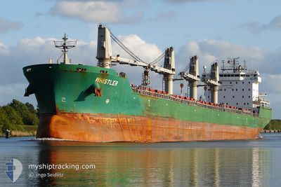
WHISTLER
Bulk Carrier
Current Trip
| Time Travelled | 10 days |
|---|---|
| Remaining Time | --- |
| Distance Travelled | 2720.42 nm |
| Remaining Distance | --- |
| AVG Speed | 11.8 Noeuds |
| MAX Speed | 14.1 Noeuds |
| AVG Wind | 8.2 knots |
| MAX Wind | 24 knots |
| MIN Temp | 23.1°C / 73.58°F |
| MAX Temp | 29.5°C / 85.1°F |
| Tirant d eau | 8.3 m |
| Position reçue | 5 d depuis |
Current Position
| Longitude | --- |
|---|---|
| Latitude | --- |
| Etat | Under way using engine |
| Vitesse | 10.6 Noeuds |
| Parcours | 105.5° |
| Zone | Laccadive Sea |
| Station | T-AIS |
| Position reçue | 5 d depuis |
Info
Information
The current position of WHISTLER is in Laccadive Sea with coordinates 5.75994° / 80.26240° as reported on 2025-03-12 15:27 by AIS to our vessel tracker app. The vessel's current speed is 10.6 Noeuds
The vessel WHISTLER (IMO: 9358371, MMSI: 538010692) is a Bulk Carrier that was built in 2007 ( 18 Age ). It's sailing under the flag of [MH] Marshall Is.
In this page you can find informations about the vessels current position, last detected port calls, and current voyage information. If the vessels is not in coverage by AIS you will find the latest position.
The current position of WHISTLER is detected by our AIS receivers and we are not responsible for the reliability of the data. The last position was recorded while the vessel was in Coverage by the Ais receivers of our vessel tracking app.
The current draught of WHISTLER as reported by AIS is 8.3 meters
Weather
| Temperature | 26.7°C / 80.06°F |
|---|---|
| Wind Speed | 6 knots |
| Direction | 31° NNE |
| Pressure | 1012 hPa |
| Humidity | 80 % |
| Cloud Coverage | 100 % |
Featured Company
Most Visited Ports (Last year)
| Port | Arrivals | |
|---|---|---|
| 2 | ||
| 2 | ||
| 2 | ||
| 2 | ||
| 1 | ||
| 1 |
Events
| Heure | Evenement | Détails | Position/ Destination | Info |
|---|---|---|---|---|
| 2025-03-17 21:54 | Démarrage | 13.24 nm, South of PORT KLANG |
2.77965 / 101.31433
PORT KLANG
|
Vitesse: 4.5 kn Parcours: 241° |
| 2025-03-17 09:30 | Arret | 13.04 nm, South of PORT KLANG |
2.78251 / 101.31914
PORT KLANG
|
Vitesse: 0.2 kn Parcours: 318° |
| 2025-03-12 15:35 | Etat Changé | Default Under way using engine |
5.75404 / 80.28342
PORT KLANG
|
Vitesse: 10.6 kn Parcours: 105.5° |
| 2025-03-12 15:27 | Hors de la zone couverte |
5.75994 / 80.26240
Laccadive Sea
PORT KLANG
|
Vitesse: 10.6 kn Parcours: 105.5° |
|
| 2025-03-12 14:54 | Changement de zone | Sri Lankan part of the Laccadive Sea Indian part of the Laccadive Sea |
5.79745 / 80.17333
Laccadive Sea
PORT KLANG
|
Vitesse: 10.2 kn Parcours: 116.1° |
| 2025-03-12 14:53 | Etat Changé | Under way using engine Default |
5.79766 / 80.17290
PORT KLANG
|
Vitesse: 10 kn Parcours: 116° |
| 2025-03-12 14:53 | Dans la zone couverte |
5.79745 / 80.17333
Laccadive Sea
PORT KLANG
|
Vitesse: 10.2 kn Parcours: 116.1° |
|
| 2025-03-11 21:55 | Etat Changé | Default Under way using engine |
7.59983 / 77.51541
PORT KLANG
|
Vitesse: 11.7 kn Parcours: 121° |
| 2025-03-11 21:46 | Hors de la zone couverte |
7.61402 / 77.49035
Laccadive Sea
PORT KLANG
|
Vitesse: 11.7 kn Parcours: 121° |
|
| 2025-03-11 18:42 | Changement d'ETA | 2025/03/17 01:00 2025/03/16 22:00 |
7.94993 / 76.99339
PORT KLANG
|
Vitesse: 11.5 kn Parcours: 125.7° |