

WESTRAC II
Towing

Current Trip
LOCAL SHIFTS
| Time Travelled | 35 mins |
|---|---|
| Remaining Time | --- |
| Distance Travelled | 1.59 nm |
| Remaining Distance | --- |
| AVG Speed | 4.1 Noeuds |
| MAX Speed | 4.5 Noeuds |
| AVG Wind | 4.3 knots |
| MAX Wind | 5 knots |
| MIN Temp | 9.4°C / 48.92°F |
| MAX Temp | 9.7°C / 49.46°F |
| Tirant d eau | 4.5 m |
| Position reçue | 1 m depuis |
Current Position
| Longitude | --- |
|---|---|
| Latitude | --- |
| Etat | Pushing Ahead - Towing |
| Vitesse | 4.4 Noeuds |
| Parcours | 163° |
| Zone | The Coastal Waters of Southeast Alaska and British Columbia |
| Station | T-AIS |
| Position reçue | 1 m depuis |
Information
The current position of WESTRAC II is in The Coastal Waters of Southeast Alaska and British Columbia with coordinates 47.56104° / -122.34577° as reported on 2025-03-26 14:41 by AIS to our vessel tracker app. The vessel's current speed is 4.4 Noeuds
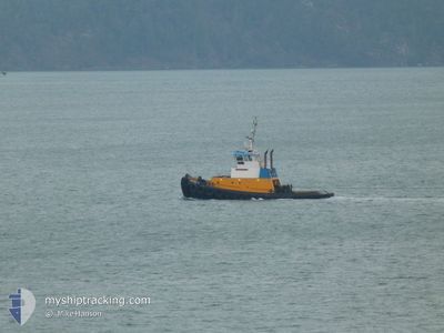
The vessel WESTRAC II (MMSI: 366695810) is a Towing It's sailing under the flag of [US] USA.
In this page you can find informations about the vessels current position, last detected port calls, and current voyage information. If the vessels is not in coverage by AIS you will find the latest position.
The current position of WESTRAC II is detected by our AIS receivers and we are not responsible for the reliability of the data. The last position was recorded while the vessel was in Coverage by the Ais receivers of our vessel tracking app.
The current draught of WESTRAC II as reported by AIS is 4.5 meters
Weather
| Temperature | 9.4°C / 48.92°F |
|---|---|
| Wind Speed | 5 knots |
| Direction | 11° N |
| Pressure | 1007.7 hPa |
| Humidity | 95.3 % |
| Cloud Coverage | 100 % |


Featured Company
Last Port Calls
| Port | Arrival | Departure | Time In Port |
|---|---|---|---|
| 2025-03-25 20:00 | 2025-03-26 07:08 | 11 h | |
| 2025-03-25 18:04 | 2025-03-25 19:34 | 1 h | |
| 2025-03-25 07:58 | 2025-03-25 17:25 | 9 h | |
| 2025-03-24 19:39 | 2025-03-25 07:14 | 11 h | |
| 2025-03-24 16:38 | 2025-03-24 19:12 | 2 h | |
| 2025-03-24 14:11 | 2025-03-24 15:33 | 1 h | |
| 2025-03-24 13:44 | 2025-03-24 14:02 | 18 m | |
| 2025-03-24 12:55 | 2025-03-24 13:03 | 8 m | |
| 2025-03-24 11:26 | 2025-03-24 12:33 | 1 h | |
| 2025-03-23 19:47 | 2025-03-24 10:37 | 14 h |
Last Trips
| Origin | Departure | Destination | Arrival | Distance | |
|---|---|---|---|---|---|
| 2025-03-25 19:34 | 2025-03-25 20:00 | 1.08 nm | |||
| 2025-03-25 17:25 | 2025-03-25 18:04 | 2.09 nm | |||
| 2025-03-25 07:14 | 2025-03-25 07:58 | 2.91 nm | |||
| 2025-03-24 19:12 | 2025-03-24 19:39 | 0.76 nm | |||
| 2025-03-24 15:33 | 2025-03-24 16:38 | 2.05 nm | |||
| 2025-03-24 14:02 | 2025-03-24 14:11 | 0.29 nm | |||
| 2025-03-24 13:03 | 2025-03-24 13:44 | 0.36 nm | |||
| 2025-03-24 12:33 | 2025-03-24 12:55 | 0.31 nm | |||
| 2025-03-24 10:37 | 2025-03-24 11:26 | 2.32 nm | |||
| 2025-03-23 19:15 | 2025-03-23 19:47 | 0.86 nm |
Events
| Heure | Evenement | Détails | Position/ Destination | Info |
|---|---|---|---|---|
| 2025-03-26 14:29 | Démarrage | 2.79 nm, North East of FAUNTLEROY |
47.54784 / -122.33875
LOCAL SHIFTS
|
Vitesse: 3.1 kn Parcours: 161° |
| 2025-03-26 14:14 | Arret | 2.75 nm, North East of FAUNTLEROY |
47.54586 / -122.33832
LOCAL SHIFTS
|
Vitesse: 0.2 kn Parcours: 184° |
| 2025-03-26 14:08 | PORT DE DEPART |
|
47.55661 / -122.34347
LOCAL SHIFTS
|
Vitesse: 6.8 kn Parcours: 156° |
| 2025-03-26 14:02 | Démarrage |
47.56736 / -122.34691
[US] SEATTLE
|
Vitesse: 6.9 kn Parcours: 185° |
|
| 2025-03-26 14:00 | Dans la zone couverte |
47.56775 / -122.34671
The Coastal Waters of Southeast Alaska and British Columbia
[US] SEATTLE
|
Vitesse: 6.8 kn Parcours: 206.1° |
|
| 2025-03-26 03:12 | Hors de la zone couverte |
47.56929 / -122.34624
The Coastal Waters of Southeast Alaska and British Columbia
[US] SEATTLE
|
Vitesse: Parcours: 125.2° |
|
| 2025-03-26 03:06 | Arret |
47.56929 / -122.34620
[US] SEATTLE
|
Vitesse: 0.1 kn Parcours: 176° |
|
| 2025-03-26 03:00 | Port d'arrivée |
|
47.55826 / -122.34419
[US] SEATTLE
|
Vitesse: 10 kn Parcours: 341.1° |
| 2025-03-26 02:59 | Démarrage | 2.94 nm, North East of FAUNTLEROY |
47.55628 / -122.34327
LOCAL SHIFTS
|
Vitesse: 10.1 kn Parcours: 348.5° |
| 2025-03-26 02:39 | Arret | 2.91 nm, North East of FAUNTLEROY |
47.55441 / -122.34202
LOCAL SHIFTS
|
Vitesse: 0.2 kn Parcours: 258° |