
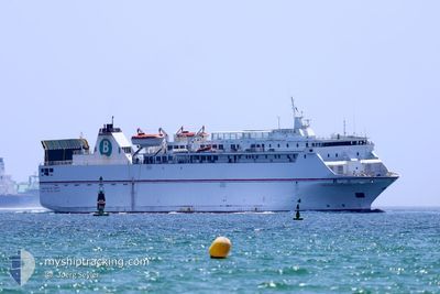
VOLCAN DE TAUCE
Ro-Ro/Passenger Ship
Current Trip
| Time Travelled | 3 h, 10 mins |
|---|---|
| Remaining Time | 2 h, 49 mins |
| Distance Travelled | 49.50 nm |
| Remaining Distance | 50.55 nm |
| AVG Speed | 16.1 Noeuds |
| MAX Speed | 17.4 Noeuds |
| AVG Wind | 4.3 knots |
| MAX Wind | 7.1 knots |
| MIN Temp | 15.5°C / 59.9°F |
| MAX Temp | 17.8°C / 64.04°F |
| Tirant d eau | 4.8 m |
| Position reçue | 3 m depuis |
Current Position
| Longitude | -4.60415° |
|---|---|
| Latitude | 36.28383° |
| Etat | Under way using engine |
| Vitesse | 16 Noeuds |
| Parcours | 65.1° |
| Zone | Alboran Sea |
| Station | T-AIS |
| Position reçue | 3 m depuis |
Info
Information
The current position of VOLCAN DE TAUCE is in Alboran Sea with coordinates 36.28383° / -4.60415° as reported on 2024-05-12 06:13 by AIS to our vessel tracker app. The vessel's current speed is 16 Noeuds and is heading at the port of TANGER MED. The estimated time of arrival as calculated by MyShipTracking vessel tracking app is 2024-05-12 09:05 LT
The vessel VOLCAN DE TAUCE (IMO: 9081588, MMSI: 224761000) is a Ro-Ro/Passenger Ship that was built in 1995 ( 29 Age ). It's sailing under the flag of [ES] Spain.
In this page you can find informations about the vessels current position, last detected port calls, and current voyage information. If the vessels is not in coverage by AIS you will find the latest position.
The current position of VOLCAN DE TAUCE is detected by our AIS receivers and we are not responsible for the reliability of the data. The last position was recorded while the vessel was in Coverage by the Ais receivers of our vessel tracking app.
The current draught of VOLCAN DE TAUCE as reported by AIS is 4.8 meters
Weather
| Temperature | 17.8°C / 64.04°F |
|---|---|
| Wind Speed | 4 knots |
| Direction | 107° ESE |
| Pressure | 1016.1 hPa |
| Humidity | 79.3 % |
| Cloud Coverage | 84 % |
Featured Company
Last Port Calls
| Port | Arrival | Departure | Time In Port |
|---|---|---|---|
| 2024-05-11 21:31 | 2024-05-12 03:06 | 5 h | |
| 2024-05-11 09:25 | 2024-05-11 14:14 | 4 h | |
| 2024-05-10 21:00 | 2024-05-11 02:16 | 5 h | |
| 2024-05-10 09:04 | 2024-05-10 13:06 | 4 h | |
| 2024-05-09 21:23 | 2024-05-10 01:53 | 4 h | |
| 2024-05-09 08:06 | 2024-05-09 13:28 | 5 h | |
| 2024-05-08 19:57 | 2024-05-09 01:01 | 5 h | |
| 2024-05-08 07:22 | 2024-05-08 12:15 | 4 h | |
| 2024-05-07 19:38 | 2024-05-08 00:21 | 4 h | |
| 2024-05-07 06:40 | 2024-05-07 12:28 | 5 h |
Most Visited Ports (Last year)
| Port | Arrivals | |
|---|---|---|
| 466 | ||
| 266 | ||
| 219 | ||
| 1 |
Last Trips
| Origin | Departure | Destination | Arrival | Distance | |
|---|---|---|---|---|---|
| 2024-05-11 16:14 | 2024-05-11 22:31 | 111.44 nm | |||
| 2024-05-11 03:16 | 2024-05-11 11:25 | 110.32 nm | |||
| 2024-05-10 15:06 | 2024-05-10 22:00 | 113.45 nm | |||
| 2024-05-10 02:53 | 2024-05-10 11:04 | 109.78 nm | |||
| 2024-05-09 15:28 | 2024-05-09 22:23 | 112.40 nm | |||
| 2024-05-09 02:01 | 2024-05-09 10:06 | 110.73 nm | |||
| 2024-05-08 14:15 | 2024-05-08 20:57 | 111.16 nm | |||
| 2024-05-08 01:21 | 2024-05-08 09:22 | 111.20 nm | |||
| 2024-05-07 14:28 | 2024-05-07 20:38 | 110.97 nm | |||
| 2024-05-07 00:21 | 2024-05-07 08:40 | 110.34 nm |
Events
| Heure | Evenement | Détails | Position/ Destination | Info |
|---|---|---|---|---|
| 2024-05-12 04:50 | Changement de zone | Spanish part of the Alboran Sea Gibraltarian part of the Alboran Sea |
36.12050 / -5.01530
Alboran Sea
ESMOT<>MAPTM
|
Vitesse: 15.6 kn Parcours: 66.2° |
| 2024-05-12 03:59 | Changement de zone | Gibraltarian part of the Alboran Sea Spanish part of the Alboran Sea |
36.01915 / -5.26722
Alboran Sea
ESMOT<>MAPTM
|
Vitesse: 17.5 kn Parcours: 65.7° |
| 2024-05-12 03:52 | Changement de zone | Spanish part of the Alboran Sea Spanish part of the Strait of Gibraltar |
36.00449 / -5.30460
Alboran Sea
ESMOT<>MAPTM
|
Vitesse: 17.2 kn Parcours: 64.4° |
| 2024-05-12 03:38 | Changement de zone | Spanish part of the Strait of Gibraltar Moroccan part of the Strait of Gibraltar |
35.97649 / -5.37897
Strait of Gibraltar
ESMOT<>MAPTM
|
Vitesse: 16.8 kn Parcours: 67° |
| 2024-05-12 03:17 | Changement d'ETA | 2024/05/12 10:30 2024/05/12 10:00 |
35.93186 / -5.47878
ESMOT<>MAPTM
|
Vitesse: 15.7 kn Parcours: 50.1° |
| 2024-05-12 03:07 | Etat Changé | Under way using engine Default |
35.90105 / -5.51323
ESMOT<>MAPTM
|
Vitesse: 14.5 kn Parcours: 27° |
| 2024-05-12 03:06 | PORT DE DEPART |
|
35.89845 / -5.51469
ESMOT<>MAPTM
|
Vitesse: 10.1 kn Parcours: 14° |
| 2024-05-12 03:02 | Démarrage |
35.88358 / -5.51963
[MA] TANGER MED
|
Vitesse: 10.1 kn Parcours: 14° |
|
| 2024-05-12 02:58 | Dans la zone couverte |
35.90256 / -5.51216
Strait of Gibraltar
ESMOT<>MAPTM
|
Vitesse: 14.5 kn Parcours: 31.8° |
|
| 2024-05-12 00:19 | Hors de la zone couverte |
35.87776 / -5.51968
Strait of Gibraltar
[MA] TANGER MED
|
Vitesse: Parcours: 139.5° |