
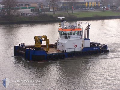
VOE VIKING
Tug
Current Trip
| Time Travelled | 1 day |
|---|---|
| Remaining Time | 3 h, 32 mins |
| Distance Travelled | 126.01 nm |
| Remaining Distance | 45.24 nm |
| AVG Speed | 6.1 Noeuds |
| MAX Speed | 9.2 Noeuds |
| AVG Wind | 7.1 knots |
| MAX Wind | 13.6 knots |
| MIN Temp | 9.3°C / 48.74°F |
| MAX Temp | 14.4°C / 57.92°F |
| Tirant d eau | 2.5 m |
| Position reçue | 17 m depuis |
Current Position
| Longitude | 4.21884° |
|---|---|
| Latitude | 53.54213° |
| Etat | Under way using engine |
| Vitesse | 2 Noeuds |
| Parcours | --- |
| Zone | North Sea |
| Station | T-AIS |
| Position reçue | 17 m depuis |
Info
Information
The current position of VOE VIKING is in North Sea with coordinates 53.54213° / 4.21884° as reported on 2024-05-05 17:07 by AIS to our vessel tracker app. The vessel's current speed is 2 Noeuds and is heading at the port of DEN HELDER. The estimated time of arrival as calculated by MyShipTracking vessel tracking app is 2024-05-05 20:57 LT
The vessel VOE VIKING (IMO: 933113900, MMSI: 235008930) is a Tug It's sailing under the flag of [GB] United Kingdom.
In this page you can find informations about the vessels current position, last detected port calls, and current voyage information. If the vessels is not in coverage by AIS you will find the latest position.
The current position of VOE VIKING is detected by our AIS receivers and we are not responsible for the reliability of the data. The last position was recorded while the vessel was in Coverage by the Ais receivers of our vessel tracking app.
The current draught of VOE VIKING as reported by AIS is 2.5 meters
Weather
| Temperature | 11.7°C / 53.06°F |
|---|---|
| Wind Speed | 5 knots |
| Direction | 223° SW |
| Pressure | 1008.4 hPa |
| Humidity | 80.1 % |
| Cloud Coverage | 84 % |
Featured Company
Last Port Calls
| Port | Arrival | Departure | Time In Port |
|---|---|---|---|
| 2024-05-04 06:03 | 2024-05-04 16:05 | 10 h | |
| 2024-04-28 06:15 | 2024-05-03 14:23 | 5 d | |
| 2024-04-26 14:52 | 2024-04-27 07:11 | 16 h | |
| 2024-04-24 14:26 | 2024-04-25 05:42 | 15 h | |
| 2024-04-24 01:58 | 2024-04-24 14:22 | 12 h | |
| 2024-03-31 13:08 | 2024-04-23 12:26 | 22 d | |
| 2024-03-26 06:44 | 2024-03-30 21:12 | 4 d | |
| 2024-03-25 14:48 |
Most Visited Ports (Last year)
| Port | Arrivals | |
|---|---|---|
| 39 | ||
| 12 | ||
| 12 | ||
| 6 | ||
| 6 | ||
| 5 |
Last Trips
| Origin | Departure | Destination | Arrival | Distance | |
|---|---|---|---|---|---|
| 2024-05-03 16:23 | 2024-05-04 08:03 | 113.84 nm | |||
| 2024-04-27 08:11 | 2024-04-28 08:15 | 188.62 nm | |||
| 2024-04-25 07:42 | 2024-04-26 15:52 | 158.83 nm | |||
| 2024-04-24 16:22 | 2024-04-24 16:26 | 0.21 nm | |||
| 2024-04-23 14:26 | 2024-04-24 03:58 | 113.31 nm | |||
| 2024-03-30 22:12 | 2024-03-31 15:08 | 98.92 nm | |||
| 2024-03-25 15:48 | 2024-03-26 07:44 | 128.89 nm |
Events
| Heure | Evenement | Détails | Position/ Destination | Info |
|---|---|---|---|---|
| 2024-05-05 17:00 | Etat Changé | Under way using engine Default |
53.54301 / 4.21924
TOWING NLDHR
|
Vitesse: 0.3 kn Parcours: -1° |
| 2024-05-05 16:46 | Dans la zone couverte |
53.54310 / 4.21952
North Sea
TOWING NLDHR
|
Vitesse: 1.7 kn Parcours: 68.3° |
|
| 2024-05-05 16:07 | Etat Changé | Default Restricted manoeuverability |
53.54500 / 4.21667
TOWING NLDHR
|
Vitesse: 1.3 kn Parcours: 511° |
| 2024-05-05 15:57 | Hors de la zone couverte |
53.54467 / 4.21585
North Sea
TOWING NLDHR
|
Vitesse: 1.3 kn Parcours: 38.5° |
|
| 2024-05-05 15:56 | Etat Changé | Restricted manoeuverability Default |
53.54461 / 4.21579
TOWING NLDHR
|
Vitesse: 1 kn Parcours: -1° |
| 2024-05-05 15:04 | Etat Changé | Default Restricted manoeuverability |
53.54812 / 4.20815
TOWING NLDHR
|
Vitesse: 1.7 kn Parcours: 511° |
| 2024-05-05 15:00 | Etat Changé | Restricted manoeuverability Default |
53.54968 / 4.20742
TOWING NLDHR
|
Vitesse: Parcours: -1° |
| 2024-05-05 14:48 | Dans la zone couverte |
53.54934 / 4.20753
North Sea
TOWING NLDHR
|
Vitesse: 1.7 kn Parcours: 166.5° |
|
| 2024-05-05 12:46 | Arret |
53.53500 / 4.21667
TOWING NLDHR
|
Vitesse: Parcours: -1° |
|
| 2024-05-05 09:36 | Hors de la zone couverte |
53.35329 / 4.51532
North Sea
TOWING NLDHR
|
Vitesse: 4.7 kn Parcours: 321° |