
VISION
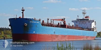
Oil/Chemical Tanker
Current Trip
| Time Travelled | 55 days |
|---|---|
| Remaining Time | --- |
| Distance Travelled | 4300.07 nm |
| Remaining Distance | --- |
| AVG Speed | 10.8 Noeuds |
| MAX Speed | 10.8 Noeuds |
| AVG Wind | 10.3 knots |
| MAX Wind | 22.3 knots |
| MIN Temp | 13°C / 55.4°F |
| MAX Temp | 30.3°C / 86.54°F |
| Tirant d eau | 6.8 m |
| Position reçue | 3 m depuis |
Current Position
| Longitude | --- |
|---|---|
| Latitude | --- |
| Etat | Not under command |
| Vitesse | 0.7 Noeuds |
| Parcours | 327° |
| Zone | Sea of Marmara |
| Station | T-AIS |
| Position reçue | 3 m depuis |
Info
Information
The current position of VISION is in Sea of Marmara with coordinates 40.71781° / 28.87987° as reported on 2024-10-28 13:20 by AIS to our vessel tracker app. The vessel's current speed is 0.7 Noeuds and is heading at the port of TERNEUZEN. The estimated time of arrival as calculated by MyShipTracking vessel tracking app is 2024-10-21 20:00 LT
The vessel VISION (IMO: 9295347, MMSI: 538007536) is a Oil/Chemical Tanker that was built in 2006 ( 18 Age ). It's sailing under the flag of [MH] Marshall Is.
In this page you can find informations about the vessels current position, last detected port calls, and current voyage information. If the vessels is not in coverage by AIS you will find the latest position.
The current position of VISION is detected by our AIS receivers and we are not responsible for the reliability of the data. The last position was recorded while the vessel was in Coverage by the Ais receivers of our vessel tracking app.
The current draught of VISION as reported by AIS is 6.8 meters
Weather
| Temperature | 16.8°C / 62.24°F |
|---|---|
| Wind Speed | 2 knots |
| Direction | 108° ESE |
| Pressure | 1021.7 hPa |
| Humidity | 53.5 % |
| Cloud Coverage | --- |
Featured Company
Last Port Calls
| Port | Arrival | Departure | Time In Port |
|---|---|---|---|
| 2024-09-01 07:32 | 2024-09-02 23:54 | 1 d | |
| 2024-08-26 14:37 | 2024-08-29 17:15 | 3 d | |
| 2024-08-15 17:58 | 2024-08-17 08:35 | 1 d | |
| 2024-08-11 05:25 | 2024-08-12 18:05 | 1 d | |
| 2024-08-04 04:38 |
Most Visited Ports (Last year)
| Port | Arrivals | |
|---|---|---|
| 4 | ||
| 3 | ||
| 2 | ||
| 1 | ||
| 1 | ||
| 1 |
Last Trips
| Origin | Departure | Destination | Arrival | Distance | |
|---|---|---|---|---|---|
| 2024-08-29 20:15 | 2024-09-01 10:32 | 545.05 nm | |||
| 2024-08-17 11:35 | 2024-08-26 17:37 | 631.89 nm | |||
| 2024-08-12 21:05 | 2024-08-15 20:58 | 549.43 nm | |||
| 2024-08-04 06:38 | 2024-08-11 08:25 | 1286.76 nm |
Events
| Heure | Evenement | Détails | Position/ Destination | Info |
|---|---|---|---|---|
| 2024-10-28 09:50 | Arret | 13.95 nm, South of YESILKOY |
40.73225 / 28.91205
FOR ORDER
|
Vitesse: 0.3 kn Parcours: 306° |
| 2024-10-28 09:13 | Etat Changé | Not under command Under way using engine |
40.72298 / 28.91895
FOR ORDER
|
Vitesse: 3.6 kn Parcours: 329° |
| 2024-10-28 08:34 | Démarrage | 16.05 nm, North West of GEMLIK |
40.64182 / 28.90378
FOR ORDER
|
Vitesse: 3.1 kn Parcours: 0° |
| 2024-10-28 08:27 | Arret | 15.87 nm, North West of GEMLIK |
40.63811 / 28.90353
FOR ORDER
|
Vitesse: Parcours: 7° |
| 2024-10-28 08:25 | Etat Changé | Under way using engine Not under command |
40.63829 / 28.90355
FOR ORDER
|
Vitesse: 0.5 kn Parcours: 9° |
| 2024-10-28 07:56 | Etat Changé | Not under command Default |
40.64252 / 28.90458
FOR ORDER
|
Vitesse: 0.5 kn Parcours: 5° |
| 2024-10-28 07:50 | Etat Changé | Default Not under command |
40.64339 / 28.90480
FOR ORDER
|
Vitesse: 0.4 kn Parcours: 3° |
| 2024-10-28 06:11 | Etat Changé | Not under command Default |
40.65901 / 28.90810
FOR ORDER
|
Vitesse: 0.5 kn Parcours: 28° |
| 2024-10-28 06:02 | Etat Changé | Default Not under command |
40.66040 / 28.90827
FOR ORDER
|
Vitesse: 0.5 kn Parcours: 26° |
| 2024-10-28 04:29 | Etat Changé | Not under command Default |
40.67663 / 28.90709
FOR ORDER
|
Vitesse: 0.6 kn Parcours: 36° |