

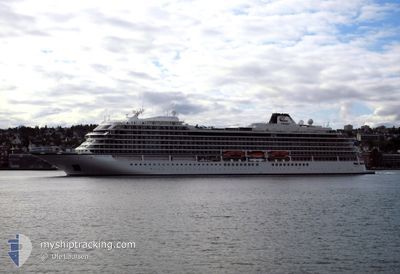
VIKING MARS
Passenger

Current Trip
| Time Travelled | 1 day |
|---|---|
| Remaining Time | 1 day |
| Distance Travelled | 588.65 nm |
| Remaining Distance | 639.18 nm |
| AVG Speed | 17 Noeuds |
| MAX Speed | 19.6 Noeuds |
| AVG Wind | 21.2 knots |
| MAX Wind | 27 knots |
| MIN Temp | 22.2°C / 71.96°F |
| MAX Temp | 25.5°C / 77.9°F |
| Tirant d eau | 6.7 m |
| Position reçue | 4 h, 22 m depuis |
Current Position
| Longitude | --- |
|---|---|
| Latitude | --- |
| Etat | Under way using engine |
| Vitesse | 18 Noeuds |
| Parcours | 139.9° |
| Zone | North Atlantic Ocean |
| Station | T-AIS |
| Position reçue | 4 h, 22 m depuis |
Information
The current position of VIKING MARS is in North Atlantic Ocean with coordinates 21.59238° / -72.57315° as reported on 2025-03-29 03:23 by AIS to our vessel tracker app. The vessel's current speed is 18 Noeuds and is heading at the port of PHILIPSBURG. The estimated time of arrival as calculated by MyShipTracking vessel tracking app is 2025-03-30 11:24 LT
The vessel VIKING MARS (IMO: 9833187, MMSI: 257800000) is a Passenger It's sailing under the flag of [NO] Norway.
In this page you can find informations about the vessels current position, last detected port calls, and current voyage information. If the vessels is not in coverage by AIS you will find the latest position.
The current position of VIKING MARS is detected by our AIS receivers and we are not responsible for the reliability of the data. The last position was recorded while the vessel was in Coverage by the Ais receivers of our vessel tracking app.
The current draught of VIKING MARS as reported by AIS is 6.7 meters
Weather
| Temperature | 25.2°C / 77.36°F |
|---|---|
| Wind Speed | 19 knots |
| Direction | 85° E |
| Pressure | 1016.4 hPa |
| Humidity | 79.1 % |
| Cloud Coverage | 31 % |


Featured Company
Last Port Calls
| Port | Arrival | Departure | Time In Port |
|---|---|---|---|
| 2025-03-27 06:17 | 2025-03-27 17:29 | 11 h | |
| 2025-03-24 07:03 | 2025-03-24 20:16 | 13 h | |
| 2025-03-23 06:27 | 2025-03-23 16:23 | 9 h | |
| 2025-03-22 06:46 | 2025-03-22 18:38 | 11 h | |
| 2025-03-20 07:12 | 2025-03-20 17:06 | 9 h | |
| 2025-03-18 12:57 | 2025-03-18 21:56 | 8 h | |
| 2025-03-17 03:33 | 2025-03-17 05:34 | 2 h | |
| 2025-03-16 06:29 | 2025-03-16 14:38 | 8 h | |
| 2025-03-13 06:20 | 2025-03-13 19:14 | 12 h | |
| 2025-03-10 07:16 | 2025-03-10 22:07 | 14 h |
Most Visited Ports (Last year)
| Port | Arrivals | |
|---|---|---|
| 13 | ||
| 13 | ||
| 13 | ||
| 13 | ||
| 11 | ||
| 9 |
Last Trips
| Origin | Departure | Destination | Arrival | Distance | |
|---|---|---|---|---|---|
| 2025-03-24 20:16 | 2025-03-27 06:17 | 589.99 nm | |||
| 2025-03-23 16:23 | 2025-03-24 07:03 | 210.18 nm | |||
| 2025-03-22 18:38 | 2025-03-23 06:27 | 120.37 nm | |||
| 2025-03-20 17:06 | 2025-03-22 06:46 | 595.90 nm | |||
| 2025-03-18 21:56 | 2025-03-20 07:12 | 296.94 nm | |||
| 2025-03-17 05:34 | 2025-03-18 12:57 | 583.52 nm | |||
| 2025-03-16 14:38 | 2025-03-17 03:33 | 202.27 nm | |||
| 2025-03-13 19:14 | 2025-03-16 06:29 | 786.22 nm | |||
| 2025-03-10 22:07 | 2025-03-13 06:20 | 589.02 nm | |||
| 2025-03-09 16:35 | 2025-03-10 07:16 | 213.21 nm |
Events
| Heure | Evenement | Détails | Position/ Destination | Info |
|---|---|---|---|---|
| 2025-03-29 03:26 | Etat Changé | Default Under way using engine |
21.58044 / -72.56248
SX PHI
|
Vitesse: 18 kn Parcours: 139.9° |
| 2025-03-29 03:23 | Hors de la zone couverte |
21.59238 / -72.57315
North Atlantic Ocean
SX PHI
|
Vitesse: 18 kn Parcours: 139.9° |
|
| 2025-03-29 03:11 | Detecté en mer | Turks and Caicos part of the North Atlantic Ocean |
21.63492 / -72.61157
North Atlantic Ocean
SX PHI
|
Vitesse: 17.5 kn Parcours: 142° |
| 2025-03-29 03:11 | Etat Changé | Under way using engine Default |
21.63492 / -72.61157
SX PHI
|
Vitesse: 17.9 kn Parcours: 141° |
| 2025-03-29 03:11 | Dans la zone couverte |
21.63492 / -72.61157
North Atlantic Ocean
SX PHI
|
Vitesse: 17.5 kn Parcours: 142° |
|
| 2025-03-28 14:41 | Etat Changé | Default Under way using engine |
24.38482 / -75.08362
SX PHI
|
Vitesse: 17 kn Parcours: 139.2° |
| 2025-03-28 14:37 | Hors de la zone couverte |
24.39809 / -75.09594
North Atlantic Ocean
SX PHI
|
Vitesse: 17 kn Parcours: 139.2° |
|
| 2025-03-28 13:48 | Etat Changé | Under way using engine Default |
24.57977 / -75.26207
SX PHI
|
Vitesse: 17.7 kn Parcours: 139° |
| 2025-03-28 13:48 | Dans la zone couverte |
24.57977 / -75.26207
North Atlantic Ocean
SX PHI
|
Vitesse: 17.7 kn Parcours: 137.3° |
|
| 2025-03-28 10:04 | Hors de la zone couverte |
25.30281 / -76.12966
North Atlantic Ocean
SX PHI
|
Vitesse: 17 kn Parcours: 131° |