
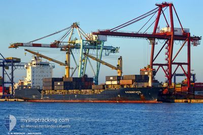
VICTORIA L
Cargo
Current Trip
| Trip Time | 9 days |
|---|---|
| Trip Distance | 228.15 nm |
| AVG Speed | 10 Noeuds |
| MAX Speed | 14.1 Noeuds |
| Tirant d eau | 9.5 m |
| AVG Wind | 16.7 knots |
| MAX Wind | 23.8 knots |
| MIN Temp | 17.4°C / 63.32°F |
| MAX Temp | 26.2°C / 79.16°F |
| Position reçue | 9 d depuis |
Current Position
| Longitude | -17.36078° |
|---|---|
| Latitude | 20.24770° |
| Etat | Under way using engine |
| Vitesse | 9.1 Noeuds |
| Parcours | 32.3° |
| Zone | North Atlantic Ocean |
| Station | T-AIS |
| Position reçue | 9 d depuis |
Info
Information
The current position of VICTORIA L is in North Atlantic Ocean with coordinates 20.24770° / -17.36078° as reported on 2024-05-25 02:29 by AIS to our vessel tracker app. The vessel's current speed is 9.1 Noeuds and is currently inside the port of NOUADHIBOU.
The vessel VICTORIA L (IMO: 9430155, MMSI: 636091410) is a Cargo It's sailing under the flag of [LR] Liberia.
In this page you can find informations about the vessels current position, last detected port calls, and current voyage information. If the vessels is not in coverage by AIS you will find the latest position.
The current position of VICTORIA L is detected by our AIS receivers and we are not responsible for the reliability of the data. The last position was recorded while the vessel was in Coverage by the Ais receivers of our vessel tracking app.
The current draught of VICTORIA L as reported by AIS is 9.5 meters
Weather
| Temperature | 19.7°C / 67.46°F |
|---|---|
| Wind Speed | 21 knots |
| Direction | 346° NNW |
| Pressure | 1014.4 hPa |
| Humidity | 82.2 % |
| Cloud Coverage | --- |
Featured Company
Last Port Calls
| Port | Arrival | Departure | Time In Port |
|---|---|---|---|
| 2024-06-03 12:02 | |||
| 2024-05-23 13:41 | 2024-05-24 12:12 | 22 h | |
| 2024-05-08 10:58 | 2024-05-08 14:24 | 3 h | |
| 2024-04-24 07:49 | 2024-04-30 20:37 | 6 d |
Most Visited Ports (Last year)
| Port | Arrivals | |
|---|---|---|
| 10 | ||
| 10 | ||
| 10 | ||
| 10 | ||
| 10 | ||
| 9 |
Last Trips
| Origin | Departure | Destination | Arrival | Distance | |
|---|---|---|---|---|---|
| 2024-05-24 12:12 | 2024-06-03 12:02 | 228.15 nm | |||
| 2024-05-08 14:24 | 2024-05-23 13:41 | 3108.59 nm | |||
| 2024-04-30 20:37 | 2024-05-08 10:58 | 10.40 nm |
Events
| Heure | Evenement | Détails | Position/ Destination | Info |
|---|---|---|---|---|
| 2024-06-03 12:20 | Arret |
20.89475 / -17.05136
[MR] NOUADHIBOU
|
Vitesse: 0.1 kn Parcours: 357° |
|
| 2024-06-03 12:02 | Port d'arrivée |
|
20.89277 / -17.04761
[MR] NOUADHIBOU
|
Vitesse: 5.9 kn Parcours: 286° |
| 2024-06-03 09:39 | Démarrage | 3.94 nm, South East of CASADO |
20.75792 / -17.00536
TANGER MED
|
Vitesse: 6.1 kn Parcours: 208° |
| 2024-05-25 07:17 | Arret | 3.97 nm, South East of CASADO |
20.75970 / -17.00053
TANGER MED
|
Vitesse: 0.1 kn Parcours: 354° |
| 2024-05-25 02:32 | Etat Changé | Default Under way using engine |
20.25493 / -17.35593
TANGER MED
|
Vitesse: 9.1 kn Parcours: 32.3° |
| 2024-05-25 02:29 | Hors de la zone couverte |
20.24770 / -17.36078
North Atlantic Ocean
|
Vitesse: 9.1 kn Parcours: 32.3° |
|
| 2024-05-25 02:26 | Changement de zone | Western Saharan part of the North Atlantic Ocean Spanish (Canary Islands) part of the North Atlantic Ocean |
20.24120 / -17.36516
North Atlantic Ocean
|
Vitesse: 9.2 kn Parcours: 32.5° |
| 2024-05-25 02:26 | Etat Changé | Under way using engine Default |
20.24120 / -17.36516
TANGER MED
|
Vitesse: 9.2 kn Parcours: 32° |
| 2024-05-25 02:13 | Dans la zone couverte |
20.24120 / -17.36516
North Atlantic Ocean
|
Vitesse: 9.2 kn Parcours: 32.5° |