
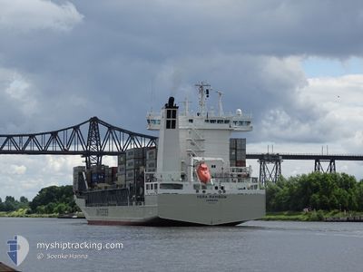
VERA RAMBOW
Container Ship
Current Trip
| Time Travelled | 1 day |
|---|---|
| Remaining Time | 1 day |
| Distance Travelled | 404.15 nm |
| Remaining Distance | 284.04 nm |
| AVG Speed | 10.6 Noeuds |
| MAX Speed | 19.7 Noeuds |
| AVG Wind | 11.3 knots |
| MAX Wind | 17.9 knots |
| MIN Temp | 8.8°C / 47.84°F |
| MAX Temp | 21.3°C / 70.34°F |
| Tirant d eau | 8.7 m |
| Position reçue | Maintenant |
Current Position
| Longitude | 9.30372° |
|---|---|
| Latitude | 54.04253° |
| Etat | Under way using engine |
| Vitesse | |
| Parcours | 191° |
| Zone | Baltic Sea |
| Station | T-AIS |
| Position reçue | Maintenant |
Info
Information
The current position of VERA RAMBOW is in Baltic Sea with coordinates 54.04253° / 9.30372° as reported on 2024-05-13 17:53 by AIS to our vessel tracker app. The vessel's current speed is 0 Noeuds and is heading at the port of ROTTERDAM. The estimated time of arrival as calculated by MyShipTracking vessel tracking app is 2024-05-15 11:48 LT
The vessel VERA RAMBOW (IMO: 9432220, MMSI: 218627000) is a Container Ship that was built in 2008 ( 16 Age ). It's sailing under the flag of [DE] Germany.
In this page you can find informations about the vessels current position, last detected port calls, and current voyage information. If the vessels is not in coverage by AIS you will find the latest position.
The current position of VERA RAMBOW is detected by our AIS receivers and we are not responsible for the reliability of the data. The last position was recorded while the vessel was in Coverage by the Ais receivers of our vessel tracking app.
The current draught of VERA RAMBOW as reported by AIS is 8.7 meters
Weather
| Temperature | 19.7°C / 67.46°F |
|---|---|
| Wind Speed | 12 knots |
| Direction | 106° ESE |
| Pressure | 1012.6 hPa |
| Humidity | 68 % |
| Cloud Coverage | 35 % |
Featured Company
Last Port Calls
| Port | Arrival | Departure | Time In Port |
|---|---|---|---|
| 2024-05-11 16:58 | 2024-05-12 08:52 | 15 h | |
| 2024-05-10 08:24 | 2024-05-10 15:02 | 6 h | |
| 2024-05-09 09:37 | 2024-05-10 05:21 | 19 h | |
| 2024-04-29 20:23 | 2024-05-06 04:11 | 6 d | |
| 2024-04-29 03:57 | 2024-04-29 12:25 | 8 h | |
| 2024-04-27 19:43 | 2024-04-27 20:22 | 39 m | |
| 2024-04-26 06:42 | 2024-04-26 16:33 | 9 h | |
| 2024-04-24 20:50 | 2024-04-25 01:48 | 4 h | |
| 2024-04-24 04:04 | 2024-04-24 17:59 | 13 h | |
| 2024-04-19 08:27 | 2024-04-20 04:39 | 20 h |
Last Trips
| Origin | Departure | Destination | Arrival | Distance | |
|---|---|---|---|---|---|
| 2024-05-10 18:02 | 2024-05-11 18:58 | 424.90 nm | |||
| 2024-05-10 08:21 | 2024-05-10 11:24 | 45.16 nm | |||
| 2024-05-06 06:11 | 2024-05-09 12:37 | 858.93 nm | |||
| 2024-04-29 14:25 | 2024-04-29 22:23 | 113.66 nm | |||
| 2024-04-27 22:22 | 2024-04-29 05:57 | 135.02 nm | |||
| 2024-04-26 18:33 | 2024-04-27 21:43 | 359.96 nm | |||
| 2024-04-25 04:48 | 2024-04-26 08:42 | 424.09 nm | |||
| 2024-04-24 20:59 | 2024-04-24 23:50 | 45.43 nm | |||
| 2024-04-20 06:39 | 2024-04-24 07:04 | 584.49 nm | |||
| 2024-04-17 18:58 | 2024-04-19 10:27 | 444.49 nm |
Events
| Heure | Evenement | Détails | Position/ Destination | Info |
|---|---|---|---|---|
| 2024-05-13 17:49 | Arret | 1.43 nm, North of HOCHDONN |
54.04235 / 9.30382
NLRTM
|
Vitesse: 0.3 kn Parcours: 189° |
| 2024-05-13 12:43 | Tirant d'eau modifié | 8.7 8 |
54.36364 / 9.84686
NLRTM
|
Vitesse: 7 kn Parcours: 271.7° |
| 2024-05-13 12:43 | Changement d'ETA | 2024/05/14 14:00 |
54.36364 / 9.84686
NLRTM
|
Vitesse: 7 kn Parcours: 271.7° |
| 2024-05-13 12:37 | Tirant d'eau modifié | 8 8.7 |
54.36118 / 9.86579
NLRTM
|
Vitesse: 6.7 kn Parcours: 296.4° |
| 2024-05-13 12:03 | Démarrage | 7.14 nm, West of KIEL |
54.34181 / 9.95691
NLRTM
|
Vitesse: 4.6 kn Parcours: 259° |
| 2024-05-13 11:47 | Arret | 7.02 nm, West of KIEL |
54.34210 / 9.96035
NLRTM
|
Vitesse: 0.3 kn Parcours: 263° |
| 2024-05-13 10:31 | Démarrage | 1.4 nm, South West of STICKENHΟRN SPORT |
54.36630 / 10.13972
NLRTM
|
Vitesse: 4 kn Parcours: 284° |
| 2024-05-13 09:55 | Arret | 1.35 nm, South West of STICKENHΟRN SPORT |
54.36578 / 10.14294
NLRTM
|
Vitesse: 0.3 kn Parcours: 283° |
| 2024-05-13 08:23 | Changement de zone | German part of the Baltic Sea Danish part of the Baltic Sea |
54.56020 / 10.55587
Baltic Sea
NLRTM
|
Vitesse: 16.9 kn Parcours: 245.7° |
| 2024-05-13 07:53 | Changement de zone | Danish part of the Baltic Sea German part of the Baltic Sea |
54.58351 / 10.79306
Baltic Sea
NLRTM
|
Vitesse: 16.6 kn Parcours: 263.9° |