
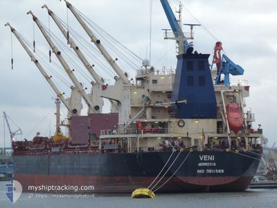
VENI
Bulk Carrier
Current Trip
| Time Travelled | 17 days |
|---|---|
| Remaining Time | --- |
| Distance Travelled | 4444.50 nm |
| Remaining Distance | --- |
| AVG Speed | 11 Noeuds |
| MAX Speed | 16.3 Noeuds |
| AVG Wind | 14.8 knots |
| MAX Wind | 28 knots |
| MIN Temp | 1.4°C / 34.52°F |
| MAX Temp | 20.2°C / 68.36°F |
| Tirant d eau | 10.4 m |
| Position reçue | 21 h, 31 m depuis |
Current Position
| Longitude | 136.85653° |
|---|---|
| Latitude | 34.69375° |
| Etat | Under way using engine |
| Vitesse | 12.9 Noeuds |
| Parcours | 325.4° |
| Zone | Philippine Sea |
| Station | T-AIS |
| Position reçue | 21 h, 31 m depuis |
Info
Information
The current position of VENI is in Philippine Sea with coordinates 34.69375° / 136.85653° as reported on 2024-05-11 10:36 by AIS to our vessel tracker app. The vessel's current speed is 12.9 Noeuds
The vessel VENI (IMO: 9611589, MMSI: 636022680) is a Bulk Carrier that was built in 2011 ( 13 Age ). It's sailing under the flag of [LR] Liberia.
In this page you can find informations about the vessels current position, last detected port calls, and current voyage information. If the vessels is not in coverage by AIS you will find the latest position.
The current position of VENI is detected by our AIS receivers and we are not responsible for the reliability of the data. The last position was recorded while the vessel was in Coverage by the Ais receivers of our vessel tracking app.
The current draught of VENI as reported by AIS is 10.4 meters
Weather
| Temperature | 19.3°C / 66.74°F |
|---|---|
| Wind Speed | 12 knots |
| Direction | 153° SSE |
| Pressure | 1015.6 hPa |
| Humidity | 78.2 % |
| Cloud Coverage | 100 % |
Featured Company
Last Port Calls
| Port | Arrival | Departure | Time In Port |
|---|---|---|---|
| 2024-04-22 16:07 | 2024-04-25 03:24 | 2 d | |
| 2024-04-09 00:28 | 2024-04-13 10:19 | 4 d | |
| 2024-04-05 16:39 | 2024-04-07 05:35 | 1 d | |
| 2024-03-30 11:30 | 2024-03-31 22:38 | 1 d |
Most Visited Ports (Last year)
| Port | Arrivals | |
|---|---|---|
| 3 | ||
| 3 | ||
| 2 | ||
| 2 | ||
| 1 | ||
| 1 |
Last Trips
| Origin | Departure | Destination | Arrival | Distance | |
|---|---|---|---|---|---|
| 2024-04-13 05:19 | 2024-04-22 09:07 | 2620.92 nm | |||
| 2024-04-06 22:35 | 2024-04-08 19:28 | 505.29 nm | |||
| 2024-03-31 16:38 | 2024-04-05 09:39 | 1361.16 nm | |||
| 2024-02-16 00:39 | 2024-03-30 05:30 | 7760.50 nm |
Events
| Heure | Evenement | Détails | Position/ Destination | Info |
|---|---|---|---|---|
| 2024-05-11 12:16 | Arret | 3.6 nm, East of YOKKAICHI |
34.95909 / 136.74548
JPNGO
|
Vitesse: Parcours: 335° |
| 2024-05-11 10:44 | Etat Changé | Default Under way using engine |
34.71802 / 136.83611
JPNGO
|
Vitesse: 12.9 kn Parcours: 325.4° |
| 2024-05-11 10:36 | Hors de la zone couverte |
34.69375 / 136.85653
Philippine Sea
JPNGO
|
Vitesse: 12.9 kn Parcours: 325.4° |
|
| 2024-05-11 10:33 | Etat Changé | Under way using engine Default |
34.68444 / 136.86449
JPNGO
|
Vitesse: 12.9 kn Parcours: 314° |
| 2024-05-11 10:25 | Dans la zone couverte |
34.68732 / 136.86191
Philippine Sea
JPNGO
|
Vitesse: 12.9 kn Parcours: 325.2° |
|
| 2024-05-11 08:59 | Etat Changé | Default Under way using engine |
34.49186 / 137.15321
JPNGO
|
Vitesse: 10.7 kn Parcours: 306.3° |
| 2024-05-11 08:56 | Etat Changé | Under way using engine Default |
34.48707 / 137.16116
JPNGO
|
Vitesse: 10.6 kn Parcours: 309° |
| 2024-05-11 08:56 | Hors de la zone couverte |
34.48707 / 137.16116
Philippine Sea
JPNGO
|
Vitesse: 10.7 kn Parcours: 306.3° |
|
| 2024-05-11 08:31 | Etat Changé | Default Under way using engine |
34.47310 / 137.25531
JPNGO
|
Vitesse: 12.4 kn Parcours: 273° |
| 2024-05-11 08:08 | Etat Changé | Under way using engine Default |
34.47310 / 137.35301
JPNGO
|
Vitesse: 12.7 kn Parcours: 271° |