

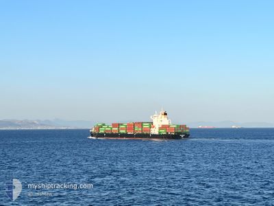
VEGA COLIGNY
Cargo D

Current Trip
| Trip Time | 22 h, 44 mins |
|---|---|
| Trip Distance | 317.12 nm |
| AVG Speed | 13.6 Noeuds |
| MAX Speed | 17.7 Noeuds |
| Tirant d eau | 7.5 m |
| AVG Wind | 11.8 knots |
| MAX Wind | 21.8 knots |
| MIN Temp | 6.9°C / 44.42°F |
| MAX Temp | 17.6°C / 63.68°F |
| Position reçue | 8 h, 55 m depuis |
Current Position
| Longitude | --- |
|---|---|
| Latitude | --- |
| Etat | Under way using engine |
| Vitesse | 12.7 Noeuds |
| Parcours | 49.9° |
| Zone | Mediterranean Sea - Eastern Basin |
| Station | T-AIS |
| Position reçue | 8 h, 55 m depuis |
Information
The current position of VEGA COLIGNY is in Mediterranean Sea - Eastern Basin with coordinates 36.49308° / 35.85023° as reported on 2025-02-20 04:43 by AIS to our vessel tracker app. The vessel's current speed is 12.7 Noeuds and is currently inside the port of ISKENDERUN.
The vessel VEGA COLIGNY (IMO: 9939876, MMSI: 538010322) is a Cargo D It's sailing under the flag of [MH] Marshall Is.
In this page you can find informations about the vessels current position, last detected port calls, and current voyage information. If the vessels is not in coverage by AIS you will find the latest position.
The current position of VEGA COLIGNY is detected by our AIS receivers and we are not responsible for the reliability of the data. The last position was recorded while the vessel was in Coverage by the Ais receivers of our vessel tracking app.
The current draught of VEGA COLIGNY as reported by AIS is 7.5 meters
Weather
| Temperature | 8.7°C / 47.66°F |
|---|---|
| Wind Speed | 9 knots |
| Direction | 309° NW |
| Pressure | 1012.5 hPa |
| Humidity | 34.4 % |
| Cloud Coverage | --- |


Featured Company
Last Port Calls
| Port | Arrival | Departure | Time In Port |
|---|---|---|---|
| 2025-02-20 07:31 | |||
| 2025-02-17 13:21 | 2025-02-19 08:47 | 1 d | |
| 2025-02-13 23:25 | 2025-02-14 13:11 | 13 h | |
| 2025-02-11 19:59 | |||
| 2025-02-11 19:57 | |||
| 2025-02-11 19:57 | |||
| 2025-02-08 21:02 | |||
| 2025-02-04 10:33 | 2025-02-05 03:10 | 16 h | |
| 2025-02-01 08:22 | 2025-02-02 04:44 | 20 h | |
| 2025-01-29 23:01 | 2025-01-30 11:01 | 12 h |
Last Trips
| Origin | Departure | Destination | Arrival | Distance | |
|---|---|---|---|---|---|
| 2025-02-19 10:47 | 2025-02-20 10:31 | 317.12 nm | |||
| 2025-02-14 15:11 | 2025-02-17 15:21 | 92.57 nm | |||
| 2025-02-11 21:59 | 2025-02-14 01:25 | 660.88 nm | |||
| 2025-02-11 21:57 | 2025-02-11 21:57 | 0.10 nm | |||
| 2025-02-05 06:10 | 2025-02-08 23:02 | 226.65 nm | |||
| 2025-02-02 07:44 | 2025-02-04 13:33 | 625.82 nm | |||
| 2025-01-30 14:01 | 2025-02-01 11:22 | 88.99 nm | |||
| 2025-01-27 23:10 | 2025-01-30 02:01 | 264.70 nm | |||
| 2025-01-26 22:54 | 2025-01-27 05:52 | 80.52 nm | |||
| 2025-01-23 02:51 | 2025-01-25 11:30 | 670.97 nm |
Events
| Heure | Evenement | Détails | Position/ Destination | Info |
|---|---|---|---|---|
| 2025-02-20 08:05 | Arret |
36.59515 / 36.18991
[TR] ISKENDERUN
|
Vitesse: 0.2 kn Parcours: 202° |
|
| 2025-02-20 07:31 | Port d'arrivée |
|
36.61717 / 36.17183
[TR] ISKENDERUN
|
Vitesse: 5 kn Parcours: 113° |
| 2025-02-20 04:48 | Etat Changé | Default Under way using engine |
36.50402 / 35.86629
TRISK
|
Vitesse: 12.7 kn Parcours: 49.9° |
| 2025-02-20 04:43 | Hors de la zone couverte |
36.49308 / 35.85023
Mediterranean Sea - Eastern Basin
TRISK
|
Vitesse: 12.7 kn Parcours: 49.9° |
|
| 2025-02-20 02:32 | Changement de zone | Turkish part of the Mediterranean Sea - Eastern Basin Syrian part of the Mediterranean Sea - Eastern Basin |
36.07052 / 35.61854
Mediterranean Sea - Eastern Basin
TRISK
|
Vitesse: 14.4 kn Parcours: 7.8° |
| 2025-02-20 02:29 | Etat Changé | Under way using engine Default |
36.06104 / 35.61682
TRISK
|
Vitesse: 14.4 kn Parcours: 11° |
| 2025-02-20 02:09 | Etat Changé | Default Under way using engine |
35.98209 / 35.59824
TRISK
|
Vitesse: 14.3 kn Parcours: 12.6° |
| 2025-02-20 02:05 | Etat Changé | Under way using engine Default |
35.96643 / 35.59397
TRISK
|
Vitesse: 14.2 kn Parcours: 17° |
| 2025-02-20 01:17 | Etat Changé | Default Under way using engine |
35.78309 / 35.52852
TRISK
|
Vitesse: 14.2 kn Parcours: 17.1° |
| 2025-02-20 01:14 | Changement de zone | Syrian part of the Mediterranean Sea - Eastern Basin Lebanese part of the Mediterranean Sea - Eastern Basin |
35.76877 / 35.52303
Mediterranean Sea - Eastern Basin
TRISK
|
Vitesse: 14.2 kn Parcours: 17.1° |