
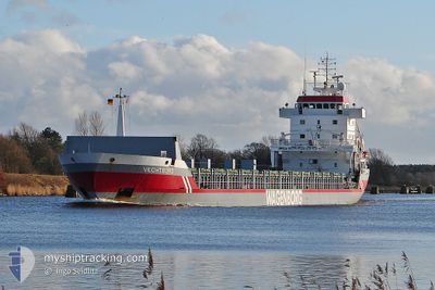
VECHTBORG
General Cargo
Current Trip
| Time Travelled | 3 days |
|---|---|
| Remaining Time | 4 days |
| Distance Travelled | 829.91 nm |
| Remaining Distance | 1466.31 nm |
| AVG Speed | 10.4 Noeuds |
| MAX Speed | 12.2 Noeuds |
| AVG Wind | 6.7 knots |
| MAX Wind | 19 knots |
| MIN Temp | 13.2°C / 55.76°F |
| MAX Temp | 17°C / 62.6°F |
| Tirant d eau | 7.6 m |
| Position reçue | 23 h, 31 m depuis |
Current Position
| Longitude | --- |
|---|---|
| Latitude | --- |
| Etat | Under way using engine |
| Vitesse | 10.8 Noeuds |
| Parcours | 358.5° |
| Zone | North Atlantic Ocean |
| Station | T-AIS |
| Position reçue | 23 h, 31 m depuis |
Info
Information
The current position of VECHTBORG is in North Atlantic Ocean with coordinates 39.65458° / -9.83212° as reported on 2025-02-17 04:26 by AIS to our vessel tracker app. The vessel's current speed is 10.8 Noeuds and is heading at the port of FREDRIKSTAD. The estimated time of arrival as calculated by MyShipTracking vessel tracking app is 2025-02-23 00:42 LT
The vessel VECHTBORG (IMO: 9160334, MMSI: 244615184) is a General Cargo that was built in 1998 ( 27 Age ). It's sailing under the flag of [NL] Netherlands.
In this page you can find informations about the vessels current position, last detected port calls, and current voyage information. If the vessels is not in coverage by AIS you will find the latest position.
The current position of VECHTBORG is detected by our AIS receivers and we are not responsible for the reliability of the data. The last position was recorded while the vessel was in Coverage by the Ais receivers of our vessel tracking app.
The current draught of VECHTBORG as reported by AIS is 7.6 meters
Weather
| Temperature | 13.2°C / 55.76°F |
|---|---|
| Wind Speed | 11 knots |
| Direction | 136° SE |
| Pressure | 1006.9 hPa |
| Humidity | 76.2 % |
| Cloud Coverage | 100 % |
Featured Company
Last Port Calls
| Port | Arrival | Departure | Time In Port |
|---|---|---|---|
| 2025-02-13 16:15 | 2025-02-14 20:08 | 1 d | |
| 2025-02-08 12:07 | 2025-02-11 13:46 | 3 d | |
| 2025-02-06 20:57 | 2025-02-07 21:23 | 1 d | |
| 2025-02-05 05:43 | 2025-02-05 22:51 | 17 h | |
| 2025-02-04 13:17 | 2025-02-04 17:13 | 3 h | |
| 2025-01-22 19:58 | 2025-01-25 12:14 | 2 d | |
| 2025-01-17 12:12 | 2025-01-20 14:22 | 3 d | |
| 2025-01-10 23:05 | 2025-01-13 04:50 | 2 d | |
| 2024-12-29 11:31 | 2025-01-05 01:43 | 6 d | |
| 2024-12-22 07:31 | 2024-12-23 05:15 | 21 h |
Last Trips
| Origin | Departure | Destination | Arrival | Distance | |
|---|---|---|---|---|---|
| 2025-02-11 13:46 | 2025-02-13 16:15 | 296.87 nm | |||
| 2025-02-07 21:23 | 2025-02-08 12:07 | 141.14 nm | |||
| 2025-02-05 22:51 | 2025-02-06 20:57 | 254.76 nm | |||
| 2025-02-04 17:13 | 2025-02-05 05:43 | 148.93 nm | |||
| 2025-01-25 12:14 | 2025-02-04 13:17 | 2608.57 nm | |||
| 2025-01-20 14:22 | 2025-01-22 19:58 | 655.77 nm | |||
| 2025-01-13 04:50 | 2025-01-17 12:12 | 862.38 nm | |||
| 2025-01-05 01:43 | 2025-01-10 23:05 | 1334.23 nm | |||
| 2024-12-23 05:15 | 2024-12-29 11:31 | 1289.16 nm | |||
| 2024-12-22 07:17 | 2024-12-22 07:31 | 1.41 nm |
Events
| Heure | Evenement | Détails | Position/ Destination | Info |
|---|---|---|---|---|
| 2025-02-17 04:27 | Etat Changé | Default Under way using engine |
39.65757 / -9.83222
NOFRK
|
Vitesse: 10.8 kn Parcours: 358.5° |
| 2025-02-17 04:26 | Etat Changé | Under way using engine Default |
39.65458 / -9.83212
NOFRK
|
Vitesse: 10.6 kn Parcours: 358° |
| 2025-02-17 04:26 | Hors de la zone couverte |
39.65458 / -9.83212
North Atlantic Ocean
NOFRK
|
Vitesse: 10.8 kn Parcours: 358.5° |
|
| 2025-02-17 04:23 | Etat Changé | Default Under way using engine |
39.64592 / -9.83179
NOFRK
|
Vitesse: 10.7 kn Parcours: 356.4° |
| 2025-02-16 17:20 | Etat Changé | Under way using engine Default |
37.73370 / -9.55522
NOFRK
|
Vitesse: 10 kn Parcours: 344° |
| 2025-02-16 17:19 | Etat Changé | Default Under way using engine |
37.73113 / -9.55426
NOFRK
|
Vitesse: 10.2 kn Parcours: 343.6° |
| 2025-02-16 16:49 | Etat Changé | Under way using engine Default |
37.64989 / -9.52491
NOFRK
|
Vitesse: 10.1 kn Parcours: 346° |
| 2025-02-16 16:23 | Etat Changé | Default Under way using engine |
37.57990 / -9.50180
NOFRK
|
Vitesse: 9.8 kn Parcours: 348.4° |
| 2025-02-16 16:15 | Etat Changé | Under way using engine Default |
37.55759 / -9.49572
NOFRK
|
Vitesse: 9.9 kn Parcours: 347° |
| 2025-02-16 15:13 | Hors de la zone couverte |
37.39180 / -9.45026
North Atlantic Ocean
NOFRK
|
Vitesse: 9.6 kn Parcours: 350.2° |