
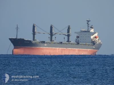
VAFAA M
General Cargo
Current Trip
ISTANBUL
| Time Travelled | 4 days |
|---|---|
| Remaining Time | --- |
| Distance Travelled | 231.37 nm |
| Remaining Distance | --- |
| AVG Speed | 11 Noeuds |
| MAX Speed | 19.4 Noeuds |
| AVG Wind | 7.3 knots |
| MAX Wind | 12 knots |
| MIN Temp | 14.8°C / 58.64°F |
| MAX Temp | 16.9°C / 62.42°F |
| Tirant d eau | 5.5 m |
| Position reçue | 4 d depuis |
Current Position
| Longitude | 29.52926° |
|---|---|
| Latitude | 41.36898° |
| Etat | Under way using engine |
| Vitesse | 11.1 Noeuds |
| Parcours | 71.5° |
| Zone | Black Sea |
| Station | T-AIS |
| Position reçue | 4 d depuis |
Info
Information
The current position of VAFAA M is in Black Sea with coordinates 41.36898° / 29.52926° as reported on 2024-05-07 19:08 by AIS to our vessel tracker app. The vessel's current speed is 11.1 Noeuds
The vessel VAFAA M (IMO: 9162409, MMSI: 518101010) is a General Cargo that was built in 1997 ( 27 Age ). It's sailing under the flag of [CK] Cook Is.
In this page you can find informations about the vessels current position, last detected port calls, and current voyage information. If the vessels is not in coverage by AIS you will find the latest position.
The current position of VAFAA M is detected by our AIS receivers and we are not responsible for the reliability of the data. The last position was recorded while the vessel was in Coverage by the Ais receivers of our vessel tracking app.
The current draught of VAFAA M as reported by AIS is 5.5 meters
Weather
| Temperature | 16.4°C / 61.52°F |
|---|---|
| Wind Speed | 7 knots |
| Direction | 102° ESE |
| Pressure | 1016.3 hPa |
| Humidity | 56.6 % |
| Cloud Coverage | 80 % |
Featured Company
Most Visited Ports (Last year)
| Port | Arrivals | |
|---|---|---|
| 2 | ||
| 2 | ||
| 2 | ||
| 1 | ||
| 1 | ||
| 1 |
Events
| Heure | Evenement | Détails | Position/ Destination | Info |
|---|---|---|---|---|
| 2024-05-07 19:10 | Etat Changé | Default Under way using engine |
41.37111 / 29.53703
ISTANBUL
|
Vitesse: 11.1 kn Parcours: 71.5° |
| 2024-05-07 19:08 | Hors de la zone couverte |
41.36898 / 29.52926
Black Sea
|
Vitesse: 11.1 kn Parcours: 71.5° |
|
| 2024-05-07 17:22 | Changement de zone | Turkish part of the Black Sea Turkish part of the Sea of Marmara |
41.24003 / 29.14845
Black Sea
|
Vitesse: 10.4 kn Parcours: 39° |
| 2024-05-07 17:06 | PORT DE DEPART |
|
41.20555 / 29.11345
ISTANBUL
|
Vitesse: 8.8 kn Parcours: 41° |
| 2024-05-07 15:21 | Port d'arrivée |
|
41.00530 / 28.99551
[TR] ISTANBUL
|
Vitesse: 7.1 kn Parcours: 3.7° |
| 2024-05-07 12:39 | Démarrage | 11.43 nm, South of YESILKOY |
40.76672 / 28.79041
ISTANBUL
|
Vitesse: 3.1 kn Parcours: 335° |
| 2024-05-07 03:16 | Arret | 11.35 nm, South of YESILKOY |
40.77278 / 28.76041
ISTANBUL
|
Vitesse: 0.3 kn Parcours: 131° |
| 2024-05-07 00:03 | Démarrage | 17.58 nm, South of AMBARLI |
40.67162 / 28.60224
ISTANBUL
|
Vitesse: 3.2 kn Parcours: 47° |
| 2024-05-06 17:07 | Arret | 15.49 nm, South of AMBARLI |
40.70193 / 28.69563
ISTANBUL
|
Vitesse: 0.3 kn Parcours: 17° |
| 2024-05-06 16:37 | Démarrage | 16.86 nm, South of AMBARLI |
40.67928 / 28.70001
ISTANBUL
|
Vitesse: 3.2 kn Parcours: 262° |