

US GOV VESSEL
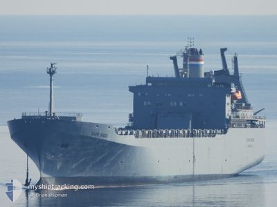
Vehicles Carrier

Current Trip
| Trip Time | 14 days |
|---|---|
| Trip Distance | 5581.52 nm |
| AVG Speed | 15.1 Noeuds |
| MAX Speed | 19.2 Noeuds |
| Tirant d eau | 8.5 m |
| AVG Wind | 13.3 knots |
| MAX Wind | 30 knots |
| MIN Temp | 7.8°C / 46.04°F |
| MAX Temp | 21.5°C / 70.7°F |
| Position reçue | 3 d depuis |
Current Position
| Longitude | --- |
|---|---|
| Latitude | --- |
| Etat | At anchor |
| Vitesse | |
| Parcours | 305° |
| Zone | Aegean Sea |
| Station | T-AIS |
| Position reçue | 3 d depuis |
Information
The current position of US GOV VESSEL is in Aegean Sea with coordinates 35.49651° / 24.10104° as reported on 2025-03-09 13:11 by AIS to our vessel tracker app. The vessel's current speed is 0 Noeuds and is currently inside the port of SOUDA.
The vessel US GOV VESSEL (IMO: 7715290, MMSI: 367801000) is a Vehicles Carrier that was built in 1978 ( 47 Age ). It's sailing under the flag of [US] USA.
In this page you can find informations about the vessels current position, last detected port calls, and current voyage information. If the vessels is not in coverage by AIS you will find the latest position.
The current position of US GOV VESSEL is detected by our AIS receivers and we are not responsible for the reliability of the data. The last position was recorded while the vessel was in Coverage by the Ais receivers of our vessel tracking app.
The current draught of US GOV VESSEL as reported by AIS is 8.5 meters
Weather
| Temperature | 15°C / 59°F |
|---|---|
| Wind Speed | 6 knots |
| Direction | 340° NNW |
| Pressure | 1015.4 hPa |
| Humidity | 57 % |
| Cloud Coverage | --- |


Featured Company
Last Port Calls
| Port | Arrival | Departure | Time In Port |
|---|---|---|---|
| 2025-03-09 09:49 | |||
| 2025-02-11 16:43 | 2025-02-22 10:39 | 10 d | |
| 2025-02-08 12:31 |
Most Visited Ports (Last year)
| Port | Arrivals | |
|---|---|---|
| 1 | ||
| 1 |
Last Trips
| Origin | Departure | Destination | Arrival | Distance | |
|---|---|---|---|---|---|
| 2025-02-22 10:39 | 2025-03-09 09:49 | 5581.52 nm | |||
| 2025-02-08 12:31 | 2025-02-11 16:43 | 1285.52 nm |
Events
| Heure | Evenement | Détails | Position/ Destination | Info |
|---|---|---|---|---|
| 2025-03-09 13:11 | Hors de la zone couverte |
35.49651 / 24.10104
Aegean Sea
[GR] SOUDA
|
Vitesse: Parcours: 56.9° |
|
| 2025-03-09 08:26 | Etat Changé | At anchor Under way using engine |
35.49721 / 24.10175
[GR] SOUDA
|
Vitesse: 0.3 kn Parcours: 275° |
| 2025-03-09 08:05 | Arret |
35.49746 / 24.10099
[GR] SOUDA
|
Vitesse: 0.3 kn Parcours: 300° |
|
| 2025-03-09 07:49 | Port d'arrivée |
|
35.49090 / 24.11632
[GR] SOUDA
|
Vitesse: 6.9 kn Parcours: 297.5° |
| 2025-03-09 04:30 | Tirant d'eau modifié | 8.5 8.6 |
35.70160 / 23.92173
FOR ORDERS
|
Vitesse: 16.3 kn Parcours: 106.8° |
| 2025-03-09 03:07 | Changement de zone | Greek part of the Aegean Sea Greek part of the Mediterranean Sea - Eastern Basin |
35.75864 / 23.45993
Aegean Sea
|
Vitesse: 16.3 kn Parcours: 91.8° |
| 2025-03-09 02:37 | Etat Changé | Under way using engine Default |
35.76611 / 23.29044
FOR ORDERS
|
Vitesse: 16.1 kn Parcours: 89° |
| 2025-03-09 02:21 | Etat Changé | Default Under way using engine |
35.76582 / 23.20267
FOR ORDERS
|
Vitesse: 16.1 kn Parcours: 90.3° |
| 2025-03-09 02:19 | Changement de zone | Greek part of the Mediterranean Sea - Eastern Basin Italian part of the Mediterranean Sea - Eastern Basin |
35.76561 / 23.19116
Mediterranean Sea - Eastern Basin
|
Vitesse: 16.1 kn Parcours: 90.3° |
| 2025-03-09 02:18 | Etat Changé | Under way using engine Default |
35.76561 / 23.18669
FOR ORDERS
|
Vitesse: 16 kn Parcours: 91° |