
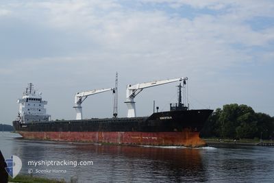
UNISTAR
General Cargo
Current Trip
| Time Travelled | 7 days |
|---|---|
| Remaining Time | --- |
| Distance Travelled | 1925.80 nm |
| Remaining Distance | --- |
| AVG Speed | 7.3 Noeuds |
| MAX Speed | 11.5 Noeuds |
| AVG Wind | 20.9 knots |
| MAX Wind | 34 knots |
| MIN Temp | 14.8°C / 58.64°F |
| MAX Temp | 25.4°C / 77.72°F |
| Tirant d eau | 6.9 m |
| Position reçue | 3 d depuis |
Current Position
| Longitude | --- |
|---|---|
| Latitude | --- |
| Etat | Under way using engine |
| Vitesse | 10.9 Noeuds |
| Parcours | 215.9° |
| Zone | North Atlantic Ocean |
| Station | T-AIS |
| Position reçue | 3 d depuis |
Info
Information
The current position of UNISTAR is in North Atlantic Ocean with coordinates 23.91491° / -17.93118° as reported on 2025-01-12 15:07 by AIS to our vessel tracker app. The vessel's current speed is 10.9 Noeuds and is heading at the port of BATA. The estimated time of arrival as calculated by MyShipTracking vessel tracking app is 2025-01-23 10:00 LT
The vessel UNISTAR (IMO: 9559901, MMSI: 305826000) is a General Cargo that was built in 2012 ( 13 Age ). It's sailing under the flag of [AG] Antigua Barbuda.
In this page you can find informations about the vessels current position, last detected port calls, and current voyage information. If the vessels is not in coverage by AIS you will find the latest position.
The current position of UNISTAR is detected by our AIS receivers and we are not responsible for the reliability of the data. The last position was recorded while the vessel was in Coverage by the Ais receivers of our vessel tracking app.
The current draught of UNISTAR as reported by AIS is 6.9 meters
Weather
| Temperature | 25.3°C / 77.54°F |
|---|---|
| Wind Speed | 14 knots |
| Direction | 23° NNE |
| Pressure | 1009.6 hPa |
| Humidity | 58.7 % |
| Cloud Coverage | 38 % |
Featured Company
Last Port Calls
| Port | Arrival | Departure | Time In Port |
|---|---|---|---|
| 2025-01-07 01:03 | 2025-01-07 17:48 | 16 h | |
| 2024-12-29 23:40 | 2025-01-01 01:33 | 2 d | |
| 2024-12-29 20:16 | 2024-12-29 22:28 | 2 h | |
| 2024-12-28 15:54 | 2024-12-29 02:04 | 10 h | |
| 2024-12-03 23:28 | 2024-12-26 20:09 | 22 d | |
| 2024-12-02 07:23 | 2024-12-03 20:00 | 1 d | |
| 2024-12-01 05:34 | 2024-12-01 22:24 | 16 h | |
| 2024-11-08 10:39 |
Last Trips
| Origin | Departure | Destination | Arrival | Distance | |
|---|---|---|---|---|---|
| 2025-01-01 01:33 | 2025-01-07 01:03 | 1291.45 nm | |||
| 2024-12-26 21:09 | 2024-12-29 23:40 | 453.55 nm | |||
| 2024-12-26 21:09 | 2024-12-29 20:16 | 447.31 nm | |||
| 2024-12-26 21:09 | 2024-12-28 15:54 | 440.35 nm | |||
| 2024-12-03 21:00 | 2024-12-04 00:28 | 31.87 nm | |||
| 2024-12-01 23:24 | 2024-12-02 08:23 | 69.76 nm | |||
| 2024-11-08 05:39 | 2024-12-01 06:34 | 4738.07 nm |
Events
| Heure | Evenement | Détails | Position/ Destination | Info |
|---|---|---|---|---|
| 2025-01-12 15:19 | Etat Changé | Default Under way using engine |
23.88609 / -17.95406
GQBSG
|
Vitesse: 10.9 kn Parcours: 215.9° |
| 2025-01-12 15:07 | Etat Changé | Under way using engine Default |
23.91491 / -17.93118
GQBSG
|
Vitesse: 11 kn Parcours: 215° |
| 2025-01-12 15:07 | Hors de la zone couverte |
23.91491 / -17.93118
North Atlantic Ocean
GQBSG
|
Vitesse: 10.9 kn Parcours: 215.9° |
|
| 2025-01-12 14:47 | Etat Changé | Default Under way using engine |
23.96568 / -17.89174
GQBSG
|
Vitesse: 11 kn Parcours: 215.3° |
| 2025-01-12 14:18 | Etat Changé | Under way using engine Default |
24.04134 / -17.84176
GQBSG
|
Vitesse: 11 kn Parcours: 200° |
| 2025-01-12 14:01 | Etat Changé | Default Under way using engine |
24.08851 / -17.82364
GQBSG
|
Vitesse: 11.2 kn Parcours: 212.4° |
| 2025-01-12 13:41 | Etat Changé | Under way using engine Default |
24.14419 / -17.78918
GQBSG
|
Vitesse: 11.2 kn Parcours: 212° |
| 2025-01-12 13:35 | Etat Changé | Default Under way using engine |
24.15942 / -17.77823
GQBSG
|
Vitesse: 11 kn Parcours: 213.5° |
| 2025-01-12 13:16 | Etat Changé | Under way using engine Default |
24.20675 / -17.74477
GQBSG
|
Vitesse: 11.1 kn Parcours: 214° |
| 2025-01-12 13:11 | Etat Changé | Default Under way using engine |
24.22082 / -17.73449
GQBSG
|
Vitesse: 11.1 kn Parcours: 213.3° |