
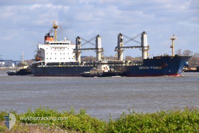
UNISON POWER
Bulk Carrier
Current Trip
| Time Travelled | 4 days |
|---|---|
| Remaining Time | --- |
| Distance Travelled | 434.77 nm |
| Remaining Distance | --- |
| AVG Speed | 11 Noeuds |
| MAX Speed | 12.6 Noeuds |
| AVG Wind | 14.1 knots |
| MAX Wind | 26.5 knots |
| MIN Temp | 8.1°C / 46.58°F |
| MAX Temp | 22.4°C / 72.32°F |
| Tirant d eau | 6.3 m |
| Position reçue | 1 m depuis |
Current Position
| Longitude | 18.64137° |
|---|---|
| Latitude | 54.52128° |
| Etat | At anchor |
| Vitesse | 0.1 Noeuds |
| Parcours | 118° |
| Zone | Baltic Sea |
| Station | T-AIS |
| Position reçue | 1 m depuis |
Info
Information
The current position of UNISON POWER is in Baltic Sea with coordinates 54.52128° / 18.64137° as reported on 2024-05-05 11:52 by AIS to our vessel tracker app. The vessel's current speed is 0.1 Noeuds
The vessel UNISON POWER (IMO: 9579406, MMSI: 370416000) is a Bulk Carrier that was built in 2012 ( 12 Age ). It's sailing under the flag of [PA] Panama.
In this page you can find informations about the vessels current position, last detected port calls, and current voyage information. If the vessels is not in coverage by AIS you will find the latest position.
The current position of UNISON POWER is detected by our AIS receivers and we are not responsible for the reliability of the data. The last position was recorded while the vessel was in Coverage by the Ais receivers of our vessel tracking app.
The current draught of UNISON POWER as reported by AIS is 6.3 meters
Weather
| Temperature | 12.1°C / 53.78°F |
|---|---|
| Wind Speed | 4 knots |
| Direction | 160° SSE |
| Pressure | 1008.8 hPa |
| Humidity | 92.6 % |
| Cloud Coverage | 100 % |
Featured Company
Last Port Calls
| Port | Arrival | Departure | Time In Port |
|---|---|---|---|
| 2024-04-27 20:21 | 2024-05-01 05:56 | 3 d | |
| 2024-04-21 23:52 | 2024-04-25 18:21 | 3 d | |
| 2024-03-30 01:05 | 2024-04-18 21:07 | 19 d | |
| 2024-03-24 12:17 | 2024-03-27 17:44 | 3 d |
Most Visited Ports (Last year)
| Port | Arrivals | |
|---|---|---|
| 1 | ||
| 1 | ||
| 1 | ||
| 1 | ||
| 1 | ||
| 1 |
Last Trips
| Origin | Departure | Destination | Arrival | Distance | |
|---|---|---|---|---|---|
| 2024-04-25 20:21 | 2024-04-27 22:21 | 524.85 nm | |||
| 2024-04-18 23:07 | 2024-04-22 01:52 | 466.34 nm | |||
| 2024-03-27 17:44 | 2024-03-30 02:05 | 185.98 nm | |||
| 2024-02-25 00:25 | 2024-03-24 12:17 | 5675.10 nm |
Events
| Heure | Evenement | Détails | Position/ Destination | Info |
|---|---|---|---|---|
| 2024-05-05 05:49 | Etat Changé | At anchor Default |
54.51893 / 18.64451
PLGDY
|
Vitesse: Parcours: 331° |
| 2024-05-05 05:15 | Etat Changé | Default At anchor |
54.51904 / 18.64548
PLGDY
|
Vitesse: Parcours: 331° |
| 2024-05-05 03:49 | Arret | 3.86 nm, East of GDYNIA |
54.51910 / 18.64554
PLGDY
|
Vitesse: 0.1 kn Parcours: 331° |
| 2024-05-05 03:48 | Démarrage | 3.85 nm, East of GDYNIA |
54.51911 / 18.64552
PLGDY
|
Vitesse: 3.4 kn Parcours: 331° |
| 2024-05-03 05:46 | Etat Changé | At anchor Default |
54.52018 / 18.64204
PLGDY
|
Vitesse: 0.1 kn Parcours: 62° |
| 2024-05-03 05:43 | Etat Changé | Default At anchor |
54.52011 / 18.64203
PLGDY
|
Vitesse: 0.1 kn Parcours: 59° |
| 2024-05-02 20:34 | Etat Changé | At anchor Under way using engine |
54.52223 / 18.64513
PLGDY
|
Vitesse: 0.1 kn Parcours: 186° |
| 2024-05-02 20:31 | Arret | 3.8 nm, East of GDYNIA |
54.52240 / 18.64523
PLGDY
|
Vitesse: 0.3 kn Parcours: 175° |
| 2024-05-02 15:43 | Changement d'ETA | 2024/05/02 15:00 2024/05/02 21:00 |
54.92340 / 18.20903
PLGDY
|
Vitesse: 11.6 kn Parcours: 80.1° |
| 2024-05-02 05:35 | Detecté en mer | Polish part of the Baltic Sea |
54.63428 / 14.86606
Baltic Sea
PLGDY
|
Vitesse: 11.7 kn Parcours: 79.4° |