

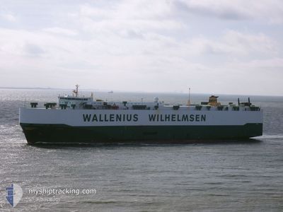
UNDINE
Vehicles Carrier

Current Trip
| Time Travelled | 1 day |
|---|---|
| Remaining Time | 19 h, 54 mins |
| Distance Travelled | 338.72 nm |
| Remaining Distance | 225.59 nm |
| AVG Speed | 11.5 Noeuds |
| MAX Speed | 13.7 Noeuds |
| AVG Wind | 16.5 knots |
| MAX Wind | 22 knots |
| MIN Temp | 23.2°C / 73.76°F |
| MAX Temp | 25.3°C / 77.54°F |
| Tirant d eau | 8.8 m |
| Position reçue | 32 m depuis |
Current Position
| Longitude | --- |
|---|---|
| Latitude | --- |
| Etat | Under way using engine |
| Vitesse | 10.8 Noeuds |
| Parcours | 8.6° |
| Zone | Coral Sea |
| Station | T-AIS |
| Position reçue | 32 m depuis |
Information
The current position of UNDINE is in Coral Sea with coordinates -29.61136° / 153.71382° as reported on 2025-02-15 11:46 by AIS to our vessel tracker app. The vessel's current speed is 10.8 Noeuds and is heading at the port of BRISBANE. The estimated time of arrival as calculated by MyShipTracking vessel tracking app is 2025-02-16 18:13 LT
The vessel UNDINE (IMO: 9240160, MMSI: 265884000) is a Vehicles Carrier that was built in 2003 ( 22 Age ). It's sailing under the flag of [SE] Sweden.
In this page you can find informations about the vessels current position, last detected port calls, and current voyage information. If the vessels is not in coverage by AIS you will find the latest position.
The current position of UNDINE is detected by our AIS receivers and we are not responsible for the reliability of the data. The last position was recorded while the vessel was in Coverage by the Ais receivers of our vessel tracking app.
The current draught of UNDINE as reported by AIS is 8.8 meters
Weather
| Temperature | 25.3°C / 77.54°F |
|---|---|
| Wind Speed | 11 knots |
| Direction | 172° S |
| Pressure | 1002.9 hPa |
| Humidity | 82 % |
| Cloud Coverage | 100 % |


Featured Company
Last Port Calls
| Port | Arrival | Departure | Time In Port |
|---|---|---|---|
| 2025-02-12 13:01 | 2025-02-14 17:10 | 2 d | |
| 2025-02-07 19:06 | 2025-02-09 11:43 | 1 d | |
| 2025-01-31 07:30 | 2025-02-02 08:23 | 2 d | |
| 2025-01-16 02:24 | 2025-01-16 16:57 | 14 h | |
| 2025-01-14 05:03 | 2025-01-15 07:03 | 1 d | |
| 2024-12-27 05:49 | 2024-12-27 17:14 | 11 h | |
| 2024-12-24 08:07 | 2024-12-24 20:10 | 12 h | |
| 2024-12-19 21:27 | 2024-12-23 20:35 | 3 d | |
| 2024-12-16 02:20 | 2024-12-19 00:43 | 2 d | |
| 2024-12-04 03:33 | 2024-12-04 17:29 | 13 h |
Most Visited Ports (Last year)
| Port | Arrivals | |
|---|---|---|
| 3 | ||
| 3 | ||
| 3 | ||
| 2 | ||
| 2 | ||
| 2 |
Last Trips
| Origin | Departure | Destination | Arrival | Distance | |
|---|---|---|---|---|---|
| 2025-02-09 11:43 | 2025-02-12 13:01 | 702.58 nm | |||
| 2025-02-02 08:23 | 2025-02-07 19:06 | 1710.98 nm | |||
| 2025-01-16 16:57 | 2025-01-31 07:30 | 4380.36 nm | |||
| 2025-01-15 07:03 | 2025-01-16 02:24 | 274.91 nm | |||
| 2024-12-27 17:14 | 2025-01-14 05:03 | 6292.97 nm | |||
| 2024-12-24 20:10 | 2024-12-27 05:49 | 583.68 nm | |||
| 2024-12-23 20:35 | 2024-12-24 08:07 | 202.94 nm | |||
| 2024-12-19 00:43 | 2024-12-19 21:27 | 331.76 nm | |||
| 2024-12-04 17:29 | 2024-12-16 02:20 | 4131.26 nm | |||
| 2024-12-03 14:28 | 2024-12-04 03:33 | 172.51 nm |
Events
| Heure | Evenement | Détails | Position/ Destination | Info |
|---|---|---|---|---|
| 2025-02-15 11:52 | Etat Changé | Default Under way using engine |
-29.59301 / 153.71704
AU BNE
|
Vitesse: 10.8 kn Parcours: 8.6° |
| 2025-02-15 11:46 | Etat Changé | Under way using engine Default |
-29.61136 / 153.71382
AU BNE
|
Vitesse: 10.8 kn Parcours: 9° |
| 2025-02-15 11:40 | Etat Changé | Default Under way using engine |
-29.62907 / 153.71062
AU BNE
|
Vitesse: 10.7 kn Parcours: 7.5° |
| 2025-02-15 11:34 | Changement de zone | Australian part of the Coral Sea Australian part of the Tasman Sea |
-29.64759 / 153.70734
Coral Sea
AU BNE
|
Vitesse: 10.7 kn Parcours: 7.5° |
| 2025-02-15 11:34 | Etat Changé | Under way using engine Default |
-29.64759 / 153.70734
AU BNE
|
Vitesse: 10.6 kn Parcours: 9° |
| 2025-02-15 11:24 | Dans la zone couverte |
-29.64759 / 153.70734
Coral Sea
AU BNE
|
Vitesse: 10.7 kn Parcours: 7.5° |
|
| 2025-02-15 04:40 | Etat Changé | Default Under way using engine |
-30.94299 / 153.40871
AU BNE
|
Vitesse: 11.6 kn Parcours: 12.4° |
| 2025-02-15 04:32 | Hors de la zone couverte |
-30.96844 / 153.40238
Tasman Sea
AU BNE
|
Vitesse: 11.6 kn Parcours: 12.4° |
|
| 2025-02-15 04:31 | Etat Changé | Under way using engine Default |
-30.97319 / 153.40118
AU BNE
|
Vitesse: 11.8 kn Parcours: 11° |
| 2025-02-15 04:24 | Etat Changé | Default Under way using engine |
-30.99383 / 153.39597
AU BNE
|
Vitesse: 11.8 kn Parcours: 11.5° |