
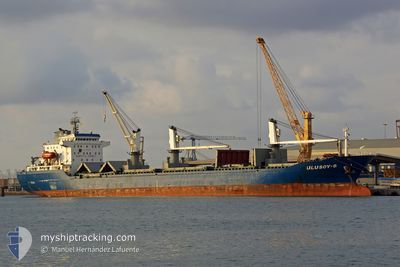
ULUSOY 8
Bulk Carrier
Current Trip
PAPCN
| Time Travelled | 8 days |
|---|---|
| Remaining Time | --- |
| Distance Travelled | 1804.24 nm |
| Remaining Distance | --- |
| AVG Speed | 9.9 Noeuds |
| MAX Speed | 12.2 Noeuds |
| AVG Wind | 14.6 knots |
| MAX Wind | 28.7 knots |
| MIN Temp | 2.2°C / 35.96°F |
| MAX Temp | 13.3°C / 55.94°F |
| Tirant d eau | 7.2 m |
| Position reçue | 7 d depuis |
Current Position
| Longitude | --- |
|---|---|
| Latitude | --- |
| Etat | Under way using engine |
| Vitesse | 11.2 Noeuds |
| Parcours | 293.4° |
| Zone | North Sea |
| Station | T-AIS |
| Position reçue | 7 d depuis |
Information
The current position of ULUSOY 8 is in North Sea with coordinates 58.80457° / 3.64093° as reported on 2025-03-20 04:17 by AIS to our vessel tracker app. The vessel's current speed is 11.2 Noeuds
The vessel ULUSOY 8 (IMO: 9458250, MMSI: 271000973) is a Bulk Carrier that was built in 2008 ( 17 Age ). It's sailing under the flag of [TR] Turkey.
In this page you can find informations about the vessels current position, last detected port calls, and current voyage information. If the vessels is not in coverage by AIS you will find the latest position.
The current position of ULUSOY 8 is detected by our AIS receivers and we are not responsible for the reliability of the data. The last position was recorded while the vessel was in Coverage by the Ais receivers of our vessel tracking app.
The current draught of ULUSOY 8 as reported by AIS is 7.2 meters
Weather
| Temperature | 12.5°C / 54.5°F |
|---|---|
| Wind Speed | 10 knots |
| Direction | 298° WNW |
| Pressure | 1025.3 hPa |
| Humidity | 91.4 % |
| Cloud Coverage | 100 % |
Featured Company
Most Visited Ports (Last year)
| Port | Arrivals | |
|---|---|---|
| 2 | ||
| 2 | ||
| 2 | ||
| 2 | ||
| 2 | ||
| 1 |
Last Trips
Events
| Heure | Evenement | Détails | Position/ Destination | Info |
|---|---|---|---|---|
| 2025-03-20 04:17 | Hors de la zone couverte |
58.80457 / 3.64093
North Sea
PAPCN
|
Vitesse: 11.2 kn Parcours: 293.4° |
|
| 2025-03-19 16:22 | Detecté en mer | Norwegian part of the North Sea |
57.79035 / 7.37081
North Sea
PAPCN
|
Vitesse: 10.9 kn Parcours: 270.7° |
| 2025-03-19 15:34 | Changement de destination | PAPCN PECLL |
57.79002 / 7.64276
PAPCN
|
Vitesse: 10.4 kn Parcours: 270.9° |
| 2025-03-19 15:34 | Changement d'ETA | 2025/04/06 17:00 2025/03/12 13:00 |
57.79002 / 7.64276
PAPCN
|
Vitesse: 10.4 kn Parcours: 270.9° |
| 2025-03-19 11:08 | Detecté en mer | Norwegian part of the Skaggerak |
57.83865 / 9.11645
Skaggerak
|
Vitesse: 11.1 kn Parcours: 266.1° |
| 2025-03-19 05:56 | Changement de zone | Danish part of the Skaggerak Danish part of the Kattegat |
57.76943 / 10.76019
Skaggerak
|
Vitesse: 9.6 kn Parcours: 318.5° |
| 2025-03-19 04:32 | Changement de zone | Danish part of the Kattegat Swedish part of the Kattegat |
57.77553 / 11.08063
Kattegat
|
Vitesse: 10.2 kn Parcours: 243.6° |
| 2025-03-19 01:50 | Changement de zone | Swedish part of the Kattegat Swedish part of the Skaggerak |
58.02059 / 11.77944
Kattegat
|
Vitesse: 10.8 kn Parcours: 197.2° |
| 2025-03-19 01:38 | Etat Changé | Under way using engine Default |
58.05266 / 11.78439
PECLL
|
Vitesse: 8.6 kn Parcours: 193° |
| 2025-03-19 01:34 | Etat Changé | Default Under way using engine |
58.06156 / 11.78173
PECLL
|
Vitesse: 9.1 kn Parcours: 194.3° |