

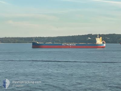
ULTRA LEOPARD
Cargo

Current Trip
BR ESG
| Time Travelled | 20 days |
|---|---|
| Remaining Time | --- |
| Distance Travelled | 6107.96 nm |
| Remaining Distance | --- |
| AVG Speed | 12.6 Noeuds |
| MAX Speed | 17.2 Noeuds |
| AVG Wind | 10 knots |
| MAX Wind | 31 knots |
| MIN Temp | 17°C / 62.6°F |
| MAX Temp | 29.1°C / 84.38°F |
| Tirant d eau | 7.4 m |
| Position reçue | 6 d depuis |
Current Position
| Longitude | --- |
|---|---|
| Latitude | --- |
| Etat | Under way using engine |
| Vitesse | 15 Noeuds |
| Parcours | 212.6° |
| Zone | Indian Ocean |
| Station | T-AIS |
| Position reçue | 6 d depuis |
Information
The current position of ULTRA LEOPARD is in Indian Ocean with coordinates -30.66938° / 31.23190° as reported on 2025-02-18 22:35 by AIS to our vessel tracker app. The vessel's current speed is 15 Noeuds
The vessel ULTRA LEOPARD (IMO: 9758428, MMSI: 352468000) is a Cargo It's sailing under the flag of [PA] Panama.
In this page you can find informations about the vessels current position, last detected port calls, and current voyage information. If the vessels is not in coverage by AIS you will find the latest position.
The current position of ULTRA LEOPARD is detected by our AIS receivers and we are not responsible for the reliability of the data. The last position was recorded while the vessel was in Coverage by the Ais receivers of our vessel tracking app.
The current draught of ULTRA LEOPARD as reported by AIS is 7.4 meters
Weather
| Temperature | 20.8°C / 69.44°F |
|---|---|
| Wind Speed | 5 knots |
| Direction | 61° ENE |
| Pressure | 1024.7 hPa |
| Humidity | 74.3 % |
| Cloud Coverage | --- |


Featured Company
Events
| Heure | Evenement | Détails | Position/ Destination | Info |
|---|---|---|---|---|
| 2025-02-18 22:43 | Etat Changé | Default Under way using engine |
-30.69569 / 31.21238
BR ESG
|
Vitesse: 15 kn Parcours: 212.6° |
| 2025-02-18 22:35 | Hors de la zone couverte |
-30.66938 / 31.23190
Indian Ocean
BR ESG
|
Vitesse: 15 kn Parcours: 212.6° |
|
| 2025-02-18 16:30 | Etat Changé | Under way using engine Default |
-29.42485 / 32.18355
BR ESG
|
Vitesse: 14.6 kn Parcours: 213° |
| 2025-02-18 16:25 | Etat Changé | Default Under way using engine |
-29.40734 / 32.19643
BR ESG
|
Vitesse: 14.5 kn Parcours: 213.7° |
| 2025-02-18 16:02 | Changement de zone | South African part of the Indian Ocean Omani part of the Gulf of Oman |
-29.33065 / 32.25499
Indian Ocean
BR ESG
|
Vitesse: 14.3 kn Parcours: 215.8° |
| 2025-02-18 16:00 | Changement de destination | BR ESG FOR ORDER |
-29.32542 / 32.25923
BR ESG
|
Vitesse: 14.4 kn Parcours: 215.6° |
| 2025-02-18 16:00 | Changement d'ETA | 2025/03/04 20:15 2026/01/22 12:00 |
-29.32542 / 32.25923
BR ESG
|
Vitesse: 14.4 kn Parcours: 215.6° |
| 2025-02-18 15:59 | Etat Changé | Under way using engine Default |
-29.32049 / 32.26320
FOR ORDER
|
Vitesse: 14.4 kn Parcours: 216° |
| 2025-02-18 15:44 | Dans la zone couverte |
-29.33065 / 32.25499
Indian Ocean
BR ESG
|
Vitesse: 14.3 kn Parcours: 215.8° |