
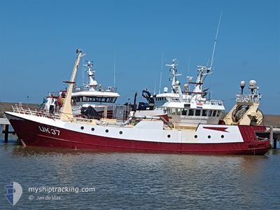
UK37 URSA MINOR
Fishing Vessel
Current Trip
FISHING GROUNDS
| Time Travelled | 3 days |
|---|---|
| Remaining Time | --- |
| Distance Travelled | 196.72 nm |
| Remaining Distance | --- |
| AVG Speed | 9.3 Noeuds |
| MAX Speed | 10.6 Noeuds |
| AVG Wind | 7.5 knots |
| MAX Wind | 9 knots |
| MIN Temp | 8.1°C / 46.58°F |
| MAX Temp | 11.7°C / 53.06°F |
| Tirant d eau | 4 m |
| Position reçue | 1 d depuis |
Current Position
| Longitude | 4.13825° |
|---|---|
| Latitude | 58.13445° |
| Etat | Engaged in Fishing |
| Vitesse | 9.4 Noeuds |
| Parcours | 257.9° |
| Zone | North Sea |
| Station | T-AIS |
| Position reçue | 1 d depuis |
Info
Information
The current position of UK37 URSA MINOR is in North Sea with coordinates 58.13445° / 4.13825° as reported on 2024-05-06 04:59 by AIS to our vessel tracker app. The vessel's current speed is 9.4 Noeuds
The vessel UK37 URSA MINOR (IMO: 7922348, MMSI: 245325000) is a Fishing Vessel that was built in 1980 ( 44 Age ). It's sailing under the flag of [NL] Netherlands.
In this page you can find informations about the vessels current position, last detected port calls, and current voyage information. If the vessels is not in coverage by AIS you will find the latest position.
The current position of UK37 URSA MINOR is detected by our AIS receivers and we are not responsible for the reliability of the data. The last position was recorded while the vessel was in Coverage by the Ais receivers of our vessel tracking app.
The current draught of UK37 URSA MINOR as reported by AIS is 4 meters
Weather
| Temperature | 9.2°C / 48.56°F |
|---|---|
| Wind Speed | 8 knots |
| Direction | 350° N |
| Pressure | 1007.5 hPa |
| Humidity | 85.3 % |
| Cloud Coverage | 98 % |
Featured Company
Last Port Calls
| Port | Arrival | Departure | Time In Port |
|---|---|---|---|
| 2024-05-04 07:43 | 2024-05-04 10:25 | 2 h | |
| 2024-04-25 23:29 | 2024-04-28 21:37 | 2 d | |
| 2024-03-22 01:29 | 2024-04-21 21:27 | ||
| 2024-03-07 10:14 | 2024-03-17 22:51 | 10 d | |
| 2024-03-06 15:49 | 2024-03-06 16:25 | 36 m | |
| 2024-03-04 01:56 |
Most Visited Ports (Last year)
| Port | Arrivals | |
|---|---|---|
| 13 | ||
| 12 | ||
| 6 | ||
| 3 | ||
| 2 | ||
| 1 |
Last Trips
| Origin | Departure | Destination | Arrival | Distance | |
|---|---|---|---|---|---|
| 2024-04-28 23:37 | 2024-05-04 09:43 | 509.33 nm | |||
| 2024-04-21 23:27 | 2024-04-26 01:29 | 107.50 nm | |||
| 2024-03-17 23:51 | 2024-03-22 02:29 | 289.04 nm | |||
| 2024-03-06 17:25 | 2024-03-07 11:14 | 164.29 nm | |||
| 2024-03-04 02:56 | 2024-03-06 16:49 | 193.34 nm |
Events
| Heure | Evenement | Détails | Position/ Destination | Info |
|---|---|---|---|---|
| 2024-05-06 04:59 | Hors de la zone couverte |
58.13445 / 4.13825
North Sea
|
Vitesse: 9.4 kn Parcours: 257.9° |
|
| 2024-05-06 04:32 | Etat Changé | Engaged in Fishing Under way using engine |
58.14466 / 4.09583
FISHING GROUNDS
|
Vitesse: 4.3 kn Parcours: 147° |
| 2024-05-06 03:25 | Dans la zone couverte |
58.22608 / 3.99806
North Sea
|
Vitesse: 5.5 kn Parcours: 144.8° |
|
| 2024-05-05 04:02 | Hors de la zone couverte |
58.50374 / 4.22649
North Sea
|
Vitesse: 9.9 kn Parcours: 313.2° |
|
| 2024-05-04 16:07 | Detecté en mer | Norwegian part of the North Sea |
57.27814 / 6.97807
North Sea
|
Vitesse: 9.4 kn Parcours: 311.4° |
| 2024-05-04 16:07 | Dans la zone couverte |
57.27814 / 6.97807
North Sea
|
Vitesse: 9.4 kn Parcours: 311.4° |
|
| 2024-05-04 12:46 | Hors de la zone couverte |
56.94042 / 7.71387
North Sea
|
Vitesse: 9.5 kn Parcours: 311.4° |
|
| 2024-05-04 10:25 | PORT DE DEPART |
|
56.70096 / 8.22855
FISHING GROUNDS
|
Vitesse: 8.1 kn Parcours: 24° |
| 2024-05-04 10:23 | Démarrage |
56.70112 / 8.22416
[DK] THYBORON
|
Vitesse: 7.6 kn Parcours: 160° |
|
| 2024-05-04 07:46 | Arret |
56.70282 / 8.22199
[DK] THYBORON
|
Vitesse: 0.2 kn Parcours: 258° |