
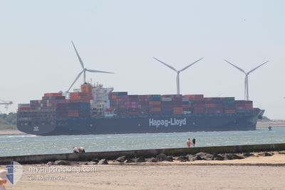
TUCAPEL
Container Ship
Current Trip
| Time Travelled | 21 days |
|---|---|
| Remaining Time | 5 days |
| Distance Travelled | 9379.14 nm |
| Remaining Distance | 2346.04 nm |
| AVG Speed | 18 Noeuds |
| MAX Speed | 20.3 Noeuds |
| AVG Wind | 11.7 knots |
| MAX Wind | 25.8 knots |
| MIN Temp | 10.5°C / 50.9°F |
| MAX Temp | 29.2°C / 84.56°F |
| Tirant d eau | 11.8 m |
| Position reçue | 3 d depuis |
Current Position
| Longitude | 32.19662° |
|---|---|
| Latitude | -29.26177° |
| Etat | Under way using engine |
| Vitesse | 16.3 Noeuds |
| Parcours | 34.7° |
| Zone | Indian Ocean |
| Station | T-AIS |
| Position reçue | 3 d depuis |
Info
Information
The current position of TUCAPEL is in Indian Ocean with coordinates -29.26177° / 32.19662° as reported on 2024-05-10 14:46 by AIS to our vessel tracker app. The vessel's current speed is 16.3 Noeuds and is heading at the port of PORT QASIM. The estimated time of arrival as calculated by MyShipTracking vessel tracking app is 2024-05-19 10:12 LT
The vessel TUCAPEL (IMO: 9569970, MMSI: 636092784) is a Container Ship that was built in 2012 ( 12 Age ). It's sailing under the flag of [LR] Liberia.
In this page you can find informations about the vessels current position, last detected port calls, and current voyage information. If the vessels is not in coverage by AIS you will find the latest position.
The current position of TUCAPEL is detected by our AIS receivers and we are not responsible for the reliability of the data. The last position was recorded while the vessel was in Coverage by the Ais receivers of our vessel tracking app.
The current draught of TUCAPEL as reported by AIS is 11.8 meters
Weather
| Temperature | 28.2°C / 82.76°F |
|---|---|
| Wind Speed | 21 knots |
| Direction | 172° S |
| Pressure | 1009.7 hPa |
| Humidity | 82.5 % |
| Cloud Coverage | 100 % |
Featured Company
Last Port Calls
| Port | Arrival | Departure | Time In Port |
|---|---|---|---|
| 2024-04-21 15:56 | 2024-04-23 04:47 | 1 d | |
| 2024-04-19 11:02 | 2024-04-20 09:38 | 22 h | |
| 2024-04-17 08:47 | 2024-04-18 06:43 | 21 h | |
| 2024-04-14 01:22 | 2024-04-14 11:22 | 9 h | |
| 2024-04-11 13:49 | 2024-04-13 04:36 | 1 d | |
| 2024-03-29 11:32 | 2024-04-01 23:49 | 3 d | |
| 2024-03-26 16:09 | 2024-03-28 13:04 | 1 d | |
| 2024-03-24 15:38 | 2024-03-25 23:24 | 1 d | |
| 2024-03-23 04:49 | 2024-03-24 00:51 | 20 h | |
| 2024-03-12 09:31 | 2024-03-13 18:01 | 1 d |
Most Visited Ports (Last year)
| Port | Arrivals | |
|---|---|---|
| 9 | ||
| 9 | ||
| 9 | ||
| 9 | ||
| 8 | ||
| 8 |
Last Trips
| Origin | Departure | Destination | Arrival | Distance | |
|---|---|---|---|---|---|
| 2024-04-20 05:38 | 2024-04-21 11:56 | 127.05 nm | |||
| 2024-04-18 02:43 | 2024-04-19 07:02 | 443.62 nm | |||
| 2024-04-14 07:22 | 2024-04-17 04:47 | 268.49 nm | |||
| 2024-04-13 00:36 | 2024-04-13 21:22 | 236.40 nm | |||
| 2024-04-02 01:49 | 2024-04-11 09:49 | 3671.02 nm | |||
| 2024-03-28 14:04 | 2024-03-29 12:32 | 301.05 nm | |||
| 2024-03-26 00:24 | 2024-03-26 17:09 | 268.75 nm | |||
| 2024-03-24 00:51 | 2024-03-24 16:38 | 135.91 nm | |||
| 2024-03-13 14:01 | 2024-03-23 04:49 | 3384.69 nm | |||
| 2024-03-11 09:32 | 2024-03-12 05:31 | 261.16 nm |
Events
| Heure | Evenement | Détails | Position/ Destination | Info |
|---|---|---|---|---|
| 2024-05-10 14:51 | Etat Changé | Default Under way using engine |
-29.23996 / 32.21369
PKBQM
|
Vitesse: 16.3 kn Parcours: 34.7° |
| 2024-05-10 14:46 | Hors de la zone couverte |
-29.26177 / 32.19662
Indian Ocean
PKBQM
|
Vitesse: 16.3 kn Parcours: 34.7° |
|
| 2024-05-10 14:08 | Etat Changé | Under way using engine Default |
-29.40580 / 32.08941
PKBQM
|
Vitesse: 16.5 kn Parcours: 33° |
| 2024-05-10 14:07 | Etat Changé | Default Under way using engine |
-29.40816 / 32.08775
PKBQM
|
Vitesse: 16.6 kn Parcours: 31.8° |
| 2024-05-10 08:14 | Changement de zone | South African part of the Indian Ocean South African part of the South Atlantic Ocean |
-30.82260 / 31.07967
Indian Ocean
PKBQM
|
Vitesse: 18.4 kn Parcours: 31.5° |
| 2024-05-10 08:12 | Etat Changé | Under way using engine Default |
-30.82821 / 31.07567
PKBQM
|
Vitesse: 18.4 kn Parcours: 31° |
| 2024-05-10 08:08 | Dans la zone couverte |
-30.82260 / 31.07967
Indian Ocean
PKBQM
|
Vitesse: 18.4 kn Parcours: 31.5° |
|
| 2024-05-08 17:46 | Etat Changé | Default Under way using engine |
-34.97205 / 19.17702
PKBQM
|
Vitesse: 19.1 kn Parcours: 117.5° |
| 2024-05-08 17:43 | Hors de la zone couverte |
-34.96362 / 19.15685
South Atlantic Ocean
PKBQM
|
Vitesse: 19.1 kn Parcours: 117.5° |
|
| 2024-05-08 16:56 | Etat Changé | Under way using engine Default |
-34.85811 / 18.88655
PKBQM
|
Vitesse: 19 kn Parcours: 117° |