
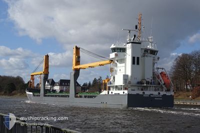
TRENT NAVIGATOR
General Cargo
Current Trip
| Trip Time | 7 days |
|---|---|
| Trip Distance | 1641.78 nm |
| AVG Speed | 8 Noeuds |
| MAX Speed | 12.3 Noeuds |
| Tirant d eau | 5.2 m |
| AVG Wind | 26 knots |
| MAX Wind | 35 knots |
| MIN Temp | -6.4°C / 20.48°F |
| MAX Temp | 11.1°C / 51.98°F |
| Position reçue | 4 d depuis |
Current Position
| Longitude | --- |
|---|---|
| Latitude | --- |
| Etat | Under way using engine |
| Vitesse | 7.7 Noeuds |
| Parcours | 294.2° |
| Zone | North Sea |
| Station | T-AIS |
| Position reçue | 4 d depuis |
Info
Information
The current position of TRENT NAVIGATOR is in North Sea with coordinates 58.40627° / 3.82427° as reported on 2024-11-18 12:34 by AIS to our vessel tracker app. The vessel's current speed is 7.7 Noeuds and is currently inside the port of HAFNARFJORDUR.
The vessel TRENT NAVIGATOR (IMO: 9631369, MMSI: 246867000) is a General Cargo that was built in 2013 ( 11 Age ). It's sailing under the flag of [NL] Netherlands.
In this page you can find informations about the vessels current position, last detected port calls, and current voyage information. If the vessels is not in coverage by AIS you will find the latest position.
The current position of TRENT NAVIGATOR is detected by our AIS receivers and we are not responsible for the reliability of the data. The last position was recorded while the vessel was in Coverage by the Ais receivers of our vessel tracking app.
The current draught of TRENT NAVIGATOR as reported by AIS is 5.2 meters
Weather
| Temperature | -6.8°C / 19.76°F |
|---|---|
| Wind Speed | 6 knots |
| Direction | 55° NE |
| Pressure | 1004.7 hPa |
| Humidity | 55.2 % |
| Cloud Coverage | 75 % |
Featured Company
Last Port Calls
| Port | Arrival | Departure | Time In Port |
|---|---|---|---|
| 2024-11-22 09:06 | |||
| 2024-11-11 23:50 | 2024-11-14 21:36 | 2 d | |
| 2024-11-03 17:13 | 2024-11-06 17:43 | 3 d | |
| 2024-10-18 19:43 | 2024-10-19 20:25 | 1 d | |
| 2024-10-15 10:57 | 2024-10-16 20:45 | 1 d | |
| 2024-10-12 02:57 | 2024-10-12 17:13 | 14 h | |
| 2024-10-06 03:13 | 2024-10-07 15:07 | 1 d | |
| 2024-10-03 04:09 | 2024-10-03 19:55 | 15 h | |
| 2024-09-29 15:09 | 2024-09-30 16:27 | 1 d | |
| 2024-09-29 11:25 | 2024-09-29 15:03 | 3 h |
Most Visited Ports (Last year)
| Port | Arrivals | |
|---|---|---|
| 2 | ||
| 2 | ||
| 2 | ||
| 2 | ||
| 2 | ||
| 2 |
Last Trips
| Origin | Departure | Destination | Arrival | Distance | |
|---|---|---|---|---|---|
| 2024-11-14 22:36 | 2024-11-22 09:06 | 1641.78 nm | |||
| 2024-11-06 17:43 | 2024-11-12 00:50 | 1121.40 nm | |||
| 2024-10-19 22:25 | 2024-11-03 17:13 | 3144.91 nm | |||
| 2024-10-16 22:45 | 2024-10-18 21:43 | 135.31 nm | |||
| 2024-10-12 20:13 | 2024-10-15 12:57 | 354.45 nm | |||
| 2024-10-07 17:07 | 2024-10-12 05:57 | 1165.66 nm | |||
| 2024-10-03 21:55 | 2024-10-06 05:13 | 591.33 nm | |||
| 2024-09-30 18:27 | 2024-10-03 06:09 | 641.33 nm | |||
| 2024-09-29 17:03 | 2024-09-29 17:09 | 1.02 nm | |||
| 2024-09-22 23:44 | 2024-09-29 13:25 | 1661.71 nm |
Events
| Heure | Evenement | Détails | Position/ Destination | Info |
|---|---|---|---|---|
| 2024-11-22 09:31 | Arret |
64.06760 / -21.98235
[IS] HAFNARFJORDUR
|
Vitesse: Parcours: 94° |
|
| 2024-11-22 09:06 | Port d'arrivée |
|
64.07020 / -21.98158
[IS] HAFNARFJORDUR
|
Vitesse: 1.9 kn Parcours: 149° |
| 2024-11-18 12:44 | Etat Changé | Default Under way using engine |
58.41414 / 3.78665
ISHAF
|
Vitesse: 7.7 kn Parcours: 294.2° |
| 2024-11-18 12:34 | Hors de la zone couverte |
58.40627 / 3.82427
North Sea
ISHAF
|
Vitesse: 7.7 kn Parcours: 294.2° |
|
| 2024-11-17 17:10 | Changement de zone | Norwegian part of the North Sea Norwegian part of the Skaggerak |
57.75275 / 7.43937
North Sea
ISHAF
|
Vitesse: 6.1 kn Parcours: 270.4° |
| 2024-11-17 07:13 | Changement de zone | Norwegian part of the Skaggerak Danish part of the Skaggerak |
57.95185 / 9.31753
Skaggerak
ISHAF
|
Vitesse: 6.4 kn Parcours: 255.1° |
| 2024-11-16 20:11 | Changement de zone | Danish part of the Skaggerak Danish part of the Kattegat |
57.77320 / 10.80692
Skaggerak
ISHAF
|
Vitesse: 10.5 kn Parcours: 4.7° |
| 2024-11-16 18:49 | Démarrage | 6.26 nm, South of SKAGEN |
57.61262 / 10.54655
ISHAF
|
Vitesse: 4 kn Parcours: 20° |
| 2024-11-16 18:46 | Etat Changé | Under way using engine At anchor |
57.61075 / 10.54643
ISHAF
|
Vitesse: 0.2 kn Parcours: 253° |
| 2024-11-16 15:06 | Arret | 6.31 nm, South of SKAGEN |
57.61150 / 10.54932
ISHAF
|
Vitesse: 0.2 kn Parcours: 271° |