
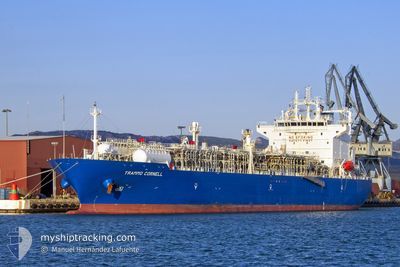
TRAMMO CORNELL
Tanker
Current Trip
FOR ORDERS
| Time Travelled | 9 days |
|---|---|
| Remaining Time | --- |
| Distance Travelled | 19.16 nm |
| Remaining Distance | --- |
| AVG Speed | 4.3 Noeuds |
| MAX Speed | 11 Noeuds |
| AVG Wind | 13.1 knots |
| MAX Wind | 26 knots |
| MIN Temp | 23.1°C / 73.58°F |
| MAX Temp | 27.2°C / 80.96°F |
| Tirant d eau | 10.3 m |
| Position reçue | 14 h, 13 m depuis |
Current Position
| Longitude | --- |
|---|---|
| Latitude | --- |
| Etat | At anchor |
| Vitesse | 0.7 Noeuds |
| Parcours | 175° |
| Zone | Indian Ocean |
| Station | T-AIS |
| Position reçue | 14 h, 13 m depuis |
Info
Information
The current position of TRAMMO CORNELL is in Indian Ocean with coordinates -28.89566° / 32.11978° as reported on 2025-02-27 02:58 by AIS to our vessel tracker app. The vessel's current speed is 0.7 Noeuds
The vessel TRAMMO CORNELL (IMO: 9543081, MMSI: 563026400) is a Tanker It's sailing under the flag of [SG] Singapore.
In this page you can find informations about the vessels current position, last detected port calls, and current voyage information. If the vessels is not in coverage by AIS you will find the latest position.
The current position of TRAMMO CORNELL is detected by our AIS receivers and we are not responsible for the reliability of the data. The last position was recorded while the vessel was in Coverage by the Ais receivers of our vessel tracking app.
The current draught of TRAMMO CORNELL as reported by AIS is 10.3 meters
Weather
| Temperature | 25.4°C / 77.72°F |
|---|---|
| Wind Speed | 10 knots |
| Direction | 169° S |
| Pressure | 1012.6 hPa |
| Humidity | 65.6 % |
| Cloud Coverage | 8 % |
Featured Company
Last Port Calls
| Port | Arrival | Departure | Time In Port |
|---|---|---|---|
| 2025-02-16 03:20 | 2025-02-17 19:52 | 1 d | |
| 2025-01-31 18:49 | 2025-02-02 10:28 | 1 d | |
| 2025-01-23 13:54 | 2025-01-24 14:49 | 1 d | |
| 2025-01-19 04:32 | 2025-01-20 06:20 | 1 d | |
| 2025-01-17 03:47 | 2025-01-18 07:19 | 1 d | |
| 2025-01-01 03:34 | 2025-01-02 14:12 | 1 d | |
| 2024-12-21 07:39 | 2024-12-22 17:07 | 1 d | |
| 2024-12-10 06:35 | 2024-12-11 05:38 | 23 h | |
| 2024-12-07 00:35 | 2024-12-07 20:51 | 20 h |
Most Visited Ports (Last year)
| Port | Arrivals | |
|---|---|---|
| 5 | ||
| 4 | ||
| 3 | ||
| 2 | ||
| 2 | ||
| 2 |
Last Trips
| Origin | Departure | Destination | Arrival | Distance | |
|---|---|---|---|---|---|
| 2025-02-02 10:28 | 2025-02-16 03:20 | 4482.29 nm | |||
| 2025-01-24 14:49 | 2025-01-31 18:49 | 2289.95 nm | |||
| 2025-01-20 06:20 | 2025-01-23 13:54 | 1050.32 nm | |||
| 2025-01-18 07:19 | 2025-01-19 04:32 | 88.83 nm | |||
| 2025-01-02 14:12 | 2025-01-17 03:47 | 3068.85 nm | |||
| 2024-12-22 17:07 | 2025-01-01 03:34 | 3262.09 nm | |||
| 2024-12-11 05:38 | 2024-12-21 07:39 | 2642.74 nm | |||
| 2024-12-07 20:51 | 2024-12-10 06:35 | 597.05 nm | |||
| 2024-11-26 04:23 | 2024-12-07 00:35 | 3208.63 nm |
Events
| Heure | Evenement | Détails | Position/ Destination | Info |
|---|---|---|---|---|
| 2025-02-27 09:28 | Arret | 7.06 nm, South East of RICHARDS BAY |
-28.89904 / 32.13002
FOR ORDERS
|
Vitesse: Parcours: 163° |
| 2025-02-27 08:36 | Démarrage | 6.89 nm, South East of RICHARDS BAY |
-28.90017 / 32.12213
FOR ORDERS
|
Vitesse: 3.4 kn Parcours: 100° |
| 2025-02-27 03:05 | Etat Changé | Default At anchor |
-28.89569 / 32.11991
FOR ORDERS
|
Vitesse: 0.7 kn Parcours: 175° |
| 2025-02-27 02:58 | Etat Changé | At anchor Default |
-28.89566 / 32.11978
FOR ORDERS
|
Vitesse: 1 kn Parcours: 169° |
| 2025-02-27 02:58 | Hors de la zone couverte |
-28.89566 / 32.11978
Indian Ocean
|
Vitesse: 0.7 kn Parcours: 175° |
|
| 2025-02-27 02:53 | Dans la zone couverte |
-28.89566 / 32.11978
Indian Ocean
|
Vitesse: 0.7 kn Parcours: 175° |
|
| 2025-02-27 01:56 | Etat Changé | Default At anchor |
-28.89589 / 32.11908
FOR ORDERS
|
Vitesse: 2.9 kn Parcours: 175° |
| 2025-02-27 01:49 | Etat Changé | At anchor Default |
-28.89566 / 32.11972
FOR ORDERS
|
Vitesse: 1.9 kn Parcours: 174° |
| 2025-02-27 01:49 | Hors de la zone couverte |
-28.89566 / 32.11972
Indian Ocean
|
Vitesse: 2.9 kn Parcours: 262.8° |
|
| 2025-02-27 01:48 | Dans la zone couverte |
-28.89566 / 32.11972
Indian Ocean
|
Vitesse: 2.9 kn Parcours: 262.8° |