

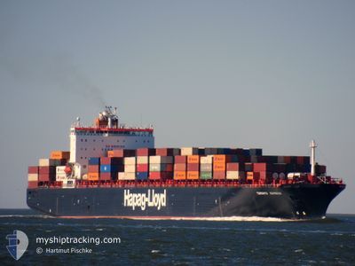
TORONTO EXPRESS
Container Ship

Current Trip
| Time Travelled | 10 days |
|---|---|
| Remaining Time | --- |
| Distance Travelled | 3096.01 nm |
| Remaining Distance | 28.74 nm |
| AVG Speed | 14.1 Noeuds |
| MAX Speed | 21.6 Noeuds |
| AVG Wind | 14.1 knots |
| MAX Wind | 28.9 knots |
| MIN Temp | -18.3°C / -0.94°F |
| MAX Temp | 9.8°C / 49.64°F |
| Tirant d eau | 10 m |
| Position reçue | 2 m depuis |
Current Position
| Longitude | --- |
|---|---|
| Latitude | --- |
| Etat | At anchor |
| Vitesse | |
| Parcours | 207° |
| Zone | English Channel |
| Station | T-AIS |
| Position reçue | 2 m depuis |
Information
The current position of TORONTO EXPRESS is in English Channel with coordinates 50.61584° / -1.07295° as reported on 2025-03-02 11:52 by AIS to our vessel tracker app. The vessel's current speed is 0 Noeuds and is heading at the port of SOUTHAMPTON. The estimated time of arrival as calculated by MyShipTracking vessel tracking app is 2025-02-27 21:00 LT
The vessel TORONTO EXPRESS (IMO: 9253727, MMSI: 310749000) is a Container Ship that was built in 2003 ( 22 Age ). It's sailing under the flag of [BM] Bermuda.
In this page you can find informations about the vessels current position, last detected port calls, and current voyage information. If the vessels is not in coverage by AIS you will find the latest position.
The current position of TORONTO EXPRESS is detected by our AIS receivers and we are not responsible for the reliability of the data. The last position was recorded while the vessel was in Coverage by the Ais receivers of our vessel tracking app.
The current draught of TORONTO EXPRESS as reported by AIS is 10 meters
Weather
| Temperature | 6.5°C / 43.7°F |
|---|---|
| Wind Speed | 11 knots |
| Direction | 83° E |
| Pressure | 1034.7 hPa |
| Humidity | 73.9 % |
| Cloud Coverage | 73 % |


Featured Company
Most Visited Ports (Last year)
| Port | Arrivals | |
|---|---|---|
| 10 | ||
| 10 | ||
| 9 | ||
| 9 |
Last Trips
| Origin | Departure | Destination | Arrival | Distance | |
|---|---|---|---|---|---|
| 2025-01-31 06:42 | 2025-02-11 02:44 | 3949.04 nm | |||
| 2025-01-27 09:04 | 2025-01-29 20:52 | 500.83 nm | |||
| 2025-01-22 14:33 | 2025-01-26 10:14 | 449.20 nm | |||
| 2025-01-10 11:19 | 2025-01-21 10:16 | 3400.99 nm | |||
| 2024-12-18 00:19 | 2025-01-01 03:39 | 3758.17 nm |
Events
| Heure | Evenement | Détails | Position/ Destination | Info |
|---|---|---|---|---|
| 2025-03-01 00:01 | Changement d'ETA | 2026/02/27 21:00 2025/02/27 21:00 |
50.61361 / -1.08008
GBSOU
|
Vitesse: 0.2 kn Parcours: 63° |
| 2025-02-27 21:11 | Etat Changé | At anchor Under way using engine |
50.61641 / -1.07290
GBSOU
|
Vitesse: 0.1 kn Parcours: 245° |
| 2025-02-27 20:51 | Arret | 3.71 nm, South East of SANDOWN |
50.61529 / -1.07367
GBSOU
|
Vitesse: 0.3 kn Parcours: 245° |
| 2025-02-27 09:19 | Tirant d'eau modifié | 10 10.2 |
49.82307 / -5.19351
GBSOU
|
Vitesse: 15 kn Parcours: 74.8° |
| 2025-02-27 09:19 | Changement d'ETA | 2025/02/27 21:00 2025/02/28 08:00 |
49.82307 / -5.19351
GBSOU
|
Vitesse: 15 kn Parcours: 74.8° |
| 2025-02-27 09:09 | Etat Changé | Under way using engine Default |
49.81499 / -5.24891
GBSOU
|
Vitesse: 12 kn Parcours: 78° |
| 2025-02-27 09:03 | Etat Changé | Default Under way using engine |
49.81092 / -5.27746
GBSOU
|
Vitesse: 12.2 kn Parcours: 78.9° |
| 2025-02-27 08:56 | Etat Changé | Under way using engine Default |
49.80590 / -5.31325
GBSOU
|
Vitesse: 12.1 kn Parcours: 77° |
| 2025-02-27 08:39 | Etat Changé | Default Under way using engine |
49.79421 / -5.39525
GBSOU
|
Vitesse: 3.9 kn Parcours: 148° |
| 2025-02-27 08:28 | Changement de zone | United Kingdom part of the English Channel United Kingdom part of the Celtic Sea |
49.80239 / -5.41413
English Channel
GBSOU
|
Vitesse: 6.6 kn Parcours: 77.3° |