
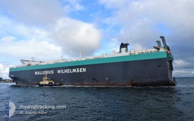
TIRRANNA
Vehicles Carrier
Current Trip
| Time Travelled | 5 days |
|---|---|
| Remaining Time | --- |
| Distance Travelled | 2072.87 nm |
| Remaining Distance | --- |
| AVG Speed | 15.8 Noeuds |
| MAX Speed | 20.5 Noeuds |
| AVG Wind | 16.7 knots |
| MAX Wind | 28.2 knots |
| MIN Temp | 15.8°C / 60.44°F |
| MAX Temp | 27°C / 80.6°F |
| Tirant d eau | 10.3 m |
| Position reçue | 5 d depuis |
Current Position
| Longitude | --- |
|---|---|
| Latitude | --- |
| Etat | Under way using engine |
| Vitesse | 17.2 Noeuds |
| Parcours | 189.5° |
| Zone | Gulf of Thailand |
| Station | T-AIS |
| Position reçue | 5 d depuis |
Info
Information
The current position of TIRRANNA is in Gulf of Thailand with coordinates 12.94645° / 100.58585° as reported on 2025-12-31 15:55 by AIS to our vessel tracker app. The vessel's current speed is 17.2 Noeuds and is heading at the port of GUNSAN. The estimated time of arrival as calculated by MyShipTracking vessel tracking app is 2026-01-07 05:00 LT
The vessel TIRRANNA (IMO: 9377523, MMSI: 259895000) is a Vehicles Carrier that was built in 2009 ( 17 Age ). It's sailing under the flag of [NO] Norway.
In this page you can find informations about the vessels current position, last detected port calls, and current voyage information. If the vessels is not in coverage by AIS you will find the latest position.
The current position of TIRRANNA is detected by our AIS receivers and we are not responsible for the reliability of the data. The last position was recorded while the vessel was in Coverage by the Ais receivers of our vessel tracking app.
The current draught of TIRRANNA as reported by AIS is 10.3 meters
Weather
| Temperature | 15.4°C / 59.72°F |
|---|---|
| Wind Speed | 18 knots |
| Direction | 20° NNE |
| Pressure | 1023.7 hPa |
| Humidity | 65.3 % |
| Cloud Coverage | 100 % |
Featured Company
Last Port Calls
| Port | Arrival | Departure | Time In Port |
|---|---|---|---|
| 2025-12-30 20:44 | 2025-12-31 21:48 | 1 d | |
| 2025-12-27 11:34 | 2025-12-28 22:21 | 1 d | |
| 2025-12-21 02:04 | 2025-12-22 02:49 | 1 d | |
| 2025-12-10 07:32 | 2025-12-10 18:25 | 10 h | |
| 2025-12-06 01:03 | 2025-12-08 17:49 | 2 d | |
| 2025-12-02 13:28 | 2025-12-03 08:24 | 18 h | |
| 2025-11-30 02:13 | 2025-12-01 01:58 | 23 h | |
| 2025-11-23 19:08 | 2025-11-24 21:24 | 1 d | |
| 2025-11-03 10:42 | 2025-11-04 12:33 | 1 d |
Most Visited Ports (Last year)
| Port | Arrivals | |
|---|---|---|
| 5 | ||
| 4 | ||
| 4 | ||
| 4 | ||
| 3 | ||
| 3 |
Last Trips
| Origin | Departure | Destination | Arrival | Distance | |
|---|---|---|---|---|---|
| 2025-12-28 22:21 | 2025-12-30 20:44 | 825.88 nm | |||
| 2025-12-22 02:49 | 2025-12-27 11:34 | 2341.53 nm | |||
| 2025-12-10 18:25 | 2025-12-21 02:04 | 1777.76 nm | |||
| 2025-12-08 17:49 | 2025-12-10 07:32 | 516.25 nm | |||
| 2025-12-03 08:24 | 2025-12-06 01:03 | 595.23 nm | |||
| 2025-12-01 01:58 | 2025-12-02 13:28 | 575.48 nm | |||
| 2025-11-24 21:24 | 2025-11-30 02:13 | 1502.57 nm | |||
| 2025-11-04 12:33 | 2025-11-23 19:08 | 6742.44 nm | |||
| 2025-10-29 23:32 | 2025-11-03 10:42 | 1533.13 nm |
Events
| Heure | Evenement | Détails | Position/ Destination | Info |
|---|---|---|---|---|
| 2025-12-31 15:59 | Etat Changé | Default Under way using engine |
12.92572 / 100.58419
KR KUV
|
Vitesse: 17.2 kn Parcours: 189.5° |
| 2025-12-31 15:55 | Hors de la zone couverte |
12.94645 / 100.58585
Gulf of Thailand
KR KUV
|
Vitesse: 17.2 kn Parcours: 189.5° |
|
| 2025-12-31 15:24 | Tirant d'eau modifié | 10.3 9 |
13.04239 / 100.68811
KR KUV
|
Vitesse: 17.9 kn Parcours: 259.9° |
| 2025-12-31 15:24 | Changement de destination | KR KUV TH LCH |
13.04239 / 100.68811
KR KUV
|
Vitesse: 17.9 kn Parcours: 259.9° |
| 2025-12-31 15:24 | Changement d'ETA | 2026/01/06 20:00 2025/12/30 19:00 |
13.04239 / 100.68811
KR KUV
|
Vitesse: 17.9 kn Parcours: 259.9° |
| 2025-12-31 14:55 | Etat Changé | Under way using engine Default |
13.07276 / 100.82412
TH LCH
|
Vitesse: 14.9 kn Parcours: 261° |
| 2025-12-31 14:49 | Etat Changé | Default Under way using engine |
13.07676 / 100.85231
TH LCH
|
Vitesse: 9.3 kn Parcours: 315° |
| 2025-12-31 14:48 | PORT DE DEPART |
|
13.07676 / 100.85231
TH LCH
|
Vitesse: 9.3 kn Parcours: 315° |
| 2025-12-31 14:31 | Etat Changé | Under way using engine Default |
13.05355 / 100.88478
[TH] LAEM CHABANG
|
Vitesse: 9.1 kn Parcours: 275° |
| 2025-12-31 14:29 | Dans la zone couverte |
13.05355 / 100.88478
Gulf of Thailand
[TH] LAEM CHABANG
|
Vitesse: 6.9 kn Parcours: 328.7° |