

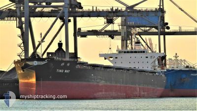
TING MAY
Cargo

Current Trip
| Time Travelled | 22 days |
|---|---|
| Remaining Time | --- |
| Distance Travelled | 4892.14 nm |
| Remaining Distance | --- |
| AVG Speed | 11.4 Noeuds |
| MAX Speed | 19.4 Noeuds |
| AVG Wind | 15.8 knots |
| MAX Wind | 37 knots |
| MIN Temp | -3.6°C / 25.52°F |
| MAX Temp | 6.4°C / 43.52°F |
| Tirant d eau | 13.7 m |
| Position reçue | 2 d depuis |
Current Position
| Longitude | --- |
|---|---|
| Latitude | --- |
| Etat | Under way using engine |
| Vitesse | 11.9 Noeuds |
| Parcours | 272.8° |
| Zone | The Coastal Waters of Southeast Alaska and British Columbia |
| Station | T-AIS |
| Position reçue | 2 d depuis |
Information
The current position of TING MAY is in The Coastal Waters of Southeast Alaska and British Columbia with coordinates 54.32560° / -132.06324° as reported on 2025-02-17 03:50 by AIS to our vessel tracker app. The vessel's current speed is 11.9 Noeuds and is heading at the port of MURORAN. The estimated time of arrival as calculated by MyShipTracking vessel tracking app is 2025-03-02 03:00 LT
The vessel TING MAY (IMO: 9853113, MMSI: 636018657) is a Cargo It's sailing under the flag of [LR] Liberia.
In this page you can find informations about the vessels current position, last detected port calls, and current voyage information. If the vessels is not in coverage by AIS you will find the latest position.
The current position of TING MAY is detected by our AIS receivers and we are not responsible for the reliability of the data. The last position was recorded while the vessel was in Coverage by the Ais receivers of our vessel tracking app.
The current draught of TING MAY as reported by AIS is 13.7 meters
Weather
| Temperature | 4.1°C / 39.38°F |
|---|---|
| Wind Speed | 9 knots |
| Direction | 192° SSW |
| Pressure | 1000.3 hPa |
| Humidity | 91.1 % |
| Cloud Coverage | 1 % |


Featured Company
Last Trips
Events
| Heure | Evenement | Détails | Position/ Destination | Info |
|---|---|---|---|---|
| 2025-02-17 03:53 | Etat Changé | Default Under way using engine |
54.32621 / -132.08015
MURORAN
|
Vitesse: 11.9 kn Parcours: 272.8° |
| 2025-02-17 03:50 | Hors de la zone couverte |
54.32560 / -132.06324
The Coastal Waters of Southeast Alaska and British Columbia
MURORAN
|
Vitesse: 11.9 kn Parcours: 272.8° |
|
| 2025-02-16 23:44 | Changement d'ETA | 2025/03/02 03:00 2025/02/16 21:34 |
54.24835 / -130.72290
MURORAN
|
Vitesse: 10.9 kn Parcours: 283.2° |
| 2025-02-16 22:16 | Démarrage | 5.13 nm, South of PRINCE RUPERT |
54.22516 / -130.34144
MURORAN
|
Vitesse: 3.1 kn Parcours: 210° |
| 2025-02-16 22:06 | Etat Changé | Under way using engine Moored |
54.22678 / -130.33797
MURORAN
|
Vitesse: Parcours: 186° |
| 2025-02-16 21:39 | Changement d'ETA | 2025/02/16 21:34 2025/02/16 21:31 |
54.22679 / -130.33794
MURORAN
|
Vitesse: Parcours: 186° |
| 2025-02-16 21:36 | Tirant d'eau modifié | 13.7 7.2 |
54.22677 / -130.33794
MURORAN
|
Vitesse: 0.1 kn Parcours: 186° |
| 2025-02-16 21:32 | Changement de destination | MURORAN PRINCE RUPERT |
54.22675 / -130.33792
MURORAN
|
Vitesse: Parcours: 186° |
| 2025-02-16 21:32 | Changement d'ETA | 2025/02/16 21:31 2025/02/11 13:00 |
54.22675 / -130.33792
MURORAN
|
Vitesse: Parcours: 186° |
| 2025-02-16 12:24 | Etat Changé | Moored Default |
54.22676 / -130.33796
PRINCE RUPERT
|
Vitesse: Parcours: 186° |