
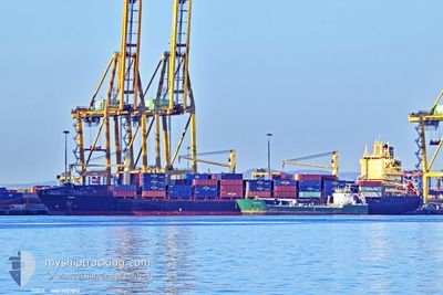
TIGER
Container Ship
Current Trip
| Trip Time | 16 h, 6 mins |
|---|---|
| Trip Distance | 94.50 nm |
| AVG Speed | 6.9 Noeuds |
| MAX Speed | 7.8 Noeuds |
| Tirant d eau | 11.2 m |
| AVG Wind | 6.4 knots |
| MAX Wind | 13 knots |
| MIN Temp | 23.5°C / 74.3°F |
| MAX Temp | 27.3°C / 81.14°F |
| Position reçue | 5 d depuis |
Current Position
| Longitude | --- |
|---|---|
| Latitude | --- |
| Etat | Under way using engine |
| Vitesse | 18.7 Noeuds |
| Parcours | 209.8° |
| Zone | North Atlantic Ocean |
| Station | T-AIS |
| Position reçue | 5 d depuis |
Info
Information
The current position of TIGER is in North Atlantic Ocean with coordinates 27.01799° / -14.44071° as reported on 2025-02-20 14:04 by AIS to our vessel tracker app. The vessel's current speed is 18.7 Noeuds and is currently inside the port of KISSY.
The vessel TIGER (IMO: 9307841, MMSI: 636092140) is a Container Ship that was built in 2005 ( 20 Age ). It's sailing under the flag of [LR] Liberia.
In this page you can find informations about the vessels current position, last detected port calls, and current voyage information. If the vessels is not in coverage by AIS you will find the latest position.
The current position of TIGER is detected by our AIS receivers and we are not responsible for the reliability of the data. The last position was recorded while the vessel was in Coverage by the Ais receivers of our vessel tracking app.
The current draught of TIGER as reported by AIS is 11.2 meters
Weather
| Temperature | 30.8°C / 87.44°F |
|---|---|
| Wind Speed | 7 knots |
| Direction | 309° NW |
| Pressure | 1012.6 hPa |
| Humidity | 47.2 % |
| Cloud Coverage | 62 % |
Featured Company
Last Port Calls
| Port | Arrival | Departure | Time In Port |
|---|---|---|---|
| 2025-02-26 09:40 | |||
| 2025-02-24 17:29 | 2025-02-25 17:34 | 1 d | |
| 2025-02-17 10:34 | 2025-02-18 22:55 | 1 d | |
| 2025-02-15 00:22 | 2025-02-15 18:33 | 18 h | |
| 2025-02-02 06:46 | 2025-02-03 06:32 | 23 h | |
| 2025-01-29 18:22 | 2025-02-01 12:07 | 2 d | |
| 2025-01-27 12:08 | 2025-01-28 09:26 | 21 h | |
| 2025-01-25 05:26 | 2025-01-26 15:08 | 1 d | |
| 2025-01-16 08:36 | 2025-01-18 10:17 | 2 d | |
| 2025-01-06 22:55 | 2025-01-08 10:06 | 1 d |
Last Trips
| Origin | Departure | Destination | Arrival | Distance | |
|---|---|---|---|---|---|
| 2025-02-25 17:34 | 2025-02-26 09:40 | 94.50 nm | |||
| 2025-02-18 22:55 | 2025-02-24 17:29 | 1973.30 nm | |||
| 2025-02-15 18:33 | 2025-02-17 10:34 | 100.95 nm | |||
| 2025-02-03 06:32 | 2025-02-15 00:22 | 2585.49 nm | |||
| 2025-02-01 12:07 | 2025-02-02 06:46 | 306.83 nm | |||
| 2025-01-28 09:26 | 2025-01-29 18:22 | 261.75 nm | |||
| 2025-01-26 15:08 | 2025-01-27 12:08 | 106.75 nm | |||
| 2025-01-18 10:17 | 2025-01-25 05:26 | 2048.84 nm | |||
| 2025-01-08 10:06 | 2025-01-16 08:36 | 2508.82 nm | |||
| 2025-01-05 16:56 | 2025-01-06 22:55 | 307.37 nm |
Events
| Heure | Evenement | Détails | Position/ Destination | Info |
|---|---|---|---|---|
| 2025-02-26 09:41 | Arret |
8.49409 / -13.21846
[SL] KISSY
|
Vitesse: Parcours: 90° |
|
| 2025-02-26 09:40 | Port d'arrivée |
|
8.49409 / -13.21846
[SL] KISSY
|
Vitesse: 0.7 kn Parcours: 94° |
| 2025-02-26 08:58 | Démarrage | 0.32 nm, North East of NASSIT |
8.49596 / -13.23157
GNCKY
|
Vitesse: 3.5 kn Parcours: 83° |
| 2025-02-26 06:30 | Arret | 0.57 nm, North East of NASSIT |
8.49883 / -13.22854
GNCKY
|
Vitesse: 0.3 kn Parcours: 101° |
| 2025-02-25 17:35 | Démarrage | 0.86 nm, South West of CONAKRY |
9.49077 / -13.72597
GNCKY
|
Vitesse: 8.1 kn Parcours: 179° |
| 2025-02-25 17:34 | PORT DE DEPART |
|
9.49077 / -13.72597
GNCKY
|
Vitesse: 2 kn Parcours: 187° |
| 2025-02-24 17:37 | Arret |
9.51044 / -13.72381
[GN] CONAKRY
|
Vitesse: 0.3 kn Parcours: 38° |
|
| 2025-02-24 17:29 | Port d'arrivée |
|
9.50869 / -13.72502
[GN] CONAKRY
|
Vitesse: 6.1 kn Parcours: 6° |
| 2025-02-24 15:35 | Démarrage | 12 nm, South of KASSA |
9.27658 / -13.76849
GNCKY
|
Vitesse: 3.6 kn Parcours: 302° |
| 2025-02-23 18:01 | Arret | 11.93 nm, South of KASSA |
9.27734 / -13.76490
GNCKY
|
Vitesse: 0.2 kn Parcours: 254° |