
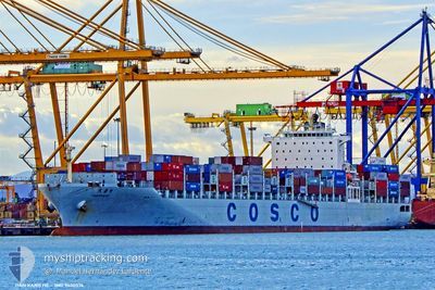
TIAN KANG HE
Container Ship
Current Trip
CNYIK
| Time Travelled | 5 days |
|---|---|
| Remaining Time | --- |
| Distance Travelled | 1651.47 nm |
| Remaining Distance | --- |
| AVG Speed | 11.7 Noeuds |
| MAX Speed | 16.9 Noeuds |
| AVG Wind | 16.9 knots |
| MAX Wind | 33 knots |
| MIN Temp | -1.3°C / 29.66°F |
| MAX Temp | 21.5°C / 70.7°F |
| Tirant d eau | 13.4 m |
| Position reçue | 12 d depuis |
Current Position
| Longitude | --- |
|---|---|
| Latitude | --- |
| Etat | Under way using engine |
| Vitesse | 13.3 Noeuds |
| Parcours | 44.2° |
| Zone | South China Sea |
| Station | T-AIS |
| Position reçue | 12 d depuis |
Info
Information
The current position of TIAN KANG HE is in South China Sea with coordinates 23.42498° / 117.86419° as reported on 2025-12-01 11:12 by AIS to our vessel tracker app. The vessel's current speed is 13.3 Noeuds
The vessel TIAN KANG HE (IMO: 9400576, MMSI: 412713000) is a Container Ship that was built in 2010 ( 15 Age ). It's sailing under the flag of [CN] China.
In this page you can find informations about the vessels current position, last detected port calls, and current voyage information. If the vessels is not in coverage by AIS you will find the latest position.
The current position of TIAN KANG HE is detected by our AIS receivers and we are not responsible for the reliability of the data. The last position was recorded while the vessel was in Coverage by the Ais receivers of our vessel tracking app.
The current draught of TIAN KANG HE as reported by AIS is 13.4 meters
Weather
| Temperature | 18.2°C / 64.76°F |
|---|---|
| Wind Speed | 21 knots |
| Direction | 42° NE |
| Pressure | 1019.8 hPa |
| Humidity | 76.8 % |
| Cloud Coverage | 100 % |
Featured Company
Last Port Calls
| Port | Arrival | Departure | Time In Port |
|---|---|---|---|
| 2025-12-06 19:53 | 2025-12-08 08:09 | 1 d | |
| 2025-11-28 11:49 | 2025-11-29 15:17 | 1 d | |
| 2025-11-20 22:32 | 2025-11-21 09:25 | 10 h | |
| 2025-11-18 19:56 | 2025-11-20 15:08 | 1 d | |
| 2025-11-09 01:00 | 2025-11-10 07:59 | 1 d | |
| 2025-11-06 23:56 | 2025-11-07 13:48 | 13 h | |
| 2025-10-29 19:44 | 2025-10-31 13:17 | 1 d | |
| 2025-10-20 06:32 | 2025-10-21 08:04 | 1 d | |
| 2025-10-18 10:56 | 2025-10-19 01:04 | 14 h | |
| 2025-10-10 17:20 | 2025-10-12 09:36 | 1 d |
Last Trips
| Origin | Departure | Destination | Arrival | Distance | |
|---|---|---|---|---|---|
| 2025-11-29 15:17 | 2025-12-06 19:53 | 1876.22 nm | |||
| 2025-11-21 09:25 | 2025-11-28 11:49 | 1896.24 nm | |||
| 2025-11-20 15:08 | 2025-11-20 22:32 | 67.55 nm | |||
| 2025-11-10 07:59 | 2025-11-18 19:56 | 1916.12 nm | |||
| 2025-11-07 13:48 | 2025-11-09 01:00 | 267.69 nm | |||
| 2025-10-31 13:17 | 2025-11-06 23:56 | 1734.77 nm | |||
| 2025-10-21 08:04 | 2025-10-29 19:44 | 1878.38 nm | |||
| 2025-10-19 01:04 | 2025-10-20 06:32 | 262.65 nm | |||
| 2025-10-12 09:36 | 2025-10-18 10:56 | 1740.91 nm | |||
| 2025-10-09 12:36 | 2025-10-10 17:20 | 69.40 nm |
Events
| Heure | Evenement | Détails | Position/ Destination | Info |
|---|---|---|---|---|
| 2025-12-08 00:09 | PORT DE DEPART |
|
40.29279 / 122.03350
CNYIK
|
Vitesse: 10.6 kn Parcours: 278° |
| 2025-12-07 23:45 | Démarrage |
40.26567 / 122.09092
[CN] BAYUQUAN
|
Vitesse: 7.2 kn Parcours: 359° |
|
| 2025-12-06 12:53 | Arret |
40.26029 / 122.09431
[CN] BAYUQUAN
|
Vitesse: 0.1 kn Parcours: 179° |
|
| 2025-12-06 11:53 | Port d'arrivée |
|
40.29193 / 122.04464
[CN] BAYUQUAN
|
Vitesse: 8.2 kn Parcours: 96° |
| 2025-12-06 10:45 | Démarrage | 11.75 nm, West of BAYUQUAN |
40.27994 / 121.80545
CNYIK
|
Vitesse: 4.5 kn Parcours: 82° |
| 2025-12-06 09:49 | Arret | 11.87 nm, West of BAYUQUAN |
40.28796 / 121.80299
CNYIK
|
Vitesse: 0.3 kn Parcours: 109° |
| 2025-12-06 09:17 | Démarrage | 15.57 nm, West of BAYUQUAN |
40.28443 / 121.72220
CNYIK
|
Vitesse: 5.8 kn Parcours: 93° |
| 2025-12-06 08:37 | Arret | 15.93 nm, West of BAYUQUAN |
40.28867 / 121.71459
CNYIK
|
Vitesse: 0.1 kn Parcours: 242° |
| 2025-12-06 05:41 | Démarrage | 16.09 nm, West of BAYUQUAN |
40.32499 / 121.71613
CNYIK
|
Vitesse: 5.8 kn Parcours: 122° |
| 2025-12-06 01:45 | Arret | 16.77 nm, West of BAYUQUAN |
40.28722 / 121.69614
CNYIK
|
Vitesse: 0.3 kn Parcours: 136° |