
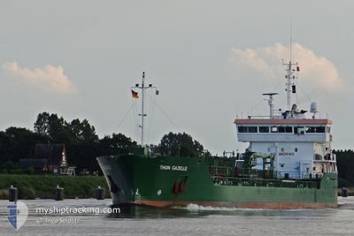
THUN GAZELLE
Oil/Chemical Tanker
Current Trip
DK KAL PEC496
| Time Travelled | 5 h, 16 mins |
|---|---|
| Remaining Time | --- |
| Distance Travelled | 64.72 nm |
| Remaining Distance | --- |
| AVG Speed | 12.5 Noeuds |
| MAX Speed | 13 Noeuds |
| AVG Wind | 12.5 knots |
| MAX Wind | 15 knots |
| MIN Temp | 4.7°C / 40.46°F |
| MAX Temp | 9.5°C / 49.1°F |
| Tirant d eau | 5.1 m |
| Position reçue | Maintenant |
Current Position
| Longitude | 23.03165° |
|---|---|
| Latitude | 59.57229° |
| Etat | Under way using engine |
| Vitesse | 12.4 Noeuds |
| Parcours | 255.9° |
| Zone | Gulf of Finland |
| Station | T-AIS |
| Position reçue | Maintenant |
Info
Information
The current position of THUN GAZELLE is in Gulf of Finland with coordinates 59.57229° / 23.03165° as reported on 2024-04-30 15:58 by AIS to our vessel tracker app. The vessel's current speed is 12.4 Noeuds
The vessel THUN GAZELLE (IMO: 9393333, MMSI: 246541000) is a Oil/Chemical Tanker that was built in 2008 ( 16 Age ). It's sailing under the flag of [NL] Netherlands.
In this page you can find informations about the vessels current position, last detected port calls, and current voyage information. If the vessels is not in coverage by AIS you will find the latest position.
The current position of THUN GAZELLE is detected by our AIS receivers and we are not responsible for the reliability of the data. The last position was recorded while the vessel was in Coverage by the Ais receivers of our vessel tracking app.
The current draught of THUN GAZELLE as reported by AIS is 5.1 meters
Weather
| Temperature | 4.7°C / 40.46°F |
|---|---|
| Wind Speed | 6 knots |
| Direction | 303° WNW |
| Pressure | 1029.7 hPa |
| Humidity | 82.7 % |
| Cloud Coverage | 96 % |
Featured Company
Last Port Calls
| Port | Arrival | Departure | Time In Port |
|---|---|---|---|
| 2024-04-29 18:00 | 2024-04-30 10:43 | 16 h | |
| 2024-04-20 02:46 | 2024-04-21 15:16 | 1 d | |
| 2024-04-17 10:54 | 2024-04-18 05:19 | 18 h | |
| 2024-04-12 13:29 | 2024-04-14 08:15 | 1 d | |
| 2024-04-10 21:53 | 2024-04-11 11:55 | 14 h | |
| 2024-04-09 21:50 | 2024-04-10 10:45 | 12 h | |
| 2024-04-06 05:04 | 2024-04-07 15:24 | 1 d | |
| 2024-04-04 08:55 | 2024-04-04 09:48 | 53 m | |
| 2024-04-01 00:47 | 2024-04-01 20:10 | 19 h | |
| 2024-03-27 18:24 | 2024-03-27 19:06 | 42 m |
Most Visited Ports (Last year)
| Port | Arrivals | |
|---|---|---|
| 59 | ||
| 23 | ||
| 18 | ||
| 14 | ||
| 13 | ||
| 10 |
Last Trips
| Origin | Departure | Destination | Arrival | Distance | |
|---|---|---|---|---|---|
| 2024-04-21 17:16 | 2024-04-29 21:00 | 1450.86 nm | |||
| 2024-04-18 06:19 | 2024-04-20 04:46 | 179.52 nm | |||
| 2024-04-14 10:15 | 2024-04-17 11:54 | 759.87 nm | |||
| 2024-04-11 13:55 | 2024-04-12 15:29 | 159.83 nm | |||
| 2024-04-10 12:45 | 2024-04-10 23:53 | 128.87 nm | |||
| 2024-04-07 17:24 | 2024-04-09 23:50 | 602.76 nm | |||
| 2024-04-04 11:48 | 2024-04-06 07:04 | 332.71 nm | |||
| 2024-04-01 23:10 | 2024-04-04 10:55 | 663.95 nm | |||
| 2024-03-27 20:06 | 2024-04-01 03:47 | 324.17 nm | |||
| 2024-03-27 14:53 | 2024-03-27 19:24 | 47.25 nm |
Events
| Heure | Evenement | Détails | Position/ Destination | Info |
|---|---|---|---|---|
| 2024-04-30 15:46 | Detecté en mer | Finnish part of the Baltic Sea |
59.58232 / 23.10803
Baltic Sea
DK KAL PEC496
|
Vitesse: 12.3 kn Parcours: 254.9° |
| 2024-04-30 15:38 | Changement d'ETA | 2024/05/02 20:00 2024/05/02 14:00 |
59.59036 / 23.16544
DK KAL PEC496
|
Vitesse: 12.2 kn Parcours: 254.3° |
| 2024-04-30 15:08 | Etat Changé | Under way using engine Default |
59.61508 / 23.34813
DK KAL PEC496
|
Vitesse: 12 kn Parcours: 255° |
| 2024-04-30 15:08 | Dans la zone couverte |
59.61454 / 23.34401
Gulf of Finland
DK KAL PEC496
|
Vitesse: 11.9 kn Parcours: 255.6° |
|
| 2024-04-30 13:32 | Etat Changé | Default Under way using engine |
59.70032 / 23.98656
DK KAL PEC496
|
Vitesse: 12.5 kn Parcours: 255.1° |
| 2024-04-30 13:24 | Hors de la zone couverte |
59.70735 / 24.03871
Gulf of Finland
DK KAL PEC496
|
Vitesse: 12.5 kn Parcours: 255.1° |
|
| 2024-04-30 13:15 | Etat Changé | Under way using engine Default |
59.70707 / 24.10001
DK KAL PEC496
|
Vitesse: 12.3 kn Parcours: 285° |
| 2024-04-30 13:13 | Etat Changé | Default Under way using engine |
59.70501 / 24.11538
DK KAL PEC496
|
Vitesse: 12.4 kn Parcours: 285.7° |
| 2024-04-30 12:58 | Detecté en mer | Finnish part of the Gulf of Finland |
59.69132 / 24.21062
Gulf of Finland
DK KAL PEC496
|
Vitesse: 12.4 kn Parcours: 286.8° |
| 2024-04-30 10:43 | PORT DE DEPART |
|
59.50337 / 24.95777
DK KAL PEC496
|
Vitesse: 8.8 kn Parcours: 16° |