
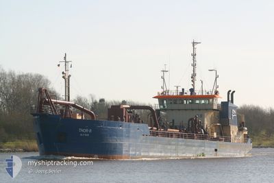
THOR R
Trailing Suction Hopper Dredger
Current Trip
DREDGING OPERATION
| Time Travelled | 1 day |
|---|---|
| Remaining Time | --- |
| Distance Travelled | 377.45 nm |
| Remaining Distance | --- |
| AVG Speed | 10 Noeuds |
| MAX Speed | 11.5 Noeuds |
| AVG Wind | 15.9 knots |
| MAX Wind | 21 knots |
| MIN Temp | 11.2°C / 52.16°F |
| MAX Temp | 15°C / 59°F |
| Tirant d eau | 5.4 m |
| Position reçue | 2 h, 23 m depuis |
Current Position
| Longitude | --- |
|---|---|
| Latitude | --- |
| Etat | Restricted manoeuverability |
| Vitesse | 11.1 Noeuds |
| Parcours | 323° |
| Zone | North Atlantic Ocean |
| Station | T-AIS |
| Position reçue | 2 h, 23 m depuis |
Info
Information
The current position of THOR R is in North Atlantic Ocean with coordinates 37.07417° / -6.93617° as reported on 2026-01-10 15:46 by AIS to our vessel tracker app. The vessel's current speed is 11.1 Noeuds
The vessel THOR R (IMO: 8325262, MMSI: 219573000) is a Trailing Suction Hopper Dredger that was built in 1984 ( 42 Age ). It's sailing under the flag of [DK] Denmark.
In this page you can find informations about the vessels current position, last detected port calls, and current voyage information. If the vessels is not in coverage by AIS you will find the latest position.
The current position of THOR R is detected by our AIS receivers and we are not responsible for the reliability of the data. The last position was recorded while the vessel was in Coverage by the Ais receivers of our vessel tracking app.
The current draught of THOR R as reported by AIS is 5.4 meters
Weather
| Temperature | 11.6°C / 52.88°F |
|---|---|
| Wind Speed | 8 knots |
| Direction | 329° NNW |
| Pressure | 1028.4 hPa |
| Humidity | 73.4 % |
| Cloud Coverage | 72 % |
Featured Company
Last Port Calls
| Port | Arrival | Departure | Time In Port |
|---|---|---|---|
| 2026-01-08 17:34 | 2026-01-08 23:27 | 5 h | |
| 2026-01-07 11:25 | 2026-01-08 10:38 | 23 h | |
| 2026-01-05 18:21 | 2026-01-06 23:05 | 1 d | |
| 2026-01-04 20:33 | 2026-01-05 15:22 | 18 h | |
| 2026-01-01 22:41 | 2026-01-03 13:46 | 1 d | |
| 2025-12-31 20:14 | 2026-01-01 05:11 | 8 h | |
| 2025-12-27 14:22 | 2025-12-28 05:30 | 15 h | |
| 2025-12-25 15:56 | 2025-12-26 04:55 | 12 h | |
| 2025-12-25 01:35 | 2025-12-25 14:24 | 12 h | |
| 2025-12-17 13:03 | 2025-12-25 01:25 | 7 d |
Most Visited Ports (Last year)
| Port | Arrivals | |
|---|---|---|
| 257 | ||
| 27 | ||
| 6 | ||
| 3 | ||
| 1 |
Last Trips
| Origin | Departure | Destination | Arrival | Distance | |
|---|---|---|---|---|---|
| 2026-01-08 10:38 | 2026-01-08 17:34 | 13.40 nm | |||
| 2026-01-06 23:05 | 2026-01-07 11:25 | 26.07 nm | |||
| 2026-01-05 15:22 | 2026-01-05 18:21 | 6.99 nm | |||
| 2026-01-03 13:46 | 2026-01-04 20:33 | 55.66 nm | |||
| 2026-01-01 05:11 | 2026-01-01 22:41 | 33.39 nm | |||
| 2025-12-28 05:30 | 2025-12-31 20:14 | 169.06 nm | |||
| 2025-12-26 04:55 | 2025-12-27 14:22 | 60.02 nm | |||
| 2025-12-25 14:24 | 2025-12-25 15:56 | 5.51 nm | |||
| 2025-12-25 01:25 | 2025-12-25 01:35 | 1.33 nm | |||
| 2025-12-17 00:17 | 2025-12-17 13:03 | 140.40 nm |
Events
| Heure | Evenement | Détails | Position/ Destination | Info |
|---|---|---|---|---|
| 2026-01-10 18:04 | Démarrage | 5.71 nm, West of HUELVA |
37.13966 / -6.99350
DREDGING OPERATION
|
Vitesse: 9 kn Parcours: 144° |
| 2026-01-10 16:39 | Arret | 6.34 nm, West of HUELVA |
37.15333 / -7.00667
DREDGING OPERATION
|
Vitesse: Parcours: -1° |
| 2026-01-10 15:54 | Etat Changé | Default Restricted manoeuverability |
37.09333 / -6.95500
DREDGING OPERATION
|
Vitesse: 11.1 kn Parcours: 323° |
| 2026-01-10 15:46 | Etat Changé | Restricted manoeuverability Under way using engine |
37.07417 / -6.93617
DREDGING OPERATION
|
Vitesse: 11.1 kn Parcours: 305° |
| 2026-01-10 15:46 | Hors de la zone couverte |
37.07417 / -6.93617
North Atlantic Ocean
DREDGING OPERATION
|
Vitesse: 11.1 kn Parcours: 323° |
|
| 2026-01-10 15:40 | Etat Changé | Under way using engine Default |
37.06333 / -6.91900
DREDGING OPERATION
|
Vitesse: 11 kn Parcours: 273° |
| 2026-01-10 15:33 | Etat Changé | Default Under way using engine |
37.05833 / -6.89167
DREDGING OPERATION
|
Vitesse: 11.3 kn Parcours: 257° |
| 2026-01-10 15:13 | Démarrage | 3.49 nm, South of HUELVA |
37.09100 / -6.85217
DREDGING OPERATION
|
Vitesse: 8.7 kn Parcours: 142° |
| 2026-01-10 15:03 | Tirant d'eau modifié | 5.4 3.8 |
37.09283 / -6.85067
DREDGING OPERATION
|
Vitesse: 0.6 kn Parcours: 285° |
| 2026-01-10 15:03 | Changement d'ETA | 2026/01/10 15:00 2026/01/10 12:50 |
37.09283 / -6.85067
DREDGING OPERATION
|
Vitesse: 0.6 kn Parcours: 285° |