
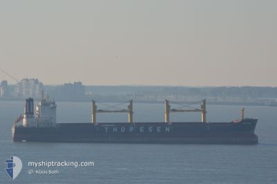
THOR BREEZE
Cargo
Current Trip
| Trip Time | 5 days |
|---|---|
| Trip Distance | 1481.12 nm |
| AVG Speed | 11.7 Noeuds |
| MAX Speed | 14.2 Noeuds |
| Tirant d eau | 6.5 m |
| AVG Wind | 12 knots |
| MAX Wind | 21.3 knots |
| MIN Temp | 24.8°C / 76.64°F |
| MAX Temp | 29.1°C / 84.38°F |
| Position reçue | 5 d depuis |
Current Position
| Longitude | -92.21934° |
|---|---|
| Latitude | 21.45951° |
| Etat | Under way using engine |
| Vitesse | 12.4 Noeuds |
| Parcours | 57.3° |
| Zone | Gulf of Mexico |
| Station | T-AIS |
| Position reçue | 5 d depuis |
Info
Information
The current position of THOR BREEZE is in Gulf of Mexico with coordinates 21.45951° / -92.21934° as reported on 2024-05-02 22:29 by AIS to our vessel tracker app. The vessel's current speed is 12.4 Noeuds and is currently inside the port of MOIN.
The vessel THOR BREEZE (IMO: 9474802, MMSI: 566985000) is a Cargo It's sailing under the flag of [SG] Singapore.
In this page you can find informations about the vessels current position, last detected port calls, and current voyage information. If the vessels is not in coverage by AIS you will find the latest position.
The current position of THOR BREEZE is detected by our AIS receivers and we are not responsible for the reliability of the data. The last position was recorded while the vessel was in Coverage by the Ais receivers of our vessel tracking app.
The current draught of THOR BREEZE as reported by AIS is 6.5 meters
Weather
| Temperature | 28.4°C / 83.12°F |
|---|---|
| Wind Speed | 2 knots |
| Direction | 320° NW |
| Pressure | 1008.5 hPa |
| Humidity | 75.8 % |
| Cloud Coverage | 100 % |
Featured Company
Last Port Calls
| Port | Arrival | Departure | Time In Port |
|---|---|---|---|
| 2024-05-07 12:51 | |||
| 2024-04-26 18:17 | 2024-05-02 00:52 | 5 d | |
| 2024-04-04 07:10 | 2024-04-07 00:22 | 2 d | |
| 2024-03-08 12:03 | 2024-03-13 14:42 | 5 d | |
| 2024-03-04 08:03 | 2024-03-07 23:04 | 3 d |
Most Visited Ports (Last year)
| Port | Arrivals | |
|---|---|---|
| 4 | ||
| 3 | ||
| 3 | ||
| 2 | ||
| 2 | ||
| 1 |
Last Trips
| Origin | Departure | Destination | Arrival | Distance | |
|---|---|---|---|---|---|
| 2024-05-01 19:52 | 2024-05-07 06:51 | 1481.12 nm | |||
| 2024-04-06 21:22 | 2024-04-26 13:17 | 4079.78 nm | |||
| 2024-03-13 09:42 | 2024-04-04 04:10 | 2528.09 nm | |||
| 2024-03-07 18:04 | 2024-03-08 07:03 | 85.34 nm | |||
| 2024-02-26 08:41 | 2024-03-04 03:03 | 1532.53 nm |
Events
| Heure | Evenement | Détails | Position/ Destination | Info |
|---|---|---|---|---|
| 2024-05-07 12:58 | Arret |
10.00596 / -83.07717
[CR] MOIN
|
Vitesse: 0.2 kn Parcours: 187° |
|
| 2024-05-07 12:51 | Port d'arrivée |
|
10.00646 / -83.07800
[CR] MOIN
|
Vitesse: 3.8 kn Parcours: 162° |
| 2024-05-07 11:25 | Démarrage | 3.47 nm, North West of MOIN |
10.06089 / -83.10146
CR MOB
|
Vitesse: 4.7 kn Parcours: 31° |
| 2024-05-07 04:52 | Arret | 3.05 nm, North of MOIN |
10.05484 / -83.09748
CR MOB
|
Vitesse: 0.2 kn Parcours: 328° |
| 2024-05-02 22:36 | Etat Changé | Default Under way using engine |
21.47157 / -92.19957
CR MOB
|
Vitesse: 12.4 kn Parcours: 57.3° |
| 2024-05-02 22:29 | Hors de la zone couverte |
21.45951 / -92.21934
Gulf of Mexico
CR MOB
|
Vitesse: 12.4 kn Parcours: 57.3° |
|
| 2024-05-02 22:17 | Tirant d'eau modifié | 6.5 11.8 |
21.43783 / -92.25931
CR MOB
|
Vitesse: 12.4 kn Parcours: 60.7° |
| 2024-05-02 22:17 | Changement de destination | CR MOB ESPADARTE PILOT |
21.43783 / -92.25931
CR MOB
|
Vitesse: 12.4 kn Parcours: 60.7° |
| 2024-05-02 22:17 | Changement d'ETA | 2024/05/07 04:00 2024/04/10 11:00 |
21.43783 / -92.25931
CR MOB
|
Vitesse: 12.4 kn Parcours: 60.7° |
| 2024-05-02 22:10 | Changement de zone | Mexican part of the Gulf of Mexico Brazilian part of the South Atlantic Ocean |
21.42647 / -92.28072
Gulf of Mexico
|
Vitesse: 12.4 kn Parcours: 60.5° |