

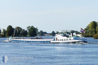
THERESIA
Cargo

Current Trip
ROTTERDAM
| Time Travelled | 2 days |
|---|---|
| Remaining Time | --- |
| Distance Travelled | 152.12 nm |
| Remaining Distance | --- |
| AVG Speed | 8.7 Noeuds |
| MAX Speed | 11.8 Noeuds |
| AVG Wind | 11.1 knots |
| MAX Wind | 14.5 knots |
| MIN Temp | -1.9°C / 28.58°F |
| MAX Temp | 17.1°C / 62.78°F |
| Tirant d eau | 1 m |
| Position reçue | 2 m depuis |
Current Position
| Longitude | --- |
|---|---|
| Latitude | --- |
| Etat | Moored |
| Vitesse | |
| Parcours | --- |
| Zone | North Sea |
| Station | T-AIS |
| Position reçue | 2 m depuis |
Information
The current position of THERESIA is in North Sea with coordinates 51.63952° / 5.98548° as reported on 2025-02-21 21:18 by AIS to our vessel tracker app. The vessel's current speed is 0 Noeuds
The vessel THERESIA (MMSI: 244730945) is a Cargo It's sailing under the flag of [NL] Netherlands.
In this page you can find informations about the vessels current position, last detected port calls, and current voyage information. If the vessels is not in coverage by AIS you will find the latest position.
The current position of THERESIA is detected by our AIS receivers and we are not responsible for the reliability of the data. The last position was recorded while the vessel was in Coverage by the Ais receivers of our vessel tracking app.
The current draught of THERESIA as reported by AIS is 1 meters
Weather
| Temperature | 11.5°C / 52.7°F |
|---|---|
| Wind Speed | 12 knots |
| Direction | 166° SSE |
| Pressure | 1015 hPa |
| Humidity | 77.6 % |
| Cloud Coverage | 100 % |


Featured Company
Last Port Calls
| Port | Arrival | Departure | Time In Port |
|---|---|---|---|
| 2025-02-18 18:58 | 2025-02-19 05:50 | 10 h | |
| 2025-02-15 08:59 | 2025-02-15 09:16 | 16 m | |
| 2025-02-15 08:43 | |||
| 2025-02-13 12:52 | 2025-02-13 13:15 | 23 m | |
| 2025-02-12 13:46 | 2025-02-12 14:11 | 24 m | |
| 2025-02-12 08:35 | 2025-02-12 11:30 | 2 h | |
| 2025-02-11 16:45 | 2025-02-12 06:43 | 13 h | |
| 2025-02-08 15:47 | 2025-02-09 08:19 | 16 h | |
| 2025-01-31 10:55 | 2025-02-08 08:15 | 7 d | |
| 2025-01-29 18:54 | 2025-01-30 06:06 | 11 h |
Last Trips
| Origin | Departure | Destination | Arrival | Distance | |
|---|---|---|---|---|---|
| 2025-02-15 10:16 | 2025-02-18 19:58 | 172.28 nm | |||
| 2025-02-13 14:15 | 2025-02-15 09:59 | 4.56 nm | |||
| 2025-02-13 14:15 | 2025-02-15 09:43 | 3.96 nm | |||
| 2025-02-12 15:11 | 2025-02-13 13:52 | 55.64 nm | |||
| 2025-02-12 12:30 | 2025-02-12 14:46 | 21.02 nm | |||
| 2025-02-12 07:43 | 2025-02-12 09:35 | 20.23 nm | |||
| 2025-02-09 09:19 | 2025-02-11 17:45 | 139.15 nm | |||
| 2025-02-08 09:15 | 2025-02-08 16:47 | 44.44 nm | |||
| 2025-01-30 07:06 | 2025-01-31 11:55 | 66.82 nm | |||
| 2025-01-29 06:00 | 2025-01-29 19:54 | 83.96 nm |
Events
| Heure | Evenement | Détails | Position/ Destination | Info |
|---|---|---|---|---|
| 2025-02-21 21:03 | Etat Changé | Moored Default |
51.63947 / 5.98551
ROTTERDAM
|
Vitesse: Parcours: -1° |
| 2025-02-21 20:57 | Etat Changé | Default Moored |
51.63946 / 5.98543
ROTTERDAM
|
Vitesse: Parcours: 511° |
| 2025-02-21 20:51 | Etat Changé | Moored Default |
51.63947 / 5.98539
ROTTERDAM
|
Vitesse: Parcours: -1° |
| 2025-02-21 20:48 | Etat Changé | Default Moored |
51.63940 / 5.98540
ROTTERDAM
|
Vitesse: Parcours: 511° |
| 2025-02-21 20:27 | Etat Changé | Moored Default |
51.63951 / 5.98546
ROTTERDAM
|
Vitesse: Parcours: -1° |
| 2025-02-21 20:24 | Etat Changé | Default Moored |
51.63951 / 5.98543
ROTTERDAM
|
Vitesse: Parcours: 511° |
| 2025-02-21 19:33 | Etat Changé | Moored Default |
51.63949 / 5.98542
ROTTERDAM
|
Vitesse: Parcours: -1° |
| 2025-02-21 19:27 | Etat Changé | Default Moored |
51.63954 / 5.98544
ROTTERDAM
|
Vitesse: Parcours: 511° |
| 2025-02-21 19:18 | Etat Changé | Moored Under way using engine |
51.63957 / 5.98546
ROTTERDAM
|
Vitesse: Parcours: 511° |
| 2025-02-21 18:44 | Arret | 1.94 nm, South East of BOXMEER |
51.64053 / 5.98189
ROTTERDAM
|
Vitesse: 0.1 kn Parcours: 511° |