
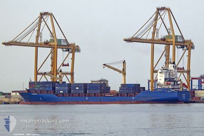
THEODOR
Container Ship
Current Trip
CRCAL
| Time Travelled | 3 days |
|---|---|
| Remaining Time | --- |
| Distance Travelled | 419.58 nm |
| Remaining Distance | --- |
| AVG Speed | 10.1 Noeuds |
| MAX Speed | 14 Noeuds |
| AVG Wind | 5.3 knots |
| MAX Wind | 15.8 knots |
| MIN Temp | 27.3°C / 81.14°F |
| MAX Temp | 30.2°C / 86.36°F |
| Tirant d eau | 10.4 m |
| Position reçue | 1 d depuis |
Current Position
| Longitude | -84.99814° |
|---|---|
| Latitude | 9.38022° |
| Etat | Not under command |
| Vitesse | 0.6 Noeuds |
| Parcours | 79° |
| Zone | North Pacific Ocean |
| Station | T-AIS |
| Position reçue | 1 d depuis |
Info
Information
The current position of THEODOR is in North Pacific Ocean with coordinates 9.38022° / -84.99814° as reported on 2024-04-30 19:45 by AIS to our vessel tracker app. The vessel's current speed is 0.6 Noeuds
The vessel THEODOR (IMO: 9301134, MMSI: 305506000) is a Container Ship that was built in 2006 ( 18 Age ). It's sailing under the flag of [AG] Antigua Barbuda.
In this page you can find informations about the vessels current position, last detected port calls, and current voyage information. If the vessels is not in coverage by AIS you will find the latest position.
The current position of THEODOR is detected by our AIS receivers and we are not responsible for the reliability of the data. The last position was recorded while the vessel was in Coverage by the Ais receivers of our vessel tracking app.
The current draught of THEODOR as reported by AIS is 10.4 meters
Weather
| Temperature | 28.4°C / 83.12°F |
|---|---|
| Wind Speed | 2 knots |
| Direction | 328° NNW |
| Pressure | 1009.2 hPa |
| Humidity | 73.7 % |
| Cloud Coverage | 92 % |
Featured Company
Last Port Calls
| Port | Arrival | Departure | Time In Port |
|---|---|---|---|
| 2024-04-27 17:03 | 2024-04-28 18:05 | 1 d | |
| 2024-04-21 05:30 | 2024-04-21 12:58 | 7 h | |
| 2024-04-19 21:02 | 2024-04-20 13:02 | 15 h | |
| 2024-04-14 22:15 | 2024-04-16 18:04 | 1 d | |
| 2024-04-08 16:32 | 2024-04-09 17:55 | 1 d | |
| 2024-04-01 14:24 | 2024-04-02 05:18 | 14 h | |
| 2024-03-29 13:33 | 2024-03-30 04:12 | 14 h | |
| 2024-03-29 13:15 | 2024-03-29 13:26 | 10 m | |
| 2024-03-27 16:06 | 2024-03-28 00:12 | 8 h | |
| 2024-03-24 08:16 | 2024-03-25 06:31 | 22 h |
Most Visited Ports (Last year)
| Port | Arrivals | |
|---|---|---|
| 11 | ||
| 10 | ||
| 10 | ||
| 7 | ||
| 6 | ||
| 4 |
Last Trips
| Origin | Departure | Destination | Arrival | Distance | |
|---|---|---|---|---|---|
| 2024-04-21 07:58 | 2024-04-27 11:03 | 779.20 nm | |||
| 2024-04-20 08:02 | 2024-04-21 00:30 | 12.41 nm | |||
| 2024-04-16 12:04 | 2024-04-19 16:02 | 771.91 nm | |||
| 2024-04-09 11:55 | 2024-04-14 16:15 | 429.34 nm | |||
| 2024-04-02 00:18 | 2024-04-08 10:32 | 557.73 nm | |||
| 2024-03-29 23:12 | 2024-04-01 09:24 | 19.85 nm | |||
| 2024-03-29 08:26 | 2024-03-29 08:33 | 0.15 nm | |||
| 2024-03-27 19:12 | 2024-03-29 08:15 | 364.76 nm | |||
| 2024-03-25 00:31 | 2024-03-27 11:06 | 611.46 nm | |||
| 2024-03-20 04:35 | 2024-03-24 02:16 | 513.56 nm |
Events
| Heure | Evenement | Détails | Position/ Destination | Info |
|---|---|---|---|---|
| 2024-05-01 22:51 | Arret |
9.34500 / -84.97334
CRCAL
|
Vitesse: Parcours: -1° |
|
| 2024-05-01 21:33 | Démarrage |
9.46167 / -85.02333
CRCAL
|
Vitesse: 4 kn Parcours: -1° |
|
| 2024-04-30 19:53 | Etat Changé | Default Not under command |
9.38093 / -84.99912
CRCAL
|
Vitesse: 0.6 kn Parcours: 79° |
| 2024-04-30 19:45 | Hors de la zone couverte |
9.38022 / -84.99814
North Pacific Ocean
|
Vitesse: 0.6 kn Parcours: 319.9° |
|
| 2024-04-30 19:29 | Etat Changé | Not under command Default |
9.37888 / -84.99594
CRCAL
|
Vitesse: 1 kn Parcours: -1° |
| 2024-04-30 19:19 | Etat Changé | Default Not under command |
9.37833 / -84.99500
CRCAL
|
Vitesse: 0.5 kn Parcours: 88° |
| 2024-04-30 19:17 | Etat Changé | Not under command Default |
9.37794 / -84.99434
CRCAL
|
Vitesse: 1 kn Parcours: -1° |
| 2024-04-30 19:17 | Changement de zone | Costa Rican part of the North Pacific Ocean Mexican part of the North Pacific Ocean |
9.37794 / -84.99434
North Pacific Ocean
|
Vitesse: 0.5 kn Parcours: 303.8° |
| 2024-04-30 19:01 | Dans la zone couverte |
9.37794 / -84.99434
North Pacific Ocean
|
Vitesse: 0.5 kn Parcours: 303.8° |
|
| 2024-04-30 08:51 | Arret |
9.33833 / -84.97500
CRCAL
|
Vitesse: Parcours: -1° |